Tour of the Marais de Cassan (link from Saint-Étienne-Cantalès)

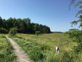
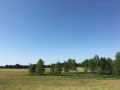
An interesting ride that’s well worth discovering, very different from the usual Cantal landscape. The terrain is flat, but that doesn’t stop there being a few lovely climbs and descents. On foot, the journey might seem a bit long, but on a mountain bike you’ll be pleasantly surprised by the variety of vegetation and scenery. Most of the ride is in the shade of the trees.

Details

10674988
Creation:
Last update:
Last review:
  • Mountain biking
    Activity: Mountain biking
  • ↔
    Distance: 11.42 mi
  • ◔
    Duration according to the author: 2.5 hrs 
  • ▲
    Difficulty: Moderate

  • ⚐
    Back to start: Yes
  • ↗
    Ascent: + 627 ft
  • ↘
    Descent: - 617 ft

  • ▲
    Highest point: 1,959 ft
  • ▼
    Lowest point: 1,693 ft
  • ⚐ Country: France
  • ⚐
  • ⚐ City: Saint-Étienne-Cantalès (15150)
  • ⚑
    Start/End: N 44.946628° / E 2.223722°
  • ❏
    IGN map(s): Ref. 2336O

  • ◶
    Type of surface:
  •  
     
     
     33% Road  34% Byway  33% Path
  • ⇧
    Bike carrying: No
  • ▲
    Difficulty: Moderate
  • Hour-by-hour weather

Photos

Description of the route

Start from the school in Saint-Étienne-Cantalès, sign for “Liaison Marais de Cassan”.

No signposting

(S/E) Head down towards the “Tour du Lac” path and follow it to the left. The path is covered with white pebbles.

(1) At the swimming pool, stay on the white pebbles and continue along the lake.

(2) Head up towards the D18 road.

Green signposts

Turn right onto the D18.

(3) At the junction in the hamlet of Lestrade, carry on along the D18 and follow it for about 1 km.

(4) After a wide bend to the right and before a bend to the left, leave the road and take a well-marked path on the left, heading downhill at a right angle. Walk straight through the hamlet of Labro, then cross a bridge over the railway line.

(5) Cross the first footbridge over the marsh and continue along the path.

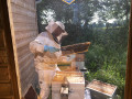
(6) At Le Devèz, there is a shelter and a beekeeping display. Turn left onto the tarmac road, which continues as a wide forest track.

(7) The signposted route goes round the woodland, but you can take a shortcut via a well-marked path on the right through the woods (200 m after passing under the high-voltage power lines). At the end of the path, about 300 m on, rejoin the green signposting and continue to the right. You’ll reach a car park.

(8) Note the main signpost marking the start of the Marais de Cassan route.
Turn left into the car park, then cross the road to follow a path running parallel on the right-hand side. 500 m further on, the path turns right at a right angle.

(9) The nature trail (blue markings) branches off to the left towards the car park. Ignore this and carry on straight ahead along the path.

(10) At a villa, turn right onto the dirt track and follow it for 500 m.

(11) At the dead end, follow the path to the right then to the left, which leads to a footbridge. After the footbridge, turn left then right.

(12) In the hamlet of Lacamp, carry on straight ahead along the tarmac road until you reach the junction with the D361.

(13) Carry on straight ahead, towards “La Frescaldie”, until you reach the next junction.

(14) Turn right onto the tarmac road, following signs for “La Vieille”, then immediately right onto a dirt track. Join the D361 and continue to the left (signposted “Lagarrigue”).

(15) At the “Calvanhac le Cassan” sign, carry on straight ahead on the D361.

(16) At the end of this road, turn left at the level crossing, then immediately right onto a dirt track. Join the D18.

(17) Turn right onto it for 100 m, then head up a track on the left-hand side. At the top of this, take the tarmac road to the right to rejoin the D18.

(4) Continue straight on along the D18.

(3) At the hamlet of Lestrade (rubbish bins, bus shelter), two roads branch off to the right at right angles. Drive a short way along the second one, then immediately turn left onto a passable dirt track signposted “Coquille Saint-Jacques”. Do not take the tarmac road running parallel to it, signposted “Lieu-dit Le Puech”, as it is a dead end.
Pass under the high-voltage power lines and reach a road.

(18) Continue to the left, pass through the old village of Saint-Étienne-Cantalès and head towards the school in Saint-Étienne-Cantalès, signposted “Liaison Marais de Cassan” (S/E).

Waypoints

  1. S/E : mi 0 - alt. 1,759 ft - School, sign reading “Liaison Marais de Cassan”. - Saint-Étienne-Cantalès
  2. 1 : mi 0.37 - alt. 1,713 ft - Swimming pool - Cère (rivière)
  3. 2 : mi 0.73 - alt. 1,719 ft - Ascent
  4. 3 : mi 1.13 - alt. 1,893 ft - Lestrade
  5. 4 : mi 1.54 - alt. 1,939 ft - Well-marked path leading downhill
  6. 5 : mi 2.07 - alt. 1,713 ft - Footbridge
  7. 6 : mi 2.39 - alt. 1,831 ft - Le Devèz. Beekeeping shelter
  8. 7 : mi 3.13 - alt. 1,824 ft - A well-marked path to the right
  9. 8 : mi 4.05 - alt. 1,778 ft - Car park. Starting signpost.
  10. 9 : mi 4.98 - alt. 1,772 ft - Go straight on; do not follow the blue markings
  11. 10 : mi 5.43 - alt. 1,804 ft - Villa
  12. 11 : mi 5.73 - alt. 1,785 ft - Dead end; path to the right
  13. 12 : mi 6.81 - alt. 1,864 ft - Lacamp. Straight ahead on tarmac
  14. 13 : mi 7.1 - alt. 1,906 ft - Crossroads. Straight on towards “La Frescaldie”
  15. 14 : mi 7.32 - alt. 1,926 ft - Turn right onto the tarmac road, then right onto the dirt track
  16. 15 : mi 8.15 - alt. 1,949 ft - Sign for “Calvanhac le Cassan”
  17. 16 : mi 8.84 - alt. 1,827 ft - Level crossing. On the right immediately after
  18. 17 : mi 9.48 - alt. 1,890 ft - D18
  19. 18 : mi 11.07 - alt. 1,824 ft - Turn left onto the road. Pass in front of the - Saint-Étienne Cantales
  20. S/E : mi 11.42 - alt. 1,749 ft - School, sign reading “Liaison Marais de Cassan”. - Saint-Étienne-Cantalès

Notes

No places to stock up on supplies along the way. Shops in Saint-Paul des Landes and Laroquebrou. Hotel and restaurant in Saint-Étienne-Cantalès.

At (5), a beekeeping demonstration hive, where the hives are accessible and protected by glass panels. With a bit of luck, you’ll see the beekeeper at work.

Water tap in front of the “new cemetery” next to the church in Saint-Étienne-Cantalès (between (S/E) and (18)). There’s a lovely view from this spot.

Worth a visit

To follow the signposting strictly, from the start (S) turn left towards the old village, then follow the points (18)––(4). The alternative route (1)–(2)–(4), which takes you round the lake, is more pleasant and shaded.

The main starting point for the Marais de Cassan signposted route is at the car park (8).

Other routes are signposted from Saint-Paul-des-Landes and Lacapelle-Viescamp (see map here).

Reviews and comments

4.3 / 5
Based on 3 reviews

Reliability of the description
4.7 / 5
Ease of following the route
4.3 / 5
Route interest
4 / 5
jclec
jclec

Overall rating : 4.7 / 5

Date of your route : Sep 04, 2023
Reliability of the description : ★★★★★ Very good
Ease of following the route : ★★★★★ Very good
Route interest : ★★★★☆ Good
Very busy route : No

Completed on foot on 31 August 2023. A very beautiful route, which would have been even more interesting in May or June when the marshes were wetter. On foot, it presented no difficulty, as the elevation gain was modest. The directions are very precise and signposts are frequently found along the way. We particularly enjoyed sections 4 to 11: the woodland, a short stretch along the railway line, and the marshes.

Machine-translated

Sylv
Sylv
• Edited:

Overall rating : 4.7 / 5

Date of your route : May 18, 2023
Reliability of the description : ★★★★★ Very good
Ease of following the route : ★★★★☆ Good
Route interest : ★★★★★ Very good
Very busy route : No

A very pleasant route, best tackled on a mountain bike, with a reasonable level of difficulty that makes it suitable for a teenager. It’s varied, running alongside the lake and through pine woods… Crossing the marsh offers a very different landscape and involves riding over several small footbridges. They break up the rhythm a little on one section of the route, but it’s fun to ride across them!

Machine-translated

randonnée pascal
randonnée pascal
• Edited:

Overall rating : 3.7 / 5

Date of your route : Sep 06, 2021
Reliability of the description : ★★★★☆ Good
Ease of following the route : ★★★★☆ Good
Route interest : ★★★☆☆ Average
Very busy route : No

A hike on foot, but I’m also a mountain biker – it makes a change from the Cantal countryside.
The path between 11 and 13 is quite narrow – watch out for the barbed wire. Best done in dry weather; you cross some wooden footbridges.

Machine-translated

For more walks, use our search engine .

The GPS track and description are the property of this route's author. Please do not copy them without permission.