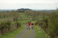
The Badailhac plateau

A mountain bike ride with no major difficulties. This route offers beautiful views over the Cère Valley, the Goul Valley and the Cantal Mountains. The most challenging section is over the last two kilometres!

Details

25938
Creation:
Last update:
Last review:
  • Mountain biking
    Activity: Mountain biking
  • ↔
    Distance: 14.12 mi
  • ◔
    Duration according to the author: 3 hrs 
  • ▲
    Difficulty: Easy

  • ⚐
    Back to start: Yes
  • ↗
    Ascent: + 1,421 ft
  • ↘
    Descent: - 1,421 ft

  • ▲
    Highest point: 3,514 ft
  • ▼
    Lowest point: 2,792 ft

Photos

Description of the route

Start from the church in Badailhac.

(S/E) Take the southern road leading down towards Cros de Ronesque. 500m after leaving the village, turn right towards the hamlet of La Calsade.

(1) Walk through the hamlet and continue straight on along the path; 300m further on, turn right in front of a farm building. The path descends towards the Espeils mill. At the mill, continue straight on to Espeils.

(2) Turn left in Espeils, then take the first road on the right, which leads down towards the stream.
Carry on straight ahead to Escazeaux.

(3) At the entrance to Escazeaux, turn right onto a road which turns into a track and leads you to the Croix des Lucs.

(4) At the cross, turn right onto the path which climbs and winds round a hillock covered in fir trees on the right.
Continue along the track which runs alongside the Cère valley (on your left). Keep going straight on.

(5) Cross a road and take the track opposite (next to the telecoms mast). Continue along this track, which climbs for several kilometres.

(6) Shortly after the highest point, turn right onto a track towards Vernet.

(7) Pass through Vernet and carry on along the road until the next junction at the bottom of the descent.

(8) Turn left towards Badailhac and, 500 metres further on, at a bend, take a track on the left signposted “entre Cère et Goul” and follow the green markings to the end. The route leads you to a tarmac road.

(9) Turn right, then take the first path on the left (100m further on). Then follow the path to a junction at the bottom of a steep descent.

(10) Take the path on your right; this will take you back to Badailhac (S/E).

Waypoints

  1. S/E : mi 0 - alt. 3,110 ft - Badailhac
  2. 1 : mi 0.98 - alt. 2,999 ft - Straight on through La Calsade
  3. 2 : mi 1.93 - alt. 2,979 ft - Turn left at Espeils
  4. 3 : mi 3.38 - alt. 2,913 ft - Turn right at the entrance to Escazeaux
  5. 4 : mi 4.21 - alt. 2,956 ft - Turn right at the cross
  6. 5 : mi 5.85 - alt. 3,104 ft - Cross a road; the path is opposite
  7. 6 : mi 7.92 - alt. 3,484 ft - Turn right towards Vernet
  8. 7 : mi 8.92 - alt. 3,327 ft - Cross Vernet
  9. 8 : mi 9.96 - alt. 3,110 ft - Turn left towards Badailhac
  10. 9 : mi 11.46 - alt. 3,143 ft - Road on the right
  11. 10 : mi 13.03 - alt. 2,966 ft - Path on the right
  12. S/E : mi 14.12 - alt. 3,110 ft - Badailhac

Notes

Do this walk in good weather as it is exposed to the elements.

Worth a visit

Ronesque and Carlat area.

Reviews and comments

4.1 / 5
Based on 3 reviews

Reliability of the description
3.3 / 5
Ease of following the route
4.3 / 5
Route interest
4.7 / 5
DUCK 15
DUCK 15

Overall rating : 4.7 / 5

Date of your route : Nov 03, 2024
Reliability of the description : ★★★★☆ Good
Ease of following the route : ★★★★★ Very good
Route interest : ★★★★★ Very good
Very busy route : No

unglasses(love)P

Machine-translated

Nicolotto
Nicolotto

Overall rating : 3.7 / 5

Date of your route : Sep 12, 2018
Reliability of the description : ★★★☆☆ Average
Ease of following the route : ★★★★☆ Good
Route interest : ★★★★☆ Good

The ‘Easy’ rating misled us a little, as we had to push the bikes a bit on a few sections.
We got a bit lost near La Calsade and the Espeils mill because the markings overlapped.
From there, we strayed from the route, went too far downhill and rejoined the circular route with more effort than expected.
But it was a good ride.

Machine-translated

bibi
bibi ★

Thank you for pointing out these two typos; I’ve just corrected them in the description. I hope they didn’t cause you any trouble during your walk.

Machine-translated

auvergnatvert
auvergnatvert

Overall rating : 4 / 5

Date of your route : Jul 19, 2015
Reliability of the description : ★★★☆☆ Average
Ease of following the route : ★★★★☆ Good
Route interest : ★★★★★ Very good

A lovely route with no significant difficulties. However, please note: whilst the map is accurate, the route description contains several errors, including two significant ones:
At Espeils, turn left, not right
After Vernet, at the crossroads, take the road to the left, not to the right
The rest is correct, and, most importantly, the map is accurate

Machine-translated

For more walks, use our search engine .

The GPS track and description are the property of this route's author. Please do not copy them without permission.