Country:

 City:
City:


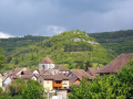
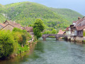
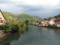
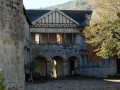
Champ de Mars car park in Vuillafans, on the lovely little square surrounded by traditional houses. Yellow-blue markings; one section is unmarked.
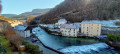
(S/E) Set off towards the bridge, but before crossing it, look out on your right for the Masonic square and compass carved above a porch. Take a short break on the bridge, with its houses overlooking the Loue. Head towards the Church of the Assumption. See if you can pop in for a visit. Pay a quick visit to the statue of Saint-Vernier, patron saint of winegrowers. Walk along the front of the church towards Échevannes and leave the village via Rue Bangue.
On the hillsides, you’ll see the low walls of the terraced fields of yesteryear. Continue climbing along the Route d’Échevannes for another hundred metres past the small road that descends to the left.
(1) Turn right at signpost 18; a lovely path awaits you, though it’s a steep climb. At the main road, walk down about twenty steps and continue along the path opposite. You’ll cross the road twice more before reaching Échevannes. Head right towards the Sainte-Gertrude Chapel and its viewpoint over the valley.
(2) Return to the junction of the Chemin du Sel and the Chemin de la Chapelle and turn right, then immediately left, onto the Chemin du Lavoir. About a hundred metres past the sewage treatment plant, turn left into the woods along a rather unattractive forestry track – though this section is short – until you reach a path on the left (forest sign 3 and hiking sign).
(3) Turn left towards the viewing points (unsecured) that line this lovely cliff-top path. You’ll soon reach an uphill track. Continue to the right, staying on this well-defined and signposted path, ignoring any paths branching off to the right or left, until you reach a gravel track and a long, rather ‘ugly’ stone embankment after this lovely Tangelet cliff-top path. It overlooks a steep slope.
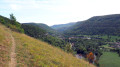
But if you clamber carefully over it , it will still offer you a magnificent view of the lower reaches of the Loue Valley, Montgesoye and Ornans, crowned by its castle.
(4) Leave the stony path on your right and continue for two hundred metres along the forest track that descends opposite. Caution! Just before you reach some fir trees on the left, head down the lovely, untamed path, lined with wild garlic, which winds its way down the wooded slope (despite the Yellow Cross and Blue Cross). At the bottom, you’ll rejoin the signposted path, which you follow for about thirty paces to the left to reach a nearby fork.
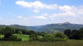
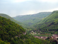
(5) Leave the marked path again and take the forest track on the left. You’ll pass at the foot of the slope and continue straight on along the narrow path. Soon, on your left, you’ll see an old dry-stone wall, a remnant of the terraced fields. You’ll arrive on the hillside at a wide, open space with superb views down the Loue Valley and upstream, towards the Rocher du Moine.
(6) Follow the track up the grassy hillside, which soon enters the woods. The path then forks.
(7) Head down to the right, staying on this descending path, until you reach the first houses of Vuillafans. Take a moment to turn round and admire the beautiful cliffs. You’ll join the Chemin de la Chenoz, which you follow down to the left until you reach the road to Besançon.
(8) Follow it to the left, staying on this side of the road, until you reach a small square. Carefully cross the pedestrian crossing and the footbridge, heading towards Châteauvieux. Stop for a moment on the footbridge to admire the old houses overlooked by the ruins of Châteauneuf. Turn immediately into Rue de la Poste to return to the car park. (S/E)
 Visorando Member

 Easy
Easy