Country:

 City:
City:



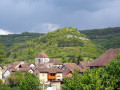
Car park in Échevannes, on the gravel area to the left in front of the first house, at the entrance to the village coming from Vuillafans. Yellow and blue signposting. Some sections are unmarked.
(S/E) Head right towards the Sainte-Gertrude Chapel and its viewpoint over the valley. Return to the junction of the Chemin du Sel and the Chemin de la Chapelle, then turn right, followed immediately by a left, onto the Chemin du Lavoir before the old wooden wayside shrine. About a hundred metres past the sewage treatment plant, turn left into the woods along a grassy forest track – not particularly charming, but only for a short while – until you reach a path on the left (forest sign 3 and hiking sign, slightly hidden by the vegetation).
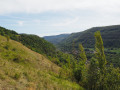
(1) Turn left (towards Montgesoye) towards the (unsecured) viewpoints over Vuillafans and Châteauvieux-les-Fossés, which line this beautiful cliff-top path. You’ll soon reach an ascending path. Continue to the right, then stay on this well-defined and signposted trail at all times, ignoring any paths branching off to the right or left, until you reach a stony track and a long, rather ‘ugly’ stone embankment after this beautiful Tangelet cliff-top path. It overlooks a steep slope. But if you climb carefully over it , it will still offer you a very fine view of the lower reaches of the Loue valley, Montgesoye and Ornans, crowned by its castle.
(2) Head down to the left along this stony path, below a beautiful rocky, moss-covered slope. At the hairpin bend, keep left towards Montgesoye until you reach a fork.
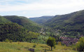
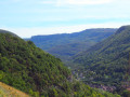
(3) Carry on to the left, leaving the signposted path behind. Soon, ignore the path joining from the right and continue straight on to reach the old vineyards, a wide, open area on the hillside offering superb views of the lower reaches of the Loue Valley and the upper reaches, towards the Rocher du Moine.
(4) Follow the well-defined path that runs along the hillside, taking care as you pass over the old dry-stone walls, remnants of the terraced fields of yesteryear. You enter a copse, soon leaving an ascending path on your left and a descending one on your right, and continuing straight on. After a steep climb, at the foot of an old ‘murger’ (dry stone wall), continue along this well-defined path, still heading up the valley. You’ll come back to the pastures.
(5) Follow the track cutting through them, taking care when passing over the old walls, which are sometimes quite high. There are lovely views of Vuillafans and the Upper Loue Valley. Enter the copses once more, passing alongside some fine piles of stone gathered from fields. At the last one, which is slightly crumbling, you’ll reach a fork in the path.
(6) Climb over the old wall on the left, rejoining a wider path which you follow uphill to the Chemin du Lavoir, which takes you back to the village and the car park on the right (S/E).
 Visorando Member

 Moderate