Lélex - Mijoux

Open from 1 April to 30 November, subject to snow conditions.

From Lélex to Mijoux via the Haute Chaîne: first stage of the two-day hiking tour "On the roof of the Jura mountains".

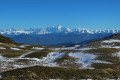
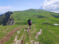
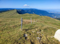
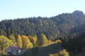
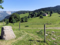
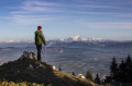
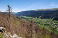
From the wild Valserine valley to the balcony of Lake Geneva, this route immerses you in the authenticity of the Haut-Jura. As you cross the Hautes Combes, you will be struck by the raw beauty of the wide open spaces, the silence of the deep forests and the open horizon of the plateaus. The trail climbs gradually, revealing exceptional panoramic views of Mont Blanc and the entire Alpine range. A life-size immersion in a land of traditions and high-altitude landscapes.
Please note – Protected area
Part of the route crosses the Haute Chaîne du Jura National Nature Reserve, which is subject to specific regulations:
Dogs are not permitted, even on a lead.
Camping in tents is prohibited.
Please respect these rules to preserve the richness of this exceptional environment.

This walk is part of a multi-day hike: On the roof of the Jura Mountains from Lélex

Details

67350134
Creation:
Last update:
Last review:
  • Walking
    Activity: Walking
  • ↔
    Distance: 10.11 mi
  • ◔
    Average duration: 7h 40 
  • ▲
    Difficulty: Difficult

  • ⚐
    Back to start: No
  • ↗
    Ascent: + 3,478 ft
  • ↘
    Descent: - 3,127 ft

  • ▲
    Highest point: 5,535 ft
  • ▼
    Lowest point: 2,927 ft

Photos

Description of the walk

GR® Red and White markings

(S) From the village of Lélex, turn right (south) onto the Voie du Col de Crozet, GR®509, then take the track on the left towards the Haute Chaîne du Jura ridges and continue until you reach a path. Turn right onto this path and follow it until you reach the green ski slope.

(1) Turn right then left and continue until you cross the ski slope a second time. Continue straight ahead and, at the intersection below "Les Gindres", keep left. The path climbs and winds through the woods to the Refuge du Ratou.

(2) Go around the refuge on the left and climb, still on the GR®, making a hairpin bend then turning right. The path crosses a white path twice before continuing its ascent through the woods to arrive at the Refuge de la Loge.

(3) From the refuge, turn right then left. The climb is gentler and the view opens up. There is more undergrowth and high mountain pastures. Turn left towards La Catheline and the Col de Crozet on the GR®9. Continue straight ahead until you reach the top of the cable car.

(4) Stay opposite, turn left, then right, and finally left again to reach the Col de Crozet.

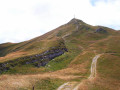
(5) Continue straight ahead, still on the GR®9, towards Colomby de Gex. Leave the track on the right. The path is hilly with views of Mont Blanc, the Alps and the Lake Geneva basin. There are at least three steep climbs before reaching the highest point of the stage: Colomby de Gex.

(6) Opposite, begin the descent, still on the GR®9 towards La Faucille and Les Montronds.

(7) Head north, following the ridge with alternating short climbs and descents. The path leaves the nature reserve before reaching the Grand Montrond.

(8) Descend to the left, then take the GR® on the right. It passes to the right of a cistern, then climbs up the hill opposite and finally descends to the Vie de Chaux crossroads.

(9) Continue downhill to the left into the heart of the resort. Pass under the Gélinotte ski lift.

(10) After this, pass along a tunnel on the ski slope, then the path on the left enters the woods. Keeping to the right, it crosses the Petit Montrond road. Go straight ahead to re-enter the woods and rejoin the road.

(11) Follow it to the right. It will take you back to the heart of the Faucille resort. Keep right again, going downhill, then descend a slope. When you reach the road, keep right and continue to the Col de la Faucille.

(12) Pass behind the Petite Chaumière and continue downhill to the left towards Mijoux via the blue trail. Then leave the trail via a signposted path on the right to rejoin it further down, continuing straight ahead and following the signs. The path runs alongside cliffs and other chasms before finally arriving at another path.

(13) Go down it to the right, then rejoin the track and follow the Sentier des Arts opposite. Turn left and then right onto Rue Royale, go straight ahead at the next crossroads and you will arrive in the village of Mijoux (E).

Waypoints

  1. S : mi 0 - alt. 2,927 ft - Village of Lélex
  2. 1 : mi 0.17 - alt. 3,061 ft - Green trail: Le Fieret
  3. 2 : mi 1.04 - alt. 3,999 ft - Refuge du Ratou
  4. 3 : mi 1.69 - alt. 4,698 ft - Refuge de la Loge
  5. 4 : mi 2 - alt. 4,747 ft - Upper station of the - Télécabine de la Catheline
  6. 5 : mi 2.29 - alt. 4,839 ft - Col de Crozet
  7. 6 : mi 4.81 - alt. 5,535 ft - Colomby de Gex
  8. 7 : mi 5.16 - alt. 5,259 ft - Ridge - View of the - Lac Léman
  9. 8 : mi 6.88 - alt. 5,240 ft - Grand Montrond
  10. 9 : mi 7.64 - alt. 4,918 ft - Crossroads of Life in Chaux
  11. 10 : mi 7.95 - alt. 4,777 ft - Crossroads after the ski lift
  12. 11 : mi 8.29 - alt. 4,554 ft - Route
  13. 12 : mi 8.87 - alt. 4,318 ft - Col de la Faucille
  14. 13 : mi 9.83 - alt. 3,543 ft - Blue trail: the Mijoux link
  15. E : mi 10.11 - alt. 3,251 ft - Village of Mijoux

Notes

Open from 1 April to 30 November, subject to snow conditions.

Before setting off:
- Check the weather forecast to ensure there will be no precipitation.
- Find out about the approach walk, the height of the route, the walking time, and possible escape routes (IGN map, GPS, guidebook, etc.).
- Assess the possible risks by consulting mountain professionals, refuges, and lodges.
- Inform a friend or family member of your plans and contact them again in case of any changes: departure and return times, number of participants with each person's telephone number, vehicle(s), parking.
- Avoid setting off alone. Use equipment that is suitable for the activity, properly adjusted and in good condition, including a head torch, a complete first aid kit, a survival blanket, etc.
- In case of an emergency, call 112 (European emergency number).

Additional advice and recommendations.
To find out more about our destination, visit our website: Pays de Gex Tourisme.

Part of the route is located in a nature reserve, so please respect the specific regulations for this area.

Dogs are not allowed, even on a leash.
Camping in tents is prohibited.

Be well equipped:
Good equipment is the key to a successful hiking trip. Bring a suitable rucksack (around 10 kilos) and don't forget the essentials:
- Technical clothing for cold and rainy weather
- Sleeping bag or groundsheet
- Sunglasses
- Food and water
- Head torch
- Walking sticks
- Complete first aid kit

Water is essential. Find out where you can get water along your route and bring purification tablets in case you don't have access to clean water.

This route passes through multiple protected areas, which may be subject to special regulations:

Worth a visit

Monts Jura is a four-season resort offering a wide range of activities, such as downhill skiing, cross-country skiing, snowshoeing, dog sledding, hiking, downhill mountain biking, rail sledding, giant zip line, tree climbing, golf, and more.

Always be cautious and plan ahead when you're outdoors. Visorando and the author of this route cannot be held responsible for any accidents occurring on this route.

The GR® and PR® markings are the intellectual property of the Fédération Française de Randonnée Pédestre.

Reviews and comments

4.7 / 5
Based on 2 reviews

Reliability of the description
4 / 5
Ease of following the route
5 / 5
Route interest
5 / 5
estelle71
estelle71

Overall rating : 5 / 5

Date of your route : Aug 07, 2025
Reliability of the description : Not used / Not applicable
Ease of following the route : ★★★★★ Very good
Route interest : ★★★★★ Very good
Very busy route : Yes

A very beautiful hike offering superb panoramic views on both sides, with splendid views of the entire Mont Blanc massif. However, the GR route is new between points 2 and 3, so the path is not very stable and the small posts with the famous red and white paint marks were often on the ground (uprooted).
The section of the route between points 8-9-10 was mandatory at the beginning of August 2025 to bypass a well-marked grazing area that made the road via Le Crozat inaccessible (we wanted to go from 8 to 10 directly via this road)

Machine-translated

Tomatemozza
Tomatemozza

Overall rating : 4.5 / 5

Date of your route : May 10, 2025
Reliability of the description : ★★★★☆ Good
Ease of following the route : Not used / Not applicable
Route interest : ★★★★★ Very good
Very busy route : Yes

Route completed in reverse, pushing on to Grand Cret (1,702 m) in approximately 6 hours and 15 minutes (21.5 km +1,350 m for two men in their thirties who are occasional hikers).
Superb scenery and views of the ridges. I recommend it.

Machine-translated

Other walks in the area

For more walks, use our search engine .

The GPS track and description are the property of this route's author. Please do not copy them without permission.