The Staffelsee Circuit

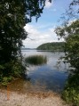
Located 70 km from Munich, the Staffelsee is one of Bavaria’s many lakes. Like many others, it is surrounded by peat bogs that have been developed for walking, allowing you to discover magnificent flora and fauna. The walk ends with a pleasant return journey by boat.

Details

266068
Creation:
Last update:
Last review:
  • Walking
    Activity: Walking
  • ↔
    Distance: 8.42 mi
  • ◔
    Average duration: 4h 10 
  • ▲
    Difficulty: Moderate

  • ⚐
    Back to start: No
  • ↗
    Ascent: + 331 ft
  • ↘
    Descent: - 331 ft

  • ▲
    Highest point: 2,228 ft
  • ▼
    Lowest point: 2,123 ft

Photos

Description of the walk

Departure from Murnau-am-Staffelsee, Seestraße (in French, Rue du Lac). For access details, see the practical information.

The lake circuit is signposted ‘Staffelsee Rundweg’ (Lake Trail). Although the route does not always follow the lake’s shoreline, it is difficult to go wrong.

(S/E) From the car park (Seestraße), head west. Turn left shortly afterwards, leaving the jetty on your right. Then turn right onto Seewaldweg. Head due west, keeping the lake on your right. Ignore the other paths on the left, particularly the cycle route.

(1) At the far end of the lake, the path enters a peat bog and continues westwards. After about 1 km, it turns north.

(2) At the junction, turn right (signposted). After crossing a small bridge over a stream (the Ach), you’ll come to a second junction; turn left (there’s a house on the left and another house on the right along the path you must not take).

(3) At the banks of the Ach, you’ll come to another junction; turn left here. The path joins a tarmac road.

(4) Turn right and follow the tarmac road north-east for about 1.8 km.

(5) Before a bend to the right in the track, leave it and turn sharply right onto a road (am Tannenbach; there’s a tree on the left-hand side of the road). Follow this road to the lakeside (it turns into a footpath a few metres before you reach it).

(6) Turn left and follow the path along the lake. After about 500 metres, head away from the lake.

(7) At the junction, let the signposted path head north-east and follow another path to the right (south-south-east). Walk alongside the lake again.

(8) After about 700m, turn left towards a wooded area.

(9) Continue north-north-east, then north, along a small tarmac road.

(10) When you reach the swimming pool (Geimeindebad Uffing), take the path (Birkenweg) which branches off to the right before the large car park.

(10) Walk along the lake until you come out onto Kirchtalstraße in the town of Uffing.

(11) Follow the road to the right. When you reach the restaurant, turn right to reach the jetty where you can catch the boat to Murnau (pronounced ‘Mour-na-au’) to return to the car park (S/E).

Waypoints

  1. S : mi 0 - alt. 2,149 ft - Murnau – Seestraße car park
  2. 1 : mi 2.43 - alt. 2,162 ft - Start of the peat bog
  3. 2 : mi 3.48 - alt. 2,185 ft - Crossroads in the peat bog
  4. 3 : mi 3.92 - alt. 2,142 ft - Crossroads by the stream
  5. 4 : mi 4.29 - alt. 2,149 ft - Tarmac track
  6. 5 : mi 5.36 - alt. 2,169 ft - Route – Turn right
  7. 6 : mi 6.1 - alt. 2,133 ft - Return to the lakeside
  8. 7 : mi 6.44 - alt. 2,129 ft - Junction – Leave the marked path
  9. 8 : mi 6.9 - alt. 2,129 ft - Junction – Turn left
  10. 9 : mi 7.32 - alt. 2,156 ft - Short tarmac road
  11. 10 : mi 7.75 - alt. 2,136 ft - Uffing Municipal Swimming Pool
  12. 11 : mi 8.24 - alt. 2,162 ft - Uffing – Kirchtalstraße
  13. E : mi 8.42 - alt. 2,156 ft - Uffing – Landing stage

Notes

How to get there:

- By car (from Munich): take the A95 motorway towards Garmisch-Patenkirchen. Take exit 10, Murnau a Staffelsee / Kochel am See. Take the St2062 towards Murnau. Once in Murnau, the St2062 becomes Kochelerstraße, then Seidlstraße. At the end of Seidlstraße, turn left and then immediately right onto the B2. Turn left onto Kohlgruber Str. At the roundabout, take the second exit onto Kohlgruber Str. Then turn right onto Seestraße. When you reach the lake, there is a fairly large car park on the right. Parking is subject to a charge, but relatively inexpensive and charged by the day.

- By train: direct service from München Hauptbahnhof to Murnau. Journey time: 55 minutes. From Murnau station, take Bergstraße, which leads directly to the lake.

The return journey is by boat (tickets can be purchased on board). See the company’s website for:
- A general overview (in French).
- Timetables (in German).
- Fares (in German).
Drinks and food are available on board.

You are visiting a sensitive area: please respect the natural environment, in particular by staying on the paths.

Reviews and comments

4.8 / 5
Based on 2 reviews

Reliability of the description
5 / 5
Ease of following the route
5 / 5
Route interest
4.5 / 5
bleusonar
bleusonar
• Edited:

Overall rating : 5 / 5

Date of your route : Mar 18, 2018
Reliability of the description : ★★★★★ Very good
Ease of following the route : ★★★★★ Very good
Route interest : ★★★★★ Very good

It's a very pleasant walk, starting out close to the houses but very soon the path moves away from them completely and the landscape becomes wilder and wilder. A real pleasure. Even though the route is very flat, the impressions of nature and wide open spaces are omnipresent. What's more, everything is perfectly signposted, so there's no risk of straying off the path by mistake.
I did the complete circuit of the lake (20 km), but the 3rd third of the walk is less interesting than the first 2, running alongside a quarry and the railway line for a while and passing through a few villages.
20 km completed in 4 hours.

Machine-translated

eljo91
eljo91

Overall rating : 4.7 / 5

Date of your route : Aug 10, 2017
Reliability of the description : ★★★★★ Very good
Ease of following the route : ★★★★★ Very good
Route interest : ★★★★☆ Good

Family hike around the Staffelsee.
Different landscapes around the lake, beautiful scenery.
The boat trip back is a pleasant way to round off the day.
Alternatively, the tour of the lake can be completed on foot with a further 7km of easy walking.

Machine-translated

For more walks, use our search engine .

The GPS track and description are the property of this route's author. Please do not copy them without permission.