


Partnach Gorge in Bavaria


Short hike in the Partnach Gorge starting from the ski resort of Garmisch-Partenkirchen, then in the surrounding forest. (Entrance to the gorge costs €10 per person.) Challenging route on the first climb out of the gorge.
Details
Creation:
Last update:
Last review:
–
–
-
 Activity: Walking
 -
 Distance: 3.54 mi
 -
 Average duration: 2h 40
 -
 Difficulty: Moderate
 -
-
 Back to start: Yes
 -
 Ascent: + 1,148 ft
 -
 Descent: - 1,168 ft
 -
-
 Highest point: 3,235 ft
 -
 Lowest point: 2,438 ft
-
 Country:
Germany
Country:
Germany
-
 Area: Alps
 -
 City:
Garmisch-Partenkirchen
City:
Garmisch-Partenkirchen -
 Start/End: N 47.477853° / E 11.112936°
 -


 Hour-by-hour weather


Waypoints
- S/E : mi 0 - alt. 2,464 ft
- 1 : mi 0.08 - alt. 2,438 ft - Crossroads
- 2 : mi 0.67 - alt. 2,579 ft - Intersection
- 3 : mi 1.48 - alt. 2,644 ft - Partnach
- 4 : mi 2.22 - alt. 3,232 ft - Partnachalm
- S/E : mi 3.54 - alt. 2,438 ft
Other walks in the area
Tour of Lake Eibsee
 Visorando Member4.55 mi
+548 ft
-564 ft
2h 35
Visorando Member4.55 mi
+548 ft
-564 ft
2h 35
 Easy
Easy
 Departure from Grainau (Upper Bavaria)
A very pretty tour of Lake Eibsee in Bavaria. The path runs along the shores from a distance, through a beautiful mossy forest, but it is possible to take secondary paths to reach the many coves and swim in the crystal-clear water.
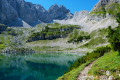
The Drachensee via the Seebensee
 8.24 mi
+1,798 ft
-1,772 ft
5h 20
Moderate
Departure from Ehrwald (Bezirk Reutte)
8.24 mi
+1,798 ft
-1,772 ft
5h 20
Moderate
Departure from Ehrwald (Bezirk Reutte)
In the heart of the Wetterstein, a mountain range in the northern Eastern Pre-Alps straddling the border between Austria and Germany, this hike will take you past two stunning mountain lakes.
The climb up to the Drachensee is steep, and you can stop off at the Seebensee.
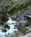
The Gleirschklamm Gorge
 7.22 mi
+1,729 ft
-1,716 ft
4h 50
Moderate
Departure from Scharnitz (Bezirk Innsbruck-Land)
7.22 mi
+1,729 ft
-1,716 ft
4h 50
Moderate
Departure from Scharnitz (Bezirk Innsbruck-Land)
Starting from the town of Scharnitz, this Austrian hike takes you on a one-hour walk through a magnificent gorge before offering a moment of relaxation.
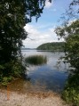
The Staffelsee Circuit
 8.42 mi
+331 ft
-331 ft
4h 10
Moderate
Departure from Murnau am Staffelsee (Upper Bavaria)
8.42 mi
+331 ft
-331 ft
4h 10
Moderate
Departure from Murnau am Staffelsee (Upper Bavaria)
Located 70 km from Munich, the Staffelsee is one of Bavaria’s many lakes. Like many others, it is surrounded by peat bogs that have been developed for walking, allowing you to discover magnificent flora and fauna. The walk ends with a pleasant return journey by boat.
For more walks, use our search engine .
The GPS track and description are the property of this route's author. Please do not copy them without permission.

