The Tour des Marcais

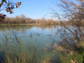
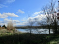
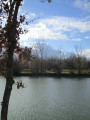
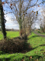
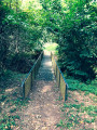
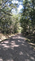
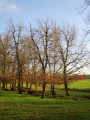
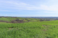
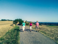
A pleasant walk through the countryside. With two riding centres along the route, you’ll have plenty of opportunities to spot horses in the meadows. At the Éconotre centre, you can easily join the Voie Verte, which runs through our area for 17 km.

Details

3385801
Creation:
Last update:
Last review:
  • Walking
    Activity: Walking
  • ↔
    Distance: 3.72 mi
  • ◔
    Average duration: 1h 45 
  • ▲
    Difficulty: Easy

  • ⚐
    Back to start: Yes
  • ↗
    Ascent: + 49 ft
  • ↘
    Descent: - 49 ft

  • ▲
    Highest point: 394 ft
  • ▼
    Lowest point: 341 ft
  • ⚐ Country: France
  • ⚐ City: Bessières (31660)
  • ⚑
    Start/End: N 43.79269° / E 1.55969°
  • ❏
    IGN map(s): Ref. 2142O
  • Hour-by-hour weather

Photos

Description of the walk

Starting point: Lac des Marcais car park – Bessières.

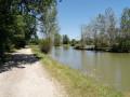
(S/E) Follow the road straight on, with the lake on your left, and continue to the very end of the dead-end road,

(1) Turn left along the hedge, just before the private property gate, and join a road.

(2) When you reach the tarmac section, at the bend, take the path down to the right after the gate.

(3) Turn left at the first junction. Walk past the Bessières stables and continue straight on along the Chemin d’Al Neple, keeping to the right so as not to turn left onto the path leading to a house.

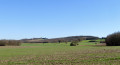
(4) Cross the D15f and take the Chemin de Cordes (signposted) opposite, which runs through the fields. Walk past the refuge, then cross the road (Chemin des Turques) to follow the path opposite that runs alongside the greenhouses.

(5) At the end of the last greenhouse, turn left and continue all the way to the Route de la Magdelaine, the D15f.

(6) Turn left onto this road and follow it carefully until you reach the Chemin de Marcays, which you should take on the right. Shortly afterwards, turn left onto the Chemin d’En Lourde and continue straight on to the car park by the lake

(S/E) Lac des Marcais

Waypoints

  1. S/E : mi 0 - alt. 390 ft - Lac des Marcais
  2. 1 : mi 0.25 - alt. 394 ft - Les Prats
  3. 2 : mi 0.52 - alt. 384 ft - Chemin des Coustousses
  4. 3 : mi 0.76 - alt. 371 ft - Coustousses
  5. 4 : mi 1.51 - alt. 344 ft - Crossing the D15f
  6. 5 : mi 2.29 - alt. 344 ft - En Naudou
  7. 6 : mi 2.94 - alt. 377 ft - Junction with the Route de la Magdelaine (D15f)
  8. S/E : mi 3.72 - alt. 390 ft - Lac des Marcais

Notes

(5) You can join the Voie Verte by turning right after the market gardens.

Reviews and comments

4 / 5
Based on 4 reviews

Reliability of the description
4.8 / 5
Ease of following the route
4.8 / 5
Route interest
2.5 / 5
Valserine
Valserine

We couldn’t find the start of the walk, despite popping into the town hall to ask for help.

Machine-translated

Chriscau31
Chriscau31

Overall rating : 3.7 / 5

Date of your route : Jan 24, 2024
Reliability of the description : ★★★★★ Very good
Ease of following the route : ★★★★★ Very good
Route interest : ★☆☆☆☆ Very disappointing
Very busy route : No

I was really very disappointed with this walk. This is the third time I’ve done this route: the first time left me with fond memories, the second left a bitter taste at the end as I made my way back to the car park (see below), and this one – which is unfortunately the last, such is my disappointment. I did the walk with my little dog (harness, lead, good recall and sociable).
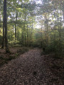
The walk starts off well with the lake, the path through a small wood and quite a few fields. Be careful after rain – there’s a risk of slipping on the descent before point 3.
From point 4 onwards, it’s a disaster! What used to be fields and countryside has become a vast area under construction. The landscape there has been completely ruined. You walk alongside the barriers separating you from the building site all the way to the dog club, which is no longer of any interest.
The path alongside the greenhouse has been rutted by tractors digging (or re-digging) trenches on the greenhouse side, and there’s clearly work going on near the clearing too. This section is still passable, but I thought I’d seen the worst of it when, from point 5 onwards, the entire landscape on the left-hand side is destroyed by building work (yet again), stretching almost all the way to the little bridge. From there, the scenery hasn’t changed (for now?). From point 6, it’s a tarmac road, as indicated in the details, with very little traffic (but do watch out for the speed of any cars that do come along).
Finally, it was time to head back to the car park, where I had the fright of my life: as I walked past the riding centre (which had no proper fencing) with my dog on a lead, the centre’s enormous dog came running towards us, baring its teeth and growling. There were people at the riding centre, but nobody reacted or came to retrieve their dog, which wasn’t responding to their calls. The dog tried to jump on me to attack my dog, whom I’d grabbed and held in my arms. But still nobody came, despite my screams. The dog eventually obeyed and walked away.
Another person who works at the riding centre, who was looking after the horses by the lake, came over to ask if everything was all right. This kind person explained to me that this dog attacks small dogs but is apparently friendly towards large ones…
The last time the same thing happened to me, someone did come over, quickly called the dog back and told us it wasn’t ‘mean’ despite its attempt to bite my dog… I wanted to make peace with this place, but that’s no longer possible.
So, a word of warning to dog-friendly visitors: this dog attacks our little furballs.
I strongly advise against this walk, unless you need to be reminded of the ecological disasters we continue to bring about.

Machine-translated

grandpirate
grandpirate

Overall rating : 3.7 / 5

Date of your route : Nov 23, 2023
Reliability of the description : ★★★★★ Very good
Ease of following the route : ★★★★★ Very good
Route interest : ★☆☆☆☆ Very disappointing
Very busy route : No

From point 4 to point 5, it may be an economic success, but it’s a real ecological disaster!
It’s awful – with all the bulldozers, greenhouse complexes and gravel pits…

Machine-translated

pollet denis
pollet denis

Overall rating : 4 / 5

Date of your route : May 15, 2023
Reliability of the description : ★★★★☆ Good
Ease of following the route : ★★★★☆ Good
Route interest : ★★★★☆ Good
Very busy route : No

Check for an update for Visorando on a PC

Machine-translated

Vendinielle
Vendinielle

Overall rating : 4.7 / 5

Date of your route : Dec 30, 2020
Reliability of the description : ★★★★★ Very good
Ease of following the route : ★★★★★ Very good
Route interest : ★★★★☆ Good
Very busy route : No

An easy walk. Even at this time of year, the paths are still very walkable (provided you’re wearing proper shoes, of course). Lovely views of the lakes and the village of Paulhac. It’s a shame you can’t avoid the section between 4 and 5.

Machine-translated

Other walks in the area

For more walks, use our search engine .

The GPS track and description are the property of this route's author. Please do not copy them without permission.