Magdelaine-sur-Tarn lake circular route

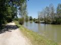
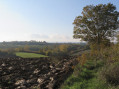
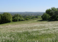
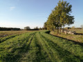
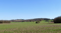
A key route through the fields that combines nature and heritage and allows you to join the Greenway to continue your exploration. An easy walk that ends at the edge of a small lake where you can relax. This circular loop takes you along mostly paved paths, keeping you dry in wet weather. Bring a hat on sunny days!

Details

3414609
Creation:
Last update:
Last review:
  • Walking
    Activity: Walking
  • ↔
    Distance: 6.38 mi
  • ◔
    Average duration: 3h 00 
  • ▲
    Difficulty: Easy

  • ⚐
    Back to start: Yes
  • ↗
    Ascent: + 52 ft
  • ↘
    Descent: - 52 ft

  • ▲
    Highest point: 394 ft
  • ▼
    Lowest point: 328 ft

Photos

Description of the walk

Departure from Place du Souvenir in La Magdelaine-sur-Tarn.

(S/E) From the square, turn your back on the Town Hall and walk down towards the crossroads. Turn right onto the D15 and you will come to a roundabout (note the magnificent 18th-century dovecote).

(1) Turn left down Chemin de Briac, then turn right onto Chemin de Carrelis.

(2) Turn left before the dead end to join the Voie Verte. The track then crosses the small Rieutord stream.

(3) Follow the Voie Verte to the left for 3.2 km.

(4) At the intersection with the D630, keep left on the same side (do not cross) and follow the road for a few metres, staying close to the hedge. Turn left onto Chemin de la Martigne and pass this locality.

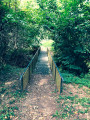
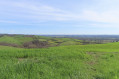
(5) In the bend, at the small bridge, cross the stream to the right and follow Chemin de Borio Blanc. Continue straight ahead on the wide track that crosses the fields.

(6) At the end of the track, turn right onto the D71, then quickly left onto the D32.

(7) Turn left onto Chemin des Toulzas. Pass the stables and continue to the end of Chemin des Toulzas. At the fork, turn right onto Chemin de la Barthe, which runs alongside a pond, and continue to Laurenci.

(8) At the crossroads, turn left onto the D32a. Follow it carefully, cross a bridge and continue to the small path on the right.

(9) Take the path across the fields. A sign prohibiting vehicles marks its start. This path leads to the lake, which you can walk around.

(10) Then turn left onto the D61 to reach the roundabout with the dovecote.

(1) Turn left to reach the village centre and Place du Souvenir (S/E).

Waypoints

  1. S/E : mi 0 - alt. 381 ft - Place du Souvenir
  2. 1 : mi 0.09 - alt. 374 ft - Crossroads of the circular loop
  3. 2 : mi 0.48 - alt. 344 ft - Fork to the left
  4. 3 : mi 0.78 - alt. 335 ft - The Greenway near the - Tarn (rivère)
  5. 4 : mi 2.69 - alt. 328 ft - Intersection with the D630
  6. 5 : mi 3.03 - alt. 341 ft - Chemin de Borio Blanc
  7. 6 : mi 3.72 - alt. 374 ft - D71 junction
  8. 7 : mi 4.04 - alt. 381 ft - Chemin des Toulzas
  9. 8 : mi 5.03 - alt. 387 ft - Chemin de la alluvial plain
  10. 9 : mi 5.4 - alt. 381 ft - Fork in the path on the right
  11. 10 : mi 6.07 - alt. 381 ft - Junction with the D61
  12. S/E : mi 6.38 - alt. 381 ft - Place du Souvenir

Worth a visit

Lac de la Magdelaine: picnic area, children's playground and motorhome area.
Magnificently restored 18th-century dovecote.

Reviews and comments

3.9 / 5
Based on 9 reviews

Reliability of the description
4.1 / 5
Ease of following the route
4.4 / 5
Route interest
3.2 / 5
MEMEL81300
MEMEL81300

Overall rating : 3 / 5

Date of your route : May 13, 2024
Reliability of the description : ★★★☆☆ Average
Ease of following the route : ★★★☆☆ Average
Route interest : ★★★☆☆ Average
Very busy route : No

Pleasant hike, minimal signposting, be careful at the start as the information is not very consistent and can be confusing.

Machine-translated

Jean Pierre 31
Jean Pierre 31

Overall rating : 4.7 / 5

Date of your route : Dec 18, 2023
Reliability of the description : ★★★★★ Very good
Ease of following the route : ★★★★★ Very good
Route interest : ★★★★☆ Good
Very busy route : No

Visorando is a great website for organising a hiking route.

Machine-translated

randomadeleine
randomadeleine

Overall rating : 3.3 / 5

Date of your route : Dec 21, 2021
Reliability of the description : ★★★☆☆ Average
Ease of following the route : ★★★★☆ Good
Route interest : ★★★☆☆ Average
Very busy route : No

A route to do in winter as there is very little muddy ground (which is often the case in this region).
Lots of road. Pleasant trail.
Best avoided in midsummer as there is little shade.
Can be done in both directions and shortened to avoid too much greenway.

Machine-translated

Les Randonneurs Toulousains

Overall rating : 4.3 / 5

Date of your route : May 17, 2021
Reliability of the description : ★★★★★ Very good
Ease of following the route : ★★★★★ Very good
Route interest : ★★★☆☆ Average
Very busy route : No

route without difficulties too much tarmac; no shade
not very busy
pleasant lake for picnics
avoid if too hot

Machine-translated

M31N19
M31N19

Overall rating : 4.3 / 5

Date of your route : May 26, 2021
Reliability of the description : ★★★★☆ Good
Ease of following the route : ★★★★★ Very good
Route interest : ★★★★☆ Good
Very busy route : No

Flat route, not difficult but pleasant despite the amount of tarmac; the small roads are quiet.
At point 3, we turned right onto the greenway and cycled to Mirepoix and back, which added about 2.5 km to the route.

Machine-translated

SANCERNI
SANCERNI

Overall rating : 4.3 / 5

Date of your route : Feb 28, 2021
Reliability of the description : ★★★★★ Very good
Ease of following the route : ★★★★★ Very good
Route interest : ★★★☆☆ Average
Very busy route : Yes

Easy and dry feet

Machine-translated

massat09
massat09

Overall rating : 4 / 5

Date of your route : Sep 08, 2020
Reliability of the description : ★★★★☆ Good
Ease of following the route : ★★★★☆ Good
Route interest : ★★★★☆ Good
Very busy route : Yes

A pleasant route between nature and tarmac

Machine-translated

claudine_marty
claudine_marty

Overall rating : 3.7 / 5

Date of your route : Aug 23, 2020
Reliability of the description : ★★★★☆ Good
Ease of following the route : ★★★★☆ Good
Route interest : ★★★☆☆ Average
Very busy route : No

Acceptable hike but far too much tarmac.
Fortunately, it wasn't too hot that day.
The description should include the percentage of tarmac road.

Machine-translated

bricoleurconfirme
bricoleurconfirme

Overall rating : 3.7 / 5

Date of your route : Aug 17, 2020
Reliability of the description : ★★★★☆ Good
Ease of following the route : ★★★★★ Very good
Route interest : ★★☆☆☆ Disappointing
Very busy route : No

A shame about the tarmac or engraved route, very little shade, best reserved for a day without sun and only for a warm-up.

Machine-translated

Other walks in the area

For more walks, use our search engine .

The GPS track and description are the property of this route's author. Please do not copy them without permission.