The Tour Sainte-Croix
The Tour Sainte-Croix is a procession that sets off from Marbais in the early hours of the morning, following a mass. It takes place on the first Sunday in May. It brings together archers from Saint-Sébastien, the Sapeurs and the faithful, who accompany the relic of the Holy Cross on a route linking the churches of the aforementioned villages. (Further information, photos and videos are available on the Villers parish website.)
Rigenée Golf Club
Le Soir – 24 April 2003 – Eric Meuwissen – “Manu (the late Emmanuel Descampe) founded his golf course in April 1982. Rigenée was, in fact, regarded as one of the finest successes to emerge from the golfing craze that swept the country during the 1980s. He had invested everything he held most dear: his family and his estate, including his farmland. He laid out the course entirely by himself at the start, using equipment from his farm. Today, Rigenée boasts an 18-hole course and a 9-hole course, as well as a golf school set up by his daughter Florence, a true star in her own right. The club has 600 members and Christophe Descampe has just taken over from his late father.”
The Water Tower at Sart-Dames-Avelines
“An Art Deco water tower built in 1938 which, following its renovation in 2007, is in the process of being listed. There are 38 of this type in Belgium, out of the 871 listed, but the one in Sart-Dames-Avelines is one of the most distinctive. This is particularly due to the use of glazed corners, which was a modern innovation at the time. The structure itself consists of eight pillars, providing a radius of seven metres. There are 222 narrow steps leading up to the tank.” – Le Soir – 14 March 2018
Le Châtelet
relaisduvisiteur.be
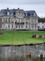
“Perched on a rocky outcrop, the Châtelet de Marbais seems to watch over the Thyle valley and its surroundings. Built at the confluence of two watercourses, the Thyle and the Ri des Goutailles, the location is ideal. Rocks and marshes provide natural and effective protection against the enemy, whilst the rivers offer an inexhaustible source of water.
It was in this small fortification that the lords of Marbais took up residence for nearly 500 years. The original keep was gradually incorporated into a larger structure and protected by towers, ramparts and a drawbridge. In 1600, when the line of the lords of Marbais died out, the castle passed into the hands of neighbouring lords, the T’Serclaes of Tilly. Gradually, the castle was converted into a farm and lost its political role. The keep then served as a cowshed and a granary, and the chapel as a stable.
Franquenouille or Fortbeausart Farm
an old 18th-century farm built of rubble stone.
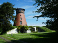
Former Hollers Mill
villers-la-ville.net: “The oldest parts of the former Hollers Mill (built of schist) date from the 13th and 14th centuries, whilst the more recent sections (built of brick) date from the 18th and 19th centuries.
It belonged to the lords of Hollers, vassals of the Dukes of Brabant.
First mentioned in 1530, it was acquired by Villers Abbey in 1617. Powered by the River Thyle, the mill ceased grinding in 1947.
The wheel’s emplacement is still there. It forms a fine, elongated structure built of schist sandstone.’
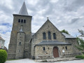
The church at Villers-la-Ville
https://fr.wikipedia.org/wiki/%C3%89glis...
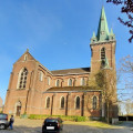
“The Church of Our Lady of the Visitation in Villers-la-Ville is a Romanesque and Neo-Romanesque church.
The interior of the church houses a wealth of heritage, such as the tympanum above the nave door on the reverse side of the façade, the funerary monument to François de Marbais, wooden altarpieces from the 15th and 16th centuries, and a Gothic-style stone niche surmounted by an ogee arch and fleurons…
The tympanum above the nave door is a 12th-century poly-lobed tympanum depicting the Paschal Lamb flanked by fleurs-de-lis: its right foreleg is bent and holds a pennant, as seen on a keystone of the westbau of the collegiate church of Tirlemont and on one of the western buttresses of St James’s Church in Leuven.
Funeral monument to François, Lord of Marbais
On one of the church walls stands the blue stone funerary monument to François and Hélène de Marbais and their daughter Jeanne, dated 1610.
This Renaissance-inspired monument, four metres high and two metres wide, was installed in the new church in 1946 at the request of the local council.
The deceased is depicted kneeling in the central section, flanked by his four coats of arms: Marbais, La Bricque, Tresnie and Saint-Val. Above him, a cartouche adorned with a skull bears the Latin inscription ‘Hodie Mihi, Cras Tibi’ (Today me, tomorrow you).
Owing to her family’s greed, on her death in 1610 Jeanne bequeathed the seigneury of Marbais to Jean t’Serclaes, Count of Tilly, chamberlain to the Duke of Lorraine: this monument therefore marks not only Jeanne’s death but also the end of the House of Marbais.
The church houses two wooden altarpieces:
the Nativity altarpiece, dating from the third quarter of the 15th century;
the Altarpiece of Our Lady, from the mid-16th century.”
The Monument to Jean ‘tSerclaes de Tilly.
cirkwi.com
‘At the foot of the church stands a monument dedicated to Jean t’Serclaes. Best known as “General Tilly”, Jean t’Serclaes was commander-in-chief of the armies of the Catholic League during the early part of the Thirty Years’ War. He inflicted defeats on the armies of Mansfeld and Brunswick. Defeated by King Gustavus Adolphus of Sweden, he died of his wounds in 1632 and became a heroic figure in German Catholic iconography. The work, created by Félix Roulin (1996), is intended as a symbol of reconciliation between peoples at a time of European integration. The hero is depicted travelling across Europe on his boots: the boot on his right foot bears a model of the town of Rothenburg, whilst the one on his left foot bears a model of Tilly.”
The Cassart Plain (former Chassart factories)
A brief history of our region (Information copied from the ‘chassart.com’ website)
• 1800 In the early 1800s, Auguste Dumont de Chassart farmed his land; he was already using fertilisers such as animal manure to enrich his soil.
• 1822 In 1822, he added a grain spirit distillery to his farm and built a barn alongside the Roman road, which would later become the Wagnelée farm.
• 1833 In 1833, he built a second distillery on the site of what would later become the Chassart estates. The site also featured a steam-powered flour mill and a small windmill used to pump water from the water table to water the livestock.
• 1836 It was in 1836 that the business really expanded, with the addition of a beet sugar factory, a steam engine, a malt house and a factory producing animal black for bleaching the sugar from the sugar factory – a rather revolutionary development for the time.
A railway linking the various family farms was even built at the time to facilitate internal transport within the family business.
• 1857 In 1857, Léopold Dumont took over and established a large grain spirit distillery by merging several small local agricultural distilleries.
A thick wall was erected around the site as protection in the event of a strike. This wall is flanked by four gates, two of which are majestic – the so-called North and South gates – built of brick and Ligny limestone. This monumental entrance has strong symbolic significance. It became the factory’s emblem on the jenever bottles; indeed, it is through this North Gate that one still enters La Plaine Chassart today.
• 1900 In the early 1900s, a yeast factory and distillery, as well as a vinegar works, were established at La Plaine Chassart. It was during this same period that a neo-Gothic chapel, dedicated to Saint Hubert, Saint Eloi and Saint Barbara, was built within the very grounds of the Chassart premises, to enable workers and service staff to attend Mass on Sundays.
• 1927 From 1927 onwards, a water tower and a wastewater treatment plant were built. Léopold Dumont demonstrated great creativity. We have already seen his interest in fertilisers and mechanisation.
Seeds were also selected at Chassart, and laboratories where experiments were carried out in both the sugar and chemical fertiliser sectors were set up there and used by the Gembloux Agricultural Institute.
• 1930 In 1930, the ‘Genièvre de Chassart’ trademark was registered with the clerk of the Commercial Court.
• The 1940s During the war, a new yeast factory was established, which would become the largest in Belgium in the 1940s.
• 1957 In 1957, the sugar refinery and the yeast factory ceased operations. Only the juniper spirit was still in production.
• The 1960s In the 1960s, the genièvre business was taken over by Martini. Léopold Dumont set up a mushroom farm with Bertrand de Briey. This mushroom farm operated until 1976. They then decided to diversify their activities until 2003 by moving into bagged potting compost and garden soil improvers. This is what we now refer to as the DNA of La Plaine Chassart.
• 2001 In 2001, a new generation of Dumont de Chassarts – four cousins – took up the baton to significantly expand the business, with the aim of offering a comprehensive service for professional gardeners and gardening enthusiasts alike!
Redebel
Sillonbelge.be 27/10/2018
“Since its inception (1988), the company has been designing and conducting agronomic trials and residue trials for all plant protection products submitted by its clients, whether herbicides, insecticides, fungicides, growth regulators, fertilisers, adjuvants… and across all types of crops. The vast majority of these trials are carried out with a view to obtaining authorisation for new products for the European market, whilst others are conducted for demonstration or research and development purposes.
Tanguy Dumont de Chassart, who has led the company since its foundation, very quickly realised that he would have to deliver work of impeccable quality to win the trust of stakeholders in the plant protection sector. This is why Redebel swiftly set about obtaining GLP (Good Laboratory Practice) and GEP (Good Experimental Practice) certifications. These were achieved in 1993 and 1997 respectively, and today a ‘Quality Assurance’ department ensures that these practices are properly monitored on a daily basis.
The trials conducted since 1988 have been diverse and varied, whether in the field or in the greenhouse. This makes it possible to carry out a wide range of so-called ‘conventional’ agronomic trials: the efficacy and selectivity of plant protection products; studies of the impacts of these products on subsequent crops (persistence) or neighbouring crops (drift); assessment of the consequences for the quality of harvested produce; tests on accumulation and dissipation in soil, and tests on weed resistance to herbicides.
Similarly, the company conducts trials designed to analyse pesticide residue levels in crops, as part of the registration procedures for these products. In this same field, it possesses the necessary expertise to measure residues that may be transferred from the leaf surface of plants to another surface, such as the skin of a worker assigned to harvesting fruit and vegetables.
Finally, with a view to meeting its clients’ evolving requirements, the company has added another string to its bow and has also developed its expertise in naturally derived products (biostimulants and biopesticides)………. ”
Ferme de la Jouerie and the D’Jirau meadow
Cirkwi: “This farmstead dates from the second half of the 18th century. In the 15th century, it was the seat of a fiefdom in Marbais, which was ravaged in 1675 by passing armies. A stone laid in 1946 commemorates the fact that Philippe Pieret, bailiff of Marbais from 1684 to 1771, lived here.
In the early 20th century, La Jouerie was a centre for breeding draught horses. The horses were requisitioned by the Germans in 1914.”
The D’jirau Meadow – The Archers of Marbais – The Royal Bird Shooting
D’jirau = Jay in Walloon
Source: archers-de-marbais.be
“As in any seigneury worthy of the name, Marbais possessed, in the Middle Ages, a most remarkable corps of archers. The adoption of firearms in the 16th century stripped this company of its military significance; it soon transformed into a recreational archery society and, as such, organised grand festivities in which the entire bourgeoisie took part. Lancelot, Lord of Marbais from 1559 to 1592, granted it a set of regulations known as the ‘Act of Establishment of the Oath of Saint Sebastian’. This institution took the name ‘Royal Oath’
The archery event takes place every year on the last Sunday in April.
On that day, at 1.00 pm sharp, the archers gather with their bows and arrows at the club’s premises. Led by the flag and a band, the members proceed in a group to the King’s residence, provided he lives in Marbais.
After refreshments provided by the King, the archers proceed to the Djirau meadow to elect a new King.
There, after raising the pole on which the cockerel has been mounted, the King administers the oath to the new members.
He shoots the first three arrows of the competition. Next, it is the turn of the new members to shoot, followed by the other members of the club in the order determined by a draw.
The archer who is the first to knock down the rooster, fixed at a height of 28 metres and known as the ‘Djirau’, will be crowned the new King.
The winner is then congratulated by all his fellow archers and dressed in the maroon cloak and the distinctive necklace of his title. He carries the shot rooster, impaled on the winning arrow, as his sceptre.
Passing through the courtyard of the Jouerie farm, where the archers are offered refreshments, the King and his entourage parade through the village streets to the sound of the brass band, before attending vespers at the parish church.
At the end of the service, the Archers perform the ‘Danse Macrabée’ in honour of the new King; they then proceed to the hall where the King is once again warmly congratulated.
It is during this gathering that the two sets of twelve archers are chosen by drawing lots to accompany the King and escort the relic of the Holy Cross during the grand procession on the first Sunday in May.
After this gathering, the King is delighted to offer a toast to his subjects, and the day draws to a close as each person sees fit.
‘The archer who shoots down the bird for three consecutive years takes the title of Emperor.’
Monument to the Desecrated Hosts (according to Paysdevillers-tourisme)
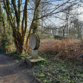
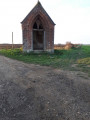
“This memorial stone was erected in 1804, after sacrilegious hands had stolen the ciborium from the parish church and thrown away the consecrated hosts; they were found by a shepherd.
According to legend, the day after the theft, the shepherd, who was grazing his sheep in the meadow at the Jouerie farm, saw his animals heading towards the ditch bordering the path and kneeling in a circle before something he could not make out. The shepherd approached and discovered the scattered holy hosts. To make amends for the desecration, the people of Marbais had a memorial stone erected at that spot.”
Place known as: ‘Arbre de la Bruyère’
villers-la-ville.be
“This large-leaved lime tree (Tilia platyphyllos) is situated on the boundary between the municipalities of
Wagnelée, Villers-Perwin and Sart-Dames-Avelines. It is 22 metres tall and has a
circumference of 3.15 m.”



 Country:
 City:
City:




 Visorando Member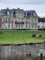
 Easy
Easy 
 Moderate