Golf de la Bruyère, starting from Camp

Enjoy the Brabant countryside near Marbais.
Dirt tracks and tarmac roads with light traffic.
A short stretch through the Golf de la Bruyère.

Details

n°4344571
Creation:
Last update:
Last review:
  • Walking
    Activity: Walking
  • ↔
    Distance: 3.55 mi
  • ◔
    Average duration: 1h 40 
  • ▲
    Difficulty: Easy

  • ⚐
    Back to start: Yes
  • ↗
    Ascent: + 39 ft
  • ↘
    Descent: - 39 ft

  • ▲
    Highest point: 531 ft
  • ▼
    Lowest point: 472 ft

Photos

Description of the walk

If you’re arriving by car, please park before you reach the unpaved section of Rue du Camp so as not to obstruct the passage of tractors.

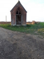
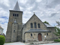
(S/E) Continue on foot to reach the chapel, which is, sadly, in ruins. In front of the chapel, take the path on the left and you’ll soon come out onto a tarmac road with a water tower in the distance.

(1) Turn left and, at the bottom of the gentle slope, you’ll reach a main road: the N93 (Namur–Nivelles).

(2) Cross it carefully and head straight on along a dirt track which will take you to the Sart-Dames-Avelines golf course (Golf de La Bruyère).

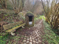
(3) At the golf course, turn left onto a path that is difficult to make out as it looks as though it’s part of the green. It’s located just past the sort of open wooden arbour or shelter. Take care; have a look at the photo. As you leave the golf course path, carry on straight ahead, passing a first wind turbine (on your left).

(4) Turn left before the second wind turbine, then carry on until you reach the main road again.

(5) Cross it carefully and enter Marbais via a concrete track.

(6) Take the second street on the left, after the TCI garage (on your left) and Rue Lorrain (on your right). This will take you to Rue du Camp and the starting car park (S/E).

Waypoints

  1. S/E : mi 0 - alt. 512 ft - Chapelle du Camp
  2. 1 : mi 0.56 - alt. 531 ft - Monceau du Berger
  3. 2 : mi 0.9 - alt. 525 ft - Route N93
  4. 3 : mi 1.33 - alt. 489 ft - La Bruyère Golf Course
  5. 4 : mi 1.98 - alt. 522 ft - 2nd wind turbine
  6. 5 : mi 2.75 - alt. 492 ft - N93 road
  7. 6 : mi 3.19 - alt. 486 ft - Rue du Camp
  8. S/E : mi 3.55 - alt. 512 ft - Chapelle du Camp

Notes

(3) Nearby bar and restaurant

Worth a visit

(1) Sart-Dames-Avelines Water Tower / Le Soir: this is an Art Deco tower, built in 1938, which, following its renovation in 2007, is currently in the process of being listed. There are 38 of this type in Belgium, out of the 871 listed, but the one in Sart-Dames-Avelines is one of the most distinctive. This is mainly due to the use of glazed corners, which was considered a modern solution at the time. The structure itself consists of eight pillars, providing a span of seven metres. In fact, you have to climb 222 very narrow metal steps to reach the 850 m³ water tank, situated 43 metres above ground level.
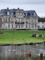
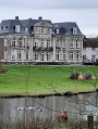
The white building that appears to stand at the foot of the château is the Haras des Avelines (lessons, boarding, courses).

Reviews and comments

4 / 5
Based on 2 reviews

Reliability of the description
4.5 / 5
Ease of following the route
4.5 / 5
Route interest
3 / 5
philippe flament
philippe flament

Overall rating : 4 / 5

Date of your route : Mar 20, 2023
Reliability of the description : ★★★★★ Very good
Ease of following the route : ★★★★★ Very good
Route interest : ★★☆☆☆ Disappointing
Very busy route : No

A rather uninteresting route across a monotonous plateau, apart from a 500-metre stretch across a golf course

Machine-translated

Chantheys
Chantheys
• Edited:

Thank you for your feedback.
Chantheys

Machine-translated

rossionf
rossionf

Overall rating : 4 / 5

Date of your route : Mar 07, 2021
Reliability of the description : ★★★★☆ Good
Ease of following the route : ★★★★☆ Good
Route interest : ★★★★☆ Good
Very busy route : No

A very easy, peaceful walk along fairly flat paths. The scenery is that of the countryside, with wind turbines serving as landmarks all along the route.
The only (minor) drawback was the mud, which was quite prevalent on some paths following the rain the previous week. So, make sure you wear shoes suitable for muddy conditions, or go when the weather has been dry.
Despite taking a wrong turn for between 1 km and 1.5 km, we completed the walk in 1 hour 30 minutes, at a perfectly normal pace.

Machine-translated

Other walks in the area

For more walks, use our search engine .

The GPS track and description are the property of this route's author. Please do not copy them without permission.