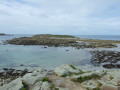
A very short walk taking you round a small island where traces of human settlement dating back to the Neolithic period can be found. Superb panoramic views of the coast and neighbouring islands await you.
Start from the small car park at Ségal Island beach, beside the road of the same name. If this car park is full, park in the neighbouring one at Porskuidig Beach, Rue du Lannic, and quickly make your way to the beach by following the coastal path south-west (red and white markings).
(S/E) Head towards the sea and you’ll reach the beach very quickly (information board on the island’s history).
(1) Head down onto the beach. Make your way towards the island by following a sand spit on the left-hand side to its end. Then climb over a short stretch of small rocks to reach the island (watch out for seaweed, which can make the rocks slippery).
(2) Walk round the island in either direction (the route shown on the map is clockwise). A faintly marked path runs almost all the way round the island. Some sections have been made more accessible (footbridges, ropes).
(2) Cross the area of small rocks again, then the sand spit to reach the edge of the beach.
(1) Cross the coastal path and you’ll immediately reach the car park (S/E).
Waypoints
S/E : mi 0 - alt. 43 ft - Car park at Ségal Island beach
1 : mi 0.04 - alt. 26 ft - Beachfront – Coastal Path
S/E : mi 0.65 - alt. 43 ft - Car park at Ségal Island beach
Notes
Warning:
At high tide, the stretch between points (1) and (2) is submerged and the island is cut off from the mainland. Undertake this walk at ebb tide or at low tide. Check the tide times at Portsall.
A good pair of trainers is sufficient for this very short walk. Take care on some of the island’s steep ledges.
This walk can be combined with the ‘Coastal and Countryside Trail from Porspaul’ walk. The point (1) on this walk is situated between the points (1) and (2) on the other walk. Although the route couldn’t be simpler, a detailed map (at the very least the one accompanying this description) allows you to explore other possible extensions.
Hike undertaken by the author on 19 September 2021.
Worth a visit
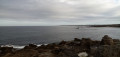
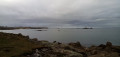
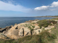
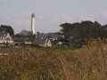
Superb panoramic views of the coast from Pointe de Corsen to the Four Lighthouse, as well as of Ouessant, Molène and the neighbouring islands.
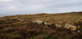
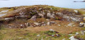
On the island, a few remains serve as a reminder of agricultural activity during the 19th century (the cultivation of rye, hence the island’s name): a low stone wall and the ruins of a dwelling. Several excavations likely mark the sites of Neolithic burial mounds which were used as stone quarries in the 17th century.
Reviews and comments
5 / 5
Based on 1 review
Reliability of the description 5 / 5
Ease of following the route 5 / 5
Route interest 5 / 5
Netra
Thank you, Nathalie! This very short route does indeed complement the “Coastal and Countryside Trail from Porspaul” nicely.
Machine-translated
grandin
Overall rating :
5 / 5
Date of your route : May 08, 2022 Reliability of the description : ★★★★★ Very good Ease of following the route : ★★★★★ Very good Route interest : ★★★★★ Very good Very busy route : No
To open this route on your smartphone, you must have the Visorando app installed. If not, got to the Apple Store (iPhone) or Google Play Store (Android) to download the app.



 Country:
 City:
City:





 Visorando Member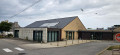

 Moderate
