Around Pointe de Corsen

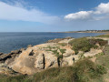
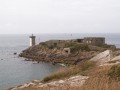
This walk takes us to Pointe de Corsen, the westernmost point of mainland France, allowing us to explore the coastal path and the countryside between Trézien and Porsmoguer.

Details

49244158
Creation:
Last update:
Last review:
  • Walking
    Activity: Walking
  • ↔
    Distance: 5.47 mi
  • ◔
    Average duration: 2h 45 
  • ▲
    Difficulty: Easy

  • ⚐
    Back to start: Yes
  • ↗
    Ascent: + 308 ft
  • ↘
    Descent: - 292 ft

  • ▲
    Highest point: 197 ft
  • ▼
    Lowest point: 23 ft
  • ⚐ Country: France
  • ⚐ City: Plouarzel (29810)
  • ⚑
    Start/End: N 48.407507° / W 4.7771°
  • ❏
    IGN map(s): Ref. 0317OT, 0417ET
  • Hour-by-hour weather

Description of the walk

Park at Kerhornou Beach.

Yellow signposts

(S/E) From the car park, head up the access road and turn right at the junction. Cross the stream and continue to the bend.

(1) Turn left and follow the path alongside the stream until you reach a road at Porsmoguer Mill.

(2) Carry on straight ahead along the road that follows the stream until you reach a crossroad.

(3) Turn right, then left, and head towards the fountain at the entrance to Trézien.

(4) Walk past the church, continue along the same street which bends left then right as it crosses the village centre. Turn left before the wash house and continue to a crossroad.

(5) Turn right heading north; on your left you’ll see some new housing estates. After about 300 m, you’ll reach the hamlet of Pen an Dreff.

(6) Turn left, then at the junction, turn left again heading west until you reach the coast at Porz Tévigné.

Red and white markings

(7) Follow theGR®34southwards until you reach a small dirt car park.

(8) Turn right, continuing to follow theGR®, and head towards Pointe de Corsen.

(9) After completing the discovery route and admiring the view from the information board, continue along the coastal path southwards until you reach the car park at Kerhornou Beach (S/E).

Waypoints

  1. S/E : mi 0 - alt. 23 ft - Kerhornou Beach
  2. 1 : mi 0.26 - alt. 52 ft - Stream path
  3. 2 : mi 0.65 - alt. 43 ft - Porsmoguer Mill
  4. 3 : mi 1.3 - alt. 144 ft - T-junction
  5. 4 : mi 1.47 - alt. 131 ft - Trézien Fountain
  6. 5 : mi 2 - alt. 194 ft - T-junction
  7. 6 : mi 2.15 - alt. 180 ft - The hamlet of Pen an Dreff
  8. 7 : mi 2.52 - alt. 23 ft - Porz Tévigné
  9. 8 : mi 3.16 - alt. 43 ft - Dirt car park
  10. 9 : mi 3.87 - alt. 112 ft - Corsen Headland
  11. S/E : mi 5.47 - alt. 23 ft - Kerhornou Beach

Notes

How to get there: from Saint-Renan, head towards Plouarzel, then towards Ploumoguer.
In Plomoguer, head towards Kherornou Beach and park in the beach car park.

Worth a visit

Always be cautious and plan ahead when you're outdoors. Visorando and the author of this route cannot be held responsible for any accidents occurring on this route.

The GR® and PR® markings are the intellectual property of the Fédération Française de Randonnée Pédestre.

Reviews and comments

4.8 / 5
Based on 2 reviews

Reliability of the description
5 / 5
Ease of following the route
4.5 / 5
Route interest
5 / 5
amuller
amuller

Overall rating : 4.7 / 5

Date of your route : Jul 10, 2026
Reliability of the description : ★★★★★ Very good
Ease of following the route : ★★★★☆ Good
Route interest : ★★★★★ Very good
Very busy route : Yes

Brilliant for older and younger people alike

Machine-translated

Sylpat
Sylpat

Overall rating : 5 / 5

Date of your route : Sep 15, 2025
Reliability of the description : ★★★★★ Very good
Ease of following the route : ★★★★★ Very good
Route interest : ★★★★★ Very good
Very busy route : No

a very beautiful hike, mainly along the coastal path, spectacular at high tide with wind!

Machine-translated

Other walks in the area

For more walks, use our search engine .

The GPS track and description are the property of this route's author. Please do not copy them without permission.