Country:
 City:
City:


The Grand Caunet car park is situated at the junction of the D3d and the D3, opposite a riding centre.
(S/E) Cross the D3 southwards with care and take the track signposted ‘Télégraphe’ directly opposite.
(1) At a fork in the road, after one kilometre, continue along the track to the left, then turn immediately right 60 metres further on.
(2) Head down the slope to the left and reach a fork in the road.
(3) Turn right towards the 333-metre mark.
(4) At this junction, do not miss the path that branches off to the right, under the trees; it tends to narrow slightly but is still perfectly passable.
(5) Follow the track up to the left at the end of this path and reach a second hairpin bend.
(6) Turn right and continue along this track in a north-westerly direction until you reach a junction at elevation 425.
(7) Turn right and follow the track for about 100 m.
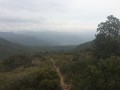
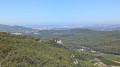
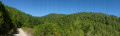
(8) Head up to the left towards the telegraph mast and its telecommunications relay station. Enjoy the view, then head back down towards the path you took on the way up.
(1) Turn left and follow the original track in the opposite direction back to the Grand Caunet car park (S/E).
 Visorando Member

 Association / Club / Walk leader
 Easy
Easy 
 Difficult