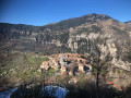
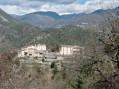
The gabion trail starting from Roussillon

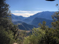
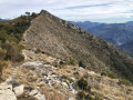
A mainly woodland walk, enjoyable in all seasons. Most of the paths are quiet and gently sloping, making for a moderate walk. Point (7) offers a beautiful panoramic view of the Var valley, the Vial and the Madone d’Utelle.

Details

n°43148493
Creation:
Last update:
Last review:
  • Walking
    Activity: Walking
  • ↔
    Distance: 3.88 mi
  • ◔
    Average duration: 3h 25 
  • ▲
    Difficulty: Moderate

  • ⚐
    Back to start: Yes
  • ↗
    Ascent: + 1,919 ft
  • ↘
    Descent: - 1,890 ft

  • ▲
    Highest point: 2,930 ft
  • ▼
    Lowest point: 1,089 ft

Photos

Description of the walk

Park in the village car park opposite the town hall.

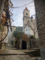
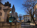
(S/E) Head down Rue du Clot towards the bottom of the village and look for marker 29. Turn left, cross the village via the Grand’Rue, and after the church, turn right onto the Chemin de Ripert to find marker 30.

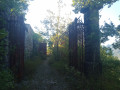
(1) Follow the signs for the Roussillon route. After a few metres, the path goes round the henhouse and heads into the forest. You’ll reach a crossroads of paths at marker 35.

Yellow markings

(2) Continue to the left towards: Route du Roussillon. Cross a DFCI (Forest Fire Defence) track twice. Each time, the path continues straight ahead. You’ll reach marker 34.

(3) Turn left towards: Route du Roussillon. Then continue to the water tower, 300 metres away.

The rest of the path is marked with cairns

(4) At the buried water tower, turn right. Leave the main track and walk past the water tower, which will be on your left. Continue to the next junction.

(5) Turn right and carry on. There are gabions throughout the forest. You’ll come to a Fork in the road.

(6) Take the path on the left. After about 100 metres, it turns left, heading north. Further on, the path veers sharply to the right, south/south-east, until it reaches a sharp bend to the left.

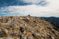
(7) The path bends sharply. Follow an open path for about ten metres, heading east. There is a small clearing here, which is the ideal spot for a break overlooking the Var, Vial and Madone d’Utelle valleys. Resume the route, heading due north, and continue until you reach a signposted path at a fork.

Yellow markings

(8) You’ll come across a larger cairn. Continue to the left (west) along this marked path. This will take you to the end of a track suitable for vehicles and marker 33. Please note: the map indicates that marker 33 is further west, but this is an error.

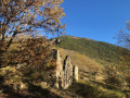
(9) Cross the track and take the path opposite. Continue along the descending path. After passing a beautiful ruin, the path runs alongside two farm sheds with rounded roofs and joins the Chemin carrossable de l’Ubac.

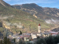
(10) Turn right onto it, then after 50 m, at the next junction, turn left (a 180° turn). The track becomes a tarmac road as it enters the village.

(1) Turn right onto the Grand’Rue. After the church, turn right onto Rue du Four, and join the (S/E).


Waypoints

  1. S/E : mi 0 - alt. 1,102 ft - Village car park
  2. 1 : mi 0.17 - alt. 1,171 ft - Marker 30 – Junction of the circular loop
  3. 2 : mi 0.54 - alt. 1,499 ft - Marker 35 – Trail junction
  4. 3 : mi 0.86 - alt. 1,929 ft - Marker 34 – Junction of paths
  5. 4 : mi 1.02 - alt. 1,857 ft - Water tower
  6. 5 : mi 1.18 - alt. 2,037 ft - Path junction
  7. 6 : mi 1.41 - alt. 2,218 ft - Path junction
  8. 7 : mi 2.15 - alt. 2,818 ft - Viewpoint
  9. 8 : mi 2.47 - alt. 2,861 ft - Path junction
  10. 9 : mi 2.9 - alt. 1,929 ft - Marker 33 – End of the track suitable for vehicles
  11. 10 : mi 3.35 - alt. 1,381 ft - Crossroads
  12. S/E : mi 3.88 - alt. 1,102 ft - Village car park

Notes

Hiking boots and walking poles recommended. Stony terrain.
No water.
At point (9), there is a fence for livestock

Reviews and comments

3.4 / 5
Based on 3 reviews

Reliability of the description
3.7 / 5
Ease of following the route
3.7 / 5
Route interest
3 / 5
bernard bb
bernard bb

Yes, there are few traces, that's true
use the app
One of the attractions is the wooded area.
Hiking friendship

Machine-translated

User 17048393

Overall rating : 2.7 / 5

Date of your route : Aug 18, 2025
Reliability of the description : ★★★☆☆ Average
Ease of following the route : ★★☆☆☆ Disappointing
Route interest : ★★★☆☆ Average
Very busy route : No

the first part of the route to the water tower (which is actually a cistern) is well signposted. After that, it's difficult to find the path because you have to turn right before the cistern and follow it with the cistern on your left. then there is a shaded path with pretty gabions until you reach the clearing (which is very small and difficult to identify as a clearing, but then the path descends, so you suspect that this is the point where you need to head back north). And there, there is nothing, no yellow markings or cairns, so we had to turn back

Machine-translated

bernard bb
bernard bb

Hello, and thank you, randonneurintrépide, for your review
Many of the footpaths around this village are closed by municipal order,
for safety reasons
Best regards, B.

Machine-translated

randonneurintrépide
randonneurintrépide

Overall rating : 3.7 / 5

Date of your route : May 07, 2024
Reliability of the description : ★★★★☆ Good
Ease of following the route : ★★★★★ Very good
Route interest : ★★☆☆☆ Disappointing
Very busy route : No

A monotonous walk, not particularly interesting. I enjoyed the return journey a bit more than the outward one. We didn’t find the little clearing.

Machine-translated

bernard bb
bernard bb

Hello Coldom

Thank you for clarifying that; I’ve just updated the description
Hiking friends, B.

Machine-translated

Coldom
Coldom

Overall rating : 4 / 5

Date of your route : Jan 21, 2024
Reliability of the description : ★★★★☆ Good
Ease of following the route : ★★★★☆ Good
Route interest : ★★★★☆ Good
Very busy route : No

A pleasant walk at this time of year, with lovely views of the Tinée and Var valleys in the upper section. There are a few sections where the path is in poor condition, but these do not present any real difficulties.
The route description is fairly precise, but a GPS may prove useful if in doubt.
A few key points might be worth clarifying: at point 4, when you reach the water tower (which is not very visible as it is buried), it should state ‘leave the main track and walk past the water tower on your left’.
At point 7, the “open path” isn’t very visible: there’s an uprooted pine tree blocking the way (a hairpin bend to the left) and we missed the small clearing recommended for a picnic (which we had at point 8).
Between points 9 and 10, at the start of the descent, we walked alongside a fence with wires on our left, which we had to climb over at the designated point (marked by a hook) to reach the “beautiful ruin” mentioned in the description. We climbed over it a little further down and rejoined the path at the ruin.

Machine-translated

Other walks in the area

For more walks, use our search engine .

The GPS track and description are the property of this route's author. Please do not copy them without permission.