The Ridge and Mayenne Trail – La Membrolle

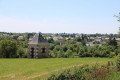
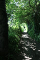
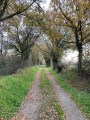
Around La Membrolle-sur-Longuenée and Pruillé, this walk allows you to discover beautiful
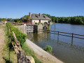
landscapes of hedgerows, orchards and peaceful, undulating paths. Further on, along the Mayenne towpath, you’ll cross paths with those cycling the ‘Vélo Francette’ route. A stop is a must at the pretty Roussière lock and at Pruillé harbour to refuel and admire the scenery.

Details

n°18861214
Creation:
Last update:
Last review:
  • Walking
    Activity: Walking
  • ↔
    Distance: 7.82 mi
  • ◔
    Average duration: 3h 50 
  • ▲
    Difficulty: Moderate

  • ⚐
    Back to start: Yes
  • ↗
    Ascent: + 259 ft
  • ↘
    Descent: - 266 ft

  • ▲
    Highest point: 262 ft
  • ▼
    Lowest point: 59 ft

Photos

Description of the walk

Start from the car park at La Placette, Rue du Cimetière (opposite the cemetery entrance).

(S/E) Leave the car park heading towards the south-western side of the cemetery. Cross Rue du Cimetière, then walk along the south-western side of the cemetery and pass the corner of a mini-market to reach Place Eric Tabarly, where the town hall is located.

Head left and walk between two buildings forming a semicircle at the junction of Rue Lamartine and Rue Jean Le François. Once behind the building, turn right to go round a pond on your left. At the junction with Impasse du Lavoir, turn right into it. Walk straight on between the buildings, two of which form a large semicircle on your left. Continue until you reach Rue Jean Le François.

Turn left onto Rue Jean Le François and, after about twenty metres, carefully cross Rue Françoise Dolto, then take a wide, tree-lined avenue heading south-east: the Mail Émile Joulain. At the end of this, carry on straight ahead along the path which leads to a roundabout on the D73 (Rue Charles de Gaulle) and connects to Rue d’Anjou.

(1) Turn left with care to follow the D73, which crosses the D775 below via a bridge, between two large embankments. Immediately afterwards, go round the roundabout by taking the path on the north side (to the left). Continue along the path which runs along the north side of Rue de la Chevallerie until you reach a third roundabout. Go round it to cross Impasse Laignier.

(2) Immediately, turn left onto the path heading north alongside Impasse Laignier.
Follow this path, which turns into a farm track a little further on before veering to the right and running alongside the hamlet of Les Mortiers on your right. At this point, the path becomes a small road and there is a pond to the right of the road.

Carry on to the hamlet of La Peloperie. At the crossroads, take the road on the right, Route de Malvoisine, which heads towards a small wood and skirts it to the north. Carry on towards Malvoisine. At the final right-angle bend, before the hamlet, take the path on the left which heads north-east and passes to the south of the hamlet of La Lande.
Carry on straight ahead until you reach the junction of Route de la Lande and Route de Vauléard.

(3) Cross Route de la Lande with care and take Route de Vauléard opposite for about two hundred metres, before turning left at the Y-junction. This road runs between two orchards (you can walk along the wide grassy verge bordering the orchards).
At the next Y-junction, take the right-hand road signposted ‘Écluse de Sautré’.
Continue to the banks of the Mayenne and go round the Sautré Lock house on the right before taking the towpath along the Mayenne heading north-west.

(4) At a lane leading to the Domaine de Vauléard, continue along the towpath, which also serves as a shared cycle path. Carry on straight ahead along the River Mayenne until you reach the Écluse de la Roussière (No. 43).

(5) Continue along the towpath beside the River Mayenne towards the Trait d’Union.
At this point, turn right onto the road leading to the Pruillé ferry, then turn left to continue along the towpath, which runs alongside the River Mayenne on your right and the “Bac de Pruillé” campsite on your left, until you reach the Pruillé river landing stage. Join the service road leading from the village.

(6) Move away from the River Mayenne by taking the road that climbs towards a building. This road takes a right-angle bend to the left. At this point, take the path on the right that runs alongside the road heading south-east. The path joins Rue du Bac. Follow it uphill for about 80 metres before taking the path on the left-hand side of the street.
Further on, the path joins the Rue Principale in Pruillé. Turn left onto the Rue Principale, which branches off to the right about twenty metres further on. Follow it to the edge of the village, where it curves sharply to the left.

(7) Turn right onto the second farm track, Chemin de la Queue de l’Étang, which heads south. In a small wooded area, turn right onto the second track on that side. The track soon runs alongside a housing estate on the right-hand side, before skirting a small plateau and reaching a road at a right-angled bend.
Carefully follow the road to the right towards the hamlet of Beausoleil.

(8) At the next junction, which forms an inverted Y-shape, take the left-hand road known as Clos de Beausoleil, which leads to the hamlet of the same name.
When the road takes a right-angle bend to the left as you reach Beausoleil, carry on straight ahead along the track heading south-west. A little further on, the track passes under a high-voltage power line and eventually reaches a T-junction.

(9) Take the left-hand track heading south. Continue along the main track until you reach the edge of the four-lane road, the D775. Turn left, follow the four-lane road as it runs overhead and continue to the Route de la Roussière. Don’t hesitate to leave the tarmac road and take the path on the right, which remains at the same level and leads to the next junction just before the bridge under the four-lane road.
Turn right and follow Route de la Roussière, which passes under the four-lane road.

(10) About sixty metres after exiting the tunnel, turn left onto a path which leads further on to Rue Lamartine. Turn right and follow Rue Lamartine, then turn right onto Rue du Lavoir, which runs alongside the cemetery.
At the end of Rue du Lavoir, cross Rue du Cimetière and return to the car park in the small square opposite the cemetery (E).

Waypoints

  1. S/E : mi 0 - alt. 177 ft - Car park on Rue du Cimetière
  2. 1 : mi 0.44 - alt. 217 ft - Roundabout to the west of the D775 road
  3. 2 : mi 0.69 - alt. 210 ft - Roundabout. Le Voyageur, Route de la Chevalerie
  4. 3 : mi 2.55 - alt. 95 ft - Route des Vergers junction
  5. 4 : mi 3.37 - alt. 59 ft - Towpath junction - Mayenne (rivière)
  6. 5 : mi 4.56 - alt. 66 ft - Lock No. 43 on the Roussière
  7. 6 : mi 5.5 - alt. 66 ft - Crossroads. Campsite
  8. 7 : mi 5.97 - alt. 164 ft - Crossroads
  9. 8 : mi 6.53 - alt. 246 ft - Clos de Beausoleil road junction
  10. 9 : mi 6.94 - alt. 217 ft - T-junction
  11. 10 : mi 7.59 - alt. 144 ft - Junction with the Route de la Roussière
  12. S/E : mi 7.82 - alt. 177 ft - Car park on Rue du Cimetière

Notes

This walk across varied terrain requires suitable footwear.

This walk is signposted in purple for almost the entire route. It follows almost the entire route of the walk entitled ‘From the Marcillé plateau to the towpath’, published as a ‘randofiche’ by the French Hiking Federation (FFrandonnée 2018). In addition, it is advisable to follow the instructions in the description and on the map, whilst paying close attention to the landscape. The waypoints (with their GPS coordinates and the distance from the starting point) serve as aids for walkers exploring the route for the first time.

Alternative route:
After the (2), at a place called Les Mortiers, turn left onto the grassy, tree-lined path heading north. The path passes under a high-voltage power line. At the next crossroads, turn left and continue straight on until you reach the Route de la Roussière. Turn right and follow the Route de la Roussière with care until you reach the right-angled bend in the road to the left near the River Mayenne. There, take the path on the right (closed to vehicles) and head towards La Roussière to rejoin the route. The total distance is then: 9.1 km

Hike completed by the author on 10 May 2022

Worth a visit

Longuenée-en-Anjou
With its four delegated communes (including L’Mambrolle), Longuenée-en-Anjou forms a rurban area that moves to the rhythm of nature, its thriving economy, the 90 associations that bring it to life, and its unmissable cultural events.
Steeped in rural traditions, it is also a committed economic player that supports businesses within its area and, with regard to the development of the digital sector, aims to be a rural testing ground for businesses as part of the #Longuenée Tech initiative.

The Mayenne
Before joining the Sarthe a little further on at Île Saint-Aubin to form the Maine, the River Mayenne flows through the commune of Longuenée-en-Anjou for over 7 km, offering, all along its course, an ideal setting for walks and outdoor leisure activities, whilst showcasing the exceptional biodiversity characteristic of the lower Anjou valleys.
The River Mayenne was for a long time the region’s most important economic artery. Already in use in Charlemagne’s time, navigation continued until the mid-20th century, with barges travelling upstream to trade in timber, oil or sand from the Loire, and downstream carrying cereals, linen or hemp cloth… It was thus only natural that people settled along the riverbanks, building towns and villages. After a brief period of decline, the Mayenne has been given a new lease of life thanks to river tourism and the conversion of the towpath into a walking trail.
In the past, boats pulled by horses or men from the path running alongside the river would travel upstream ‘by tow’. This is how the Mayenne towpath was formed over the years. The towpath is one of the most beautiful greenways in France: an 85-kilometre hiking route that is completely safe and open to all non-motorised walkers. It is undoubtedly the simplest and most authentic way to get to the heart of the region…
Source: the town’s official website

Pruillé
Until December 2015, Pruillé was part of the Lion d’Angers community of communes. On1 January 2016, it joined forces with La Meignanne, Le Plessis-Macé and La Membrolle-sur-Longuenée to form the new commune of Longuenée-en-Anjou, thereby becoming part of the Angers Loire Métropole urban community.
The municipality covers a vast area on both sides of the River Mayenne, stretching as far as the boundaries of La Membrolle-sur-Longuenée, Grez-Neuville, Feneu and Sceaux d’Anjou.
It is accessible via the Angers–Rennes road, which serves the La Chesnaie business park.
A typical riverside village which still had a population of 330 in 1975, Pruillé has experienced steady, controlled population growth with the construction of new housing estates (Les Basses Vignes 1 and 2 in 2004, La Perrière in 2010, Les Basses Vignes 3 in 2017, and so on).
There are still a few old houses here that add to the village’s charm: these small, low-ceilinged manor houses, built of schist stone. Take, for example, the Auberge restaurant, with its exposed wooden beams and fireplace.
Although commercial traffic is no longer a feature, the riverbanks remain very lively during the high season. A stroll along the towpath, a spot of fishing, a crossing on the ferry, a wander round the harbour, lunch in the former ferryman’s house—now converted into a guinguette—or at the inn in the village centre, a picnic on the banks of the Mayenne near the campsite… In Pruillé, people appreciate these friendly spots where regulars, locals and visitors alike meet and enjoy spending time together.

History
The history of Pruillé is shaped by the River Mayenne, which flows through the village. In centuries past, there was a great deal of river traffic on this river, as Pruillé was situated on a trade route linking Angers to Château-Gontier. Boats used to carry wine, grain, stone and, at one time, even weapons.
Life in the village is essentially rural, with farmers working on manorial farms. There used to be a flour mill in the village. A schist quarry was also operated in Pruillé.
The name ‘Pruillé’ as we know it today dates back to the French Revolution, but the village existed long before that.
It was in 1473 that Louis XI granted La Roussière to La Membrolle-sur-Longuenée in exchange for Le Tertre; La Membrolle-sur-Longuenée could now make use of the river, a major strategic route for transport, particularly of goods.
Since then, the boundaries of the commune have not changed much along the two banks of the river. The population has grown over the past 30 years or so, as housing estates began to be built (the first in the commune was the Hameau d’Hodéré) and people from the city began to settle in the village, which lies in thethird ring around Angers

Heritage
The Church of Saint-Symphorien
The church was founded in 1058. Built by the lords who owned all the land in Pruillé, it was still partly in secular hands in the early 12th century and was donated to the Abbey of Saint-Serge in Angers, to whom the Pope confirmed its ownership in 1159. The parish was founded around 1114–1134, with Saint Symphorien as its patron saint (Saint Symphorien, ‘He whose presence is beneficial’).
The church is a Romanesque building whose original openings (windows, south side door) are visible beneath the render from the 19th-century Gothic-style restoration. The presbytery was built in the 17th century.
In days gone by, the cemetery surrounded the church and stretched as far as the Grande Dairy Farm house; very close to the bell tower stands the grave of Gabriel de Maussion, Lord of Joncheray, Master Councillor in the Chamber of Accounts of Brittany, who died aged 78 on 25 September 1781.
In the past, the bell tower stood near the sacristy; the present tower, with its slate spire—built following a contract awarded on 8 May 1851—forms the porch over the entrance to the single-nave church with a flat chancel, featuring a mullioned window with a stained-glass panel depicting the Virgin Mary and Saint Peter, signed Truffier, Martin, Duvau, Angers 1868.
In 1868, the canopy in front of the small door on the square was built; the vault was rebuilt and renovated in 1932. In 1870, extensive works largely obliterated the Romanesque features. In 1963, the interior walls and the chancel were restored. In 1966, the Stations of the Cross (enamels on copper) were erected. In 1971, the altar was moved and repositioned to face the congregation.

The church bells
The bell tower houses three bells, the inscriptions on which tell us that they were ‘baptised in the year of our Lord 1891 by His Grace the Bishop of Angers, Charles Émile Freppel’, assisted by ‘Father Jean-Baptiste Tournerie, parish priest of Pruillé’.
The first, weighing 339 kg, sounds ‘A sharp’ and was named ‘Gabrielle, Élisabeth, Marie’ by ‘Mr Gabriel Marie Maussion du Joncheray, Mayor, and Mrs Mayaud, née Élisabeth Devienne’.
The second, weighing 236.5 kg, produced the note ‘Do’ and was named ‘Louise, Françoise, Joséphine’ by Mr Louis Mayaud and Mrs Sidonie Loi de Scepeaux-Vieilleville, Baroness du Joncheray.
The third, weighing 163.5 kg, produces the note ‘D’ and was named ‘Renée, Hélène, Symphorienne’ by Mr René Richou and Mrs Hélène Adélaïde de Guesdon, Baroness du Joncheray.
These are still operated by ropes under the porch.
Source: the municipality’s official website

Reviews and comments

4 / 5
Based on 3 reviews

Reliability of the description
4 / 5
Ease of following the route
3.3 / 5
Route interest
4.7 / 5
Éric91190
Éric91190

Overall rating : 3.7 / 5

Date of your route : Oct 06, 2026
Reliability of the description : ★★★★☆ Good
Ease of following the route : ★★★☆☆ Average
Route interest : ★★★★☆ Good
Very busy route : No

Hello, hikers – the signposting is very sporadic all along the route, but you can still find your way… Personally, we took a detour halfway through without realising it… There were lots of bikes on the towpath along the Mayenne
It’s worth noting that there are two places open on Sundays along the route, which is rare… the Bistrot de l’Ecluse in La Roussière and the Ginguette Ciao in Pruillé!
Eric

Machine-translated

Béné49
Béné49

Overall rating : 3.7 / 5

Date of your route : Mar 10, 2024
Reliability of the description : ★★★☆☆ Average
Ease of following the route : ★★★☆☆ Average
Route interest : ★★★★★ Very good
Very busy route : Yes

A lovely walk, especially in fine weather, with some beautiful views. Most of the time, we were able to follow the purple markings, but not always, which led to a few wrong turns.

Machine-translated

JYF49
JYF49

Overall rating : 4.7 / 5

Date of your route : Oct 10, 2022
Reliability of the description : ★★★★★ Very good
Ease of following the route : ★★★★☆ Good
Route interest : ★★★★★ Very good
Very busy route : No

A lovely variety of scenery, some beautiful locks and a charming mill. We had a picnic in the sunshine near the campsite, where there’s a lovely spot set aside for picnics. A brilliant day out with friends

Machine-translated

Other walks in the area

For more walks, use our search engine .

The GPS track and description are the property of this route's author. Please do not copy them without permission.