The Issaux Trail

A lovely little walk in the Issaux Forest, alternating between small country lanes, woodland paths and forest tracks.

Details

n°4891193
Creation:
Last update:
Last review:
  • Walking
    Activity: Walking
  • ↔
    Distance: 2.26 mi
  • ◔
    Average duration: 1h 25 
  • ▲
    Difficulty: Easy

  • ⚐
    Back to start: Yes
  • ↗
    Ascent: + 404 ft
  • ↘
    Descent: - 404 ft

  • ▲
    Highest point: 2,428 ft
  • ▼
    Lowest point: 2,024 ft

Photos

Description of the walk

From Lourdios-Ichère, head up the D341 road alongside the Gave d’Issaux. Park near the suspension bridge (elevation 614) in a lay-by on the right-hand side of the D341.

(S/E) Cross this bridge, keeping to the left bank of the Gave d’Issaux, and follow the path that winds through the forest.

(1) The path is not marked on IGN maps but is perfectly passable through the forest. Follow it, cross the small Ruisseau d’Arriou de la Sèque at elevation 623 and continue straight on.

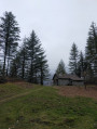
(2) At the junction, turn right, heading due south. Carry on straight ahead. The path turns into a forest track. You’ll pass a superb chalet on your right. Carry on straight ahead. Cross another small stream whilst staying on the same track. You’ll come to a fork in the track.

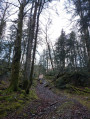
(3) You’ll see the road. Don’t join it. Turn right into the woods (the path is a bit overgrown but is still passable). Follow the road via the path that winds through the woods.

(4) The path takes you back to the D341 road between two magnificent trees. Take the road by turning right. Cross the Gave d’Issaux via the Pont du Gouat. Stay on this small road until you reach your car (S/E).

Waypoints

  1. S/E : mi 0 - alt. 2,024 ft - Car park on the right on the D341
  2. 1 : mi 0.13 - alt. 2,073 ft - A path that gradually takes shape
  3. 2 : mi 0.61 - alt. 2,290 ft - Junction with the track
  4. 3 : mi 1.19 - alt. 2,313 ft - Turn right towards the road
  5. 4 : mi 1.45 - alt. 2,119 ft - Road junction between two large trees
  6. S/E : mi 2.26 - alt. 2,024 ft - Car park on the right on the D341

Notes

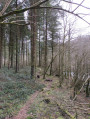
Part of the path isn’t marked on maps, but you really can’t miss it once you’re in the forest.
The return route follows a quiet, little-used tarmac road, but it’s easy to cut through the woods to avoid the tarmac.
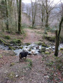
The walk is surrounded by water and woodland, ideal in hot weather and perfect for dogs.

Worth a visit

Reviews and comments

4.2 / 5
Based on 2 reviews

Reliability of the description
4 / 5
Ease of following the route
4 / 5
Route interest
4.5 / 5
User 1732905
• Edited:

Overall rating : 3.3 / 5

Date of your route : Aug 03, 2026
Reliability of the description : ★★★☆☆ Average
Ease of following the route : ★★★☆☆ Average
Route interest : ★★★★☆ Good
Very busy route : No

A lovely path in a secluded valley, but… full of horseflies! We spent the whole time shooing them away (and getting bitten anyway). The uphill section of the path (to the east) was very different from the description, as a clear-cut had been carried out: no more forest, branches everywhere, a rough and uneven path… A shame, as the area is lovely! Walk (partially) completed in July 2026.

Machine-translated

Johelnardi
Johelnardi

Overall rating : 5 / 5

Date of your route : Aug 12, 2023
Reliability of the description : ★★★★★ Very good
Ease of following the route : ★★★★★ Very good
Route interest : ★★★★★ Very good
Very busy route : No

A short, easy walk along a stream and in the shade of the trees. No difficulty at all, and it was great fun to have the path all to ourselves. There were a few more people on the last section as it runs alongside the road and there are some lovely spots to stop and rest. A really lovely walk.

Machine-translated

Other walks in the area

For more walks, use our search engine .

The GPS track and description are the property of this route's author. Please do not copy them without permission.