La Fougeraie de Lahünd

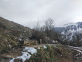
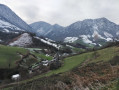
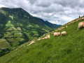
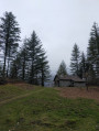
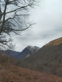
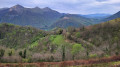
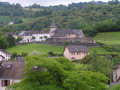
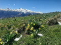
This short walk offers a refreshing view of the charming village of Lourdios-Ichère and some of the mountains surrounding the valley, such as Layens and Biscacou. You’re sure to come across donkeys, horses and pigs along the way.

Details

4525221
Creation:
Last update:
Last review:
  • Walking
    Activity: Walking
  • ↔
    Distance: 3.92 mi
  • ◔
    Average duration: 2h 45 
  • ▲
    Difficulty: Moderate

  • ⚐
    Back to start: Yes
  • ↗
    Ascent: + 1,096 ft
  • ↘
    Descent: - 1,106 ft

  • ▲
    Highest point: 2,247 ft
  • ▼
    Lowest point: 1,280 ft

Photos

Description of the walk

Park in the car park at Loudios-Ichère church.

(S/E) Stand facing the cross and head to the left. Cross the bridge and join the departmental road. Turn left and continue straight on along the departmental road, passing the white house with blue shutters (on the right) and then the farm (on the left).

(1) Shortly after the farm, cross the green bridge and turn left onto the path. Continue straight on along the track until you reach a crossroads at the highest point.

(2) Leave the track and turn left onto the grassy path leading back down towards the valley. Here, follow the sign for Lourdios via Lacoste. Continue straight down until you reach a tarmac road.

(3) At the junction, leave the path and take the tarmac road to the left. Carry on straight ahead to the farm (beware of dogs).

(4) The grassy path is on the left just before the farm (do not enter the farm buildings). Head uphill and go round the top of the farm.
Please note: Do not take the path leading uphill to the left towards the two abandoned buildings, but rather the one leading uphill to your right after the small hairpin bend. Carry on straight ahead. Pass a small house and then rejoin the tarmac road.

(5) Take this road, pass the hamlet of Superbie, and carry on straight ahead until you reach the junction by the village hall.

(6) Get back onto the departmental road by turning left. Pass the village hall and the Lourdios eco-museum. Carry on until you reach the bridge on your left. Cross the bridge and head for the car park at the church square (S/E) situated a little further up.

Waypoints

  1. S/E : mi 0 - alt. 1,463 ft - Car park at the - Église Saint-Isidore (Lourdios-Ichère)
  2. 1 : mi 0.48 - alt. 1,601 ft - Trail junction
  3. 2 : mi 2.02 - alt. 2,234 ft - High point, end of the track
  4. 3 : mi 2.85 - alt. 1,280 ft - Tarmac road
  5. 4 : mi 3.09 - alt. 1,342 ft - Farm
  6. 5 : mi 3.31 - alt. 1,467 ft - Road junction
  7. 6 : mi 3.72 - alt. 1,421 ft - Lourdios village hall
  8. S/E : mi 3.92 - alt. 1,467 ft - Car park at the - Église Saint-Isidore (Lourdios-Ichère)

Notes

Between (1) and (2) there is a water point, the Cournau fountain. Ideal for giving your four-legged friends a drink.
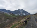
Please be aware that there are animals roaming freely in the valley (horses, donkeys). You may also come across pigs. Please ensure your dogs do not chase after them.

Worth a visit

The route also takes you past Marie-Eve’s farm, where she produces Ossau-Iraty cheese. Do stop off there to stock up on farmhouse sheep’s cheese.
(6) You’ll pass by a small eco-museum. Do pop in for a look around.

Reviews and comments

4.6 / 5
Based on 3 reviews

Reliability of the description
4.7 / 5
Ease of following the route
4.3 / 5
Route interest
4.7 / 5
TheGGfamily
TheGGfamily

Overall rating : 4.7 / 5

Date of your route : May 16, 2026
Reliability of the description : ★★★★★ Very good
Ease of following the route : ★★★★☆ Good
Route interest : ★★★★★ Very good
Very busy route : No

A really lovely walk, not too long, of moderate difficulty (a good climb and a good descent), with magnificent views
Just two points to note:
- follow the VisoRando directions carefully and don’t rely on the hiking sign near the church, which is out of date
- when you leave the track for the path that descends through the ferns, once you’re well on the path, it seems to disappear at one point; keep in mind to head right rather than left, towards the trees and houses below, and you’ll find the yellow markings again.

Machine-translated

Solvei
Solvei

Overall rating : 4.7 / 5

Date of your route : Apr 21, 2025
Reliability of the description : ★★★★★ Very good
Ease of following the route : ★★★★☆ Good
Route interest : ★★★★★ Very good
Very busy route : No

A really lovely walk. Easy and well signposted. We did it in April with three children aged 9 and 5. Be careful at the start – the path indicated by the signs is very steep. The route on the walking guide is slightly different.
A 5.3 km loop following the signs and yellow markings.

Machine-translated

hervébassinarcachon
hervébassinarcachon

Overall rating : 4.3 / 5

Date of your route : Feb 03, 2021
Reliability of the description : ★★★★☆ Good
Ease of following the route : ★★★★★ Very good
Route interest : ★★★★☆ Good
Very busy route : No

It was a lovely walk; the route is well marked, with lovely views of the surrounding mountains. At point 2, you must turn left and, most importantly, head straight down. There’s some lovely sheep’s cheese at the farm.
Thank you

Machine-translated

Other walks in the area

For more walks, use our search engine .

The GPS track and description are the property of this route's author. Please do not copy them without permission.