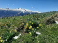
Saudalate mountain pasture

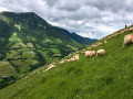
To complement the PLR hike at the Col de Laünde, this is a lovely circular walk above the village of Lourdios-Ichère, leading to the Saudalate mountain pasture where herds graze from June to September.
Moderator’s note, 21 May 2025.
(!) In light of the latest comments, it seems preferable to undertake this hike as a return trip to the Col de Laünde (6).

Details

n°20414745
Creation:
Last update:
Last review:
  • Walking
    Activity: Walking
  • ↔
    Distance: 7.23 mi
  • ◔
    Average duration: 5h 00 
  • ▲
    Difficulty: Difficult

  • ⚐
    Back to start: Yes
  • ↗
    Ascent: + 1,946 ft
  • ↘
    Descent: - 1,916 ft

  • ▲
    Highest point: 3,248 ft
  • ▼
    Lowest point: 1,467 ft

Photos

Description of the walk

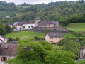
Park in the church square.

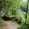
(Start/End) Turn your back on the statue of Notre-Dame des Bergers, walk past the farm on your left and continue until you reach the path that climbs to the left after the hiking information board. Turn left: be careful, this steep path on schist is slippery, especially after rain, so take care. Follow it until you reach a wide track (Piste du Bourraguill).

(1) Continue uphill to the left, walk for about 100 m and go through a cattle grid.

(2) You’ll see the return path on your right, but carry straight on and pass the Fontaine de Courneau (watering hole). Continue along this track for about 1 km until you reach another watering hole (Tos de la Coustette) at elevation 702.

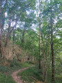
(3) Leave the track; a narrow path begins and climbs to the right up the earthen slope. Follow the narrow path as it cuts across the slope and, about 450 m further on, you’ll emerge into a large fern-covered area. Follow the track which climbs straight up the slope (caution: steep slope, take care) for about 450 m; pass beneath a rocky barrier at elevation 941 and emerge onto a grassy plateau where herds are grazing during the summer: please keep your dogs on a lead , do not approach the animals and walk round them.

(4) Continue along this broad ridge, keeping to the right-hand side. 300 m further on, the path, which had faded into the meadow, becomes clear again and turns northwards into a wood along a more comfortable track. Follow it until you reach the Col de Saüdarie, where there is an active shepherd’s hut: dogs must still be kept on a lead.

(5) Walk past the hut and continue straight on for about 1.2 km to Point No. 5: I would add ‘Turn left straight away, and after a right-hand bend, veer left again to......

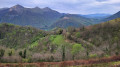
(6) At the pass, take in the view: Trône du Roi, Col de Napatch, Le Biscacou and Souturou. Turn round and head back to the Col de Saüdarie.

(5) This time, turn your back on the hut, look out for the post (marked in yellow) indicating the altitude and set off diagonally down the grassy slope towards the south-east, following the track made by passing animals. Follow this for about 300 m (marked in green) until you reach the drinking troughs at the Fontaine de la Lie.

(7) Turn your back on the drinking troughs and continue your route, first heading north-west parallel to the finishing trail, then turning west towards a large rock beneath which there is a drinking trough.

(8) Head down past the boulder and the watering hole, diagonally towards the south-east, until you reach a tree-lined hedge. Then turn right and follow it until you rejoin the wide track you took on the way up.

(2) Turn left.

(1) Continue along the track until you reach the D241.

(9) Turn right and follow the small road with care until you reach the church square (S/E).

Waypoints

  1. S/E : mi 0 - alt. 1,467 ft - Church Square
  2. 1 : mi 0.26 - alt. 1,781 ft - Track suitable for vehicles
  3. 2 : mi 0.52 - alt. 1,991 ft - Junction of the circular loop
  4. 3 : mi 1.33 - alt. 2,316 ft - Water trough (Tos de la Coustette)
  5. 4 : mi 1.96 - alt. 3,084 ft - Grassy plateau
  6. 5 : mi 2.61 - alt. 3,143 ft - Col de Saüdarie
  7. 6 : mi 3.32 - alt. 3,140 ft - Col de Laünde
  8. 7 : mi 4.35 - alt. 2,969 ft - Watering holes
  9. 8 : mi 4.81 - alt. 2,657 ft - Rock, drinking trough
  10. 9 : mi 6.79 - alt. 1,591 ft - D241
  11. S/E : mi 7.23 - alt. 1,467 ft - Church Square

Notes

Watch out for herds: keep your dogs on a lead, do not approach the animals and walk around them!
This walk is not recommended in bad weather (fog, rain, thunderstorms).
This walk is very exposed to the sun.

Worth a visit

Lourdios-Ichère Eco-Museum and occasional refreshment stop. Contact the town hall for opening times: 05 59 34 41 58.

Reviews and comments

2.6 / 5
Based on 7 reviews

Reliability of the description
2.7 / 5
Ease of following the route
2.1 / 5
Route interest
2.9 / 5
Gérard17140
Gérard17140

Overall rating : 1.3 / 5

Date of your route : May 18, 2025
Reliability of the description : ★☆☆☆☆ Very disappointing
Ease of following the route : ★☆☆☆☆ Very disappointing
Route interest : ★★☆☆☆ Disappointing
Very busy route : No

The walk to the Col de Laünde: Very good, no difficulty.
The round trip from the Saüdarie Pass is of no particular interest.
The return journey from the hut to point 2 isn’t really ‘difficult’ but is a proper ‘endless slog’ across the cow pasture. There are no proper paths apart from the muddy, rutted tracks trodden by the animals. In the meadow, you’re constantly twisting your ankles… And even so, it was a sunny day and the ferns and brambles were only just beginning to grow.
Tip: Best avoided if you don’t want to put you off low-altitude hiking.

Machine-translated

Jean-Claude montalbano

Overall rating : 2 / 5

Date of your route : Jul 26, 2024
Reliability of the description : ★★☆☆☆ Disappointing
Ease of following the route : ★★☆☆☆ Disappointing
Route interest : ★★☆☆☆ Disappointing
Very busy route : No

Walk taken on 26 July 2024
As mentioned in previous reviews, it’s a very pleasant walk to the sheepfold and the Col de Saudarie, but the return journey is along what you might call ‘paths’ – if you can call them that – as there are waist-high ferns that almost completely block them, with no signposts. You then arrive near a spring, which you can only guess at because your feet are wading through a puddle.
As for the final section at the edge of the woodland, it’s a shaded, damp path – well-marked this one – but unfortunately used by cows, which have rendered it completely impassable due to the mud, cowpat and water pooling from runoff.You therefore have to make your own way by going over the top via the animals’ ‘trails’ and battle your way through the tall ferns and brambles there too.
Of course, I followed the GPX track, but as everyone knows, GPS is only reliable to within a few metres, or even tens of metres, depending on the terrain.
In this particular case, it can only give a general direction.
It goes without saying that I would not recommend this route at all, at least not as a circular route as it is presented here, as it is by no means an enjoyable experience.

Machine-translated

GCEJM
GCEJM

Overall rating : 1 / 5

Date of your route : Jul 22, 2024
Reliability of the description : ★☆☆☆☆ Very disappointing
Ease of following the route : ★☆☆☆☆ Very disappointing
Route interest : ★☆☆☆☆ Very disappointing
Very busy route : No

A very disappointing walk, starting with a very slippery climb. After reaching the sheepfold at the Col de Saudalie and admiring the view at the end of the out-and-back section, it all goes downhill! You’ll search in vain for a path; there are no markings on a slope covered in ferns and knee-high grass, which hide the holes from view. High risk of sprains!
We do not recommend this walk.

Machine-translated

Bodl
Bodl

Overall rating : 2 / 5

Date of your route : Jul 22, 2024
Reliability of the description : ★★☆☆☆ Disappointing
Ease of following the route : ★☆☆☆☆ Very disappointing
Route interest : ★★★☆☆ Average
Very busy route : No

Be extra careful on this circular walk, as the route is very poorly signposted and the paths are virtually non-existent from the shepherd’s hut (Col de Saudarie); I wouldn’t recommend doing the full loop as the return journey is a nightmare! You’ll be wading through ferns and brambles with no clear path
The scenery is certainly lovely, but it’s hard to appreciate it because of how difficult it is to make progress
Furthermore, the start of this walk is dangerous when the ground is wet; it’s extremely slippery

Machine-translated

rd76
rd76

Overall rating : 2.3 / 5

Date of your route : Jul 22, 2024
Reliability of the description : ★★★☆☆ Average
Ease of following the route : ★☆☆☆☆ Very disappointing
Route interest : ★★★☆☆ Average
Very busy route : No

Hike completed on 20 July 2024.
There was no proper path leading down from the hut. The descent was therefore dangerous, through tall grass and ferns without being able to see where we were putting our feet, until we reached a track which, in turn, proved to be virtually impassable – muddy and completely trampled by cows. A perilous stretch of the walk with a few falls…
We won’t be going back there!

Machine-translated

Ecreviris
Ecreviris

Overall rating : 4.3 / 5

Date of your route : Jul 03, 2022
Reliability of the description : ★★★★★ Very good
Ease of following the route : ★★★★☆ Good
Route interest : ★★★★☆ Good
Very busy route : No

The climb went smoothly; in fine weather, the view is magnificent.
When I arrived at the hut, I was pounced on by the family’s three sheepdogs, who were on summer pasture – one of them even managed to nip me twice before its owners called it back. So do be careful!
The descent from the hut isn’t straightforward (though perhaps my sore leg didn’t help…), and the detour to the drinking troughs at Fontaine de la Lie (point 7) isn’t worth it. Apart from that, it’s a lovely circular route!

Machine-translated

BBbarétous64
BBbarétous64

Hello,

Thank you for the positive feedback
However, it is clearly stated that you should not set off
in foggy conditions...
Indeed, the routes are best enjoyed
in such situations.

Machine-translated

Philou64
Philou64

Overall rating : 5 / 5

Date of your route : May 12, 2022
Reliability of the description : ★★★★★ Very good
Ease of following the route : ★★★★★ Very good
Route interest : ★★★★★ Very good
Very busy route : No

A hike undertaken on Thursday 12 May, in changeable weather which turned to fog by the time we reached the mountain pasture.
The descent from the Col de Saüdarie hut along a narrow path through the fog wasn’t easy; we were really glad we’d downloaded the route onto our Garmin!
All in all, a lovely circular route to do in clear weather – we’ll be doing it again.

Machine-translated

Other walks in the area

For more walks, use our search engine .

The GPS track and description are the property of this route's author. Please do not copy them without permission.