


 Country:

 City:
City:


Park at the Polignac car park, in the Souleille neighbourhood, on Route de Champ Rouet, to the west of the village, accessible via the N102 or the D136.
(S/E) Walk uphill along the side of the road via Rue de la Souleille (D136d) and, at the bend in the road, turn left to join the N102.
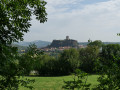
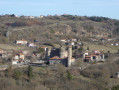
(1) After passing under the main road, turn left towards La Malouteyre and follow this path, which offers some beautiful views of Polignac Fortress. You’ll reach the junction with the road leading up to Mont Denise
(2) Continue downhill to the Route de la Malouteyre and take it on the right-hand side.
Follow this road down, ignoring the Chemin de la Fontaine on the left and then the other private roads on either side, until you reach the Route de Polignac (D13).
(3) Cross it carefully and head down to the right for about 50 metres before turning left onto Rue Traversière de Polignac until you reach the N102 (Avenue de Mondon).
(4) Cross this main road carefully and take the staircase (with beautiful basalt organ-pipe steps) which continues the descent towards Rue André Giroud, then carry on straight ahead into Rue du Pont Vieux, a fairly long bridge which you cross over the Borne.
(5) Turn right onto Rue du 86e Régiment d’Infanterie until you turn left into Rue Pons de Chapteuil, then right onto Boulevard Carnot. Cross the boulevard at the traffic lights to reach the old town via Avenue de la Cathédrale and then Rue des Tables.
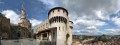
(6) The cathedral steps are a key point to continue the circular route, but you can reach them via whichever route suits you best.
(7) Take the right-hand exit at the back of the cathedral to reach a small square (with a table, two benches, a cross and a view over the town) where you can have a picnic. Leave the cathedral via the main entrance and go down the steps.
(6) Turn right into Rue Becdelièvre to reach Place Monseigneur de Galard, then the street of the same name.
(8) Take the steps on the left to reach Place Saint-Clair in the village of Aiguilhe. Continue along Rue Crozatier, then Montée de la Coustette and Rue des Écoles on the right to reach Avenue de Bonneville. Cross it with care to reach the Pont Tordu (worth a look but don’t cross it).
(9) Take the path running alongside the Borne river towards the north (Promenade de la Borne) and leave it at the next bridge.
(10) Cross it towards Le Puy Hospital. Follow the Chemin de Bouthezard uphill, then turn right off it to take a path on the left, between the properties, which ends in a flight of steps leading to the Montade de la Boriette.
(11) Turn right again, then after 40 metres take another flight of steps leading to the Allée des Pineaux. Turn right and look for the path on the left which crosses the Parc de la Boriette and emerges onto the Impasse de la Boriette. Follow the Chemin de la Boriette on the right and, via the Route de la Météo, reach the junction with the D13.
(12) Turn right onto Chemin des Réservoirs and immediately turn left onto the signposted path towards Polignac until you reach the D136.
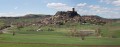
(13) Cross the road carefully and continue straight ahead until you reach Chemin de Glaveyre, which you should take on the left. The village and the fortress are unmissable landmarks.
(14) Cross the D13 with care and continue straight ahead until you reach Rue de l’École; head up this road to the left, then turn right onto the small path leading to Rue du Toria. Follow this to the right, then take Rue du Levant to the left to reach Place de Polignac and its church, which you are also welcome to visit.
(15) Walk back down Rue des Écoles.
(16) Turn right onto a path that will take you to Route de Champ Rouet, where you’ll find the car park where you started, on the left (S/E).

 Visorando Member

 Difficult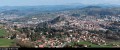

 Easy
Easy 
