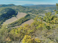
The Majargues plateau

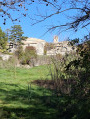
This is a short walk starting from the centre of Limans that takes you up to the neighbouring plateau, offering a lovely view over the Laye valley. The entire climb up to the plateau is quite exposed to the sun.

Details

n°59727098
Creation:
Last update:
Last review:
  • Walking
    Activity: Walking
  • ↔
    Distance: 3.10 mi
  • ◔
    Average duration: 2h 20 
  • ▲
    Difficulty: Moderate

  • ⚐
    Back to start: Yes
  • ↗
    Ascent: + 1,020 ft
  • ↘
    Descent: - 1,020 ft

  • ▲
    Highest point: 2,890 ft
  • ▼
    Lowest point: 1,870 ft

Description of the walk

Park near the local bistro on Place de Mai. The entire route is signposted with yellow signs. Follow the route marked ‘Plateau de Majargues’.

(S/E) Follow theGR® heading north-west and carry on, turning left as you leave the village.

(1) Leave theGR® and take the path leading uphill to the left. You’ll come to a crossroads.

(2) Leave the track and take the small path opposite, then climb up to the plateau.

(3) At the crossroads, take the main path on the left.

(4) Leave the main path and follow the one on the left. After a few dozen metres, leave this path and take the narrow track on the right (east), following the yellow markers. You’ll reach a wide path (Chemin de Tècle) at a place called Lombard, at a multi-way junction.

(5) Turn left (north) towards the village of Limans.

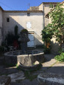
(6) When you reach the first houses, turn right to follow Rue Solheilas and enter the village. Don’t miss the lovely little church, and carry on for about thirty metres. Then turn left, cross the small square and head to the right to return to the car park (S/E).

Waypoints

  1. S/E : mi 0 - alt. 1,870 ft - Local bistro
  2. 1 : mi 0.3 - alt. 2,001 ft - End of GR°°®°°
  3. 2 : mi 0.79 - alt. 2,385 ft - Leave the track and take the path opposite
  4. 3 : mi 1.5 - alt. 2,838 ft - Junction, on the left
  5. 4 : mi 1.95 - alt. 2,451 ft - Leave the main path, turning left
  6. 5 : mi 2.19 - alt. 2,224 ft - Chemin de Tècle
  7. 6 : mi 2.94 - alt. 1,890 ft - Rue Solheilas
  8. S/E : mi 3.1 - alt. 1,870 ft - Local bistro

Always be cautious and plan ahead when you're outdoors. Visorando and the author of this route cannot be held responsible for any accidents occurring on this route.

The GR® and PR® markings are the intellectual property of the Fédération Française de Randonnée Pédestre.

Reviews and comments

4.7 / 5
Based on 1 review

Reliability of the description
5 / 5
Ease of following the route
5 / 5
Route interest
4 / 5
brayman
brayman

Overall rating : 4.7 / 5

Date of your route : Oct 04, 2025
Reliability of the description : ★★★★★ Very good
Ease of following the route : ★★★★★ Very good
Route interest : ★★★★☆ Good
Very busy route : No

The elevation gain of 300 metres is concentrated in the first 2 kilometres but is very steady, with no significant difficulty.
Magnificent views of the valley (for locals, as far as La Roche Amère, near Villeneuve and Manosque)
On the plateau, it's a windy day, so be prepared for some headwinds!
Not a bad way to reward yourself for your efforts: in the village of Limans, there is a nice bistro restaurant (the same in Lardier, 9 km away)

Machine-translated

Other walks in the area

For more walks, use our search engine .

The GPS track and description are the property of this route's author. Please do not copy them without permission.