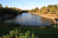
Le Petit Anjou as seen from Landemont

Follow the old tracks of the Petit Anjou, a historic railway line that operated in the late19thcentury. It ceased operations in the early 1950s. A few sections remain, offering a lovely walk along sunken paths and a series of crossings over the River Divatte.

Details

n°68169923
Creation:
Last update:
Last review:
  • Walking
    Activity: Walking
  • ↔
    Distance: 6.35 mi
  • ◔
    Average duration: 3h 10 
  • ▲
    Difficulty: Moderate

  • ⚐
    Back to start: Yes
  • ↗
    Ascent: + 246 ft
  • ↘
    Descent: - 256 ft

  • ▲
    Highest point: 305 ft
  • ▼
    Lowest point: 128 ft
  • ⚐ Country: France
  • ⚐ City: Landemont (49270)
  • ⚑
    Start/End: N 47.265926° / W 1.244747°
  • ❏
    IGN map(s): Ref. 1323SB
  • Hour-by-hour weather

Photos

Description of the walk

 Blue signposting 

(S/E) Set off from the sports centre car park, where you can park. Turn right and head towards the cemetery.

(1) Walk past it, keeping it on your right, and head towards La Remaudière along Rue de la Paix. At the school complex, turn right, then right again onto Route du Quarteron.

(2) Walk through the Quarteron neighbourhood until you reach the end of the tarmac road, then carry on straight ahead, following a botanical trail to the Divatte and Moinie streams.Please note that the path, which has a steep gradient, can be slippery in wet weather. Cross the stream via an old little bridge; you are now in Loire-Atlantique.

(3) Then carry on straight ahead to La Hiardière and first turn left then right. Next, pass through two chicanes and head up a sunken track. Walk alongside several fields. Take a ramp cut into the embankment down to the platform of the ‘Le Petit Anjou’ railway line. Carry on straight ahead to the road and the bridge.

(4) Once on the road, turn right, crossing the Divatte again via the same bridge used by the train that ran until 1948. Continue along the tarmac, then take the path on the left leading to the Grotte de Lourdes.

(5) Facing the grotto, go down the steps to the river. Walk along the Divatte and then cross it. Next, take the sunken path. Follow the blue signposts, which will lead you uphill to your left towards the hamlet of La Sartinière.

(6) Take this path, then turn 90° to the right, then 90° to the left and again to the right to cross through the hamlet.

(7) Carry on and, once you reach the higher ground near the village of La Pierre Blanche, turn left towards La Chauffetière.

(8) Cross through the hamlet as well. Carry on straight ahead along the small tarmac road called La Chochonnière. Follow the blue signposts, cross La Cochonnière and you’ll come to a Fork in the road.

(9) At the junction, turn right, then left onto the path towards Pré Neuf and carry on straight ahead until you reach the Landemont–La Boissière du Doré road.

(10) Turn left onto it towards Landemont. There is a marked path: either head down towards the stream in summer, or walk alongside the road for a few metres before joining the marked path again in winter. Take the path on the right towards La Pouquelière. Enter the village of La Pouquelière. Turn left, then left again after the last house, and follow the path uphill through the vineyards to finish at the square in the Le Chêne Rond housing estate.

(11) Turn left, then right into Allée des Mortiers. Continue along Impasse des Violettes between the houses. First turn right then left, and cross Rue d’Anjou, then carry on straight ahead into Rue Bon Accueil. Continue until you reach Route de Saint-Sauveur and head for the sports centre by turning left (S/E).

Waypoints

  1. S/E : mi 0 - alt. 295 ft - Car park at the Landemont sports complex
  2. 1 : mi 0.08 - alt. 299 ft - Landemont Cemetery
  3. 2 : mi 0.8 - alt. 269 ft - The village of Quarteron
  4. 3 : mi 1.13 - alt. 128 ft - Bridge over the Divatte and the Moinie - Divatte (rivière)
  5. 4 : mi 2.18 - alt. 167 ft - Pont au Moine bridge over the - Divatte (rivière)
  6. 5 : mi 2.42 - alt. 161 ft - Lourdes Grotto or Grotto of La Remaudière - Divatte (rivière)
  7. 6 : mi 3.05 - alt. 171 ft - Uphill path
  8. 7 : mi 3.53 - alt. 236 ft - La Sartinière
  9. 8 : mi 4.14 - alt. 253 ft - La Chauffetière
  10. 9 : mi 4.81 - alt. 272 ft - Junction
  11. 10 : mi 5.29 - alt. 213 ft - Route de Landemont
  12. 11 : mi 5.81 - alt. 289 ft - Chêne Rond housing estate
  13. S/E : mi 6.35 - alt. 295 ft - Car park at the Landemont sports complex

Worth a visit

(4) Bridge used by the train until 1948
(5) Lourdes Grotto

Reviews and comments

3.5 / 5
Based on 2 reviews

Reliability of the description
2.5 / 5
Ease of following the route
3 / 5
Route interest
5 / 5
general11
general11
• Edited:

Overall rating : 2.3 / 5

Date of your route : Nov 16, 2025
Reliability of the description : ★☆☆☆☆ Very disappointing
Ease of following the route : ★☆☆☆☆ Very disappointing
Route interest : ★★★★★ Very good
Very busy route : No

A pleasant route through the countryside, alternating between Maine-et-Loire and Loire-Atlantique, but a bit too much tarmac for my liking. There are some lovely signs telling the story of the Petit Anjou train, but they could do with a bit of restoration.
PLEASE NOTE: the blue markings are recent and must be followed, as the GPS route on Visiorando was created on a computer and not in the field, and does not correspond to the route between points 6 and 7 or after point 10.

Machine-translated

Antoine SECHER
Antoine SECHER

Overall rating : 4.7 / 5

Date of your route : May 26, 2025
Reliability of the description : ★★★★☆ Good
Ease of following the route : ★★★★★ Very good
Route interest : ★★★★★ Very good
Very busy route : No

A lovely route along the banks of the Divatte

Machine-translated

Other walks in the area

For more walks, use our search engine .

The GPS track and description are the property of this route's author. Please do not copy them without permission.