Around Saint-Sauveur-de-Landemont

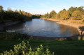
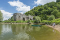
Discover the many points of interest and landscapes of Saint-Sauveur-de-Landemont: its pond, its cave, its castle and its scenery.

Details

n°7836248
Creation:
Last update:
Last review:
  • Walking
    Activity: Walking
  • ↔
    Distance: 2.84 mi
  • ◔
    Average duration: 1h 30 
  • ▲
    Difficulty: Easy

  • ⚐
    Back to start: Yes
  • ↗
    Ascent: + 197 ft
  • ↘
    Descent: - 190 ft

  • ▲
    Highest point: 249 ft
  • ▼
    Lowest point: 128 ft

Description of the walk

Coming from Landemont, park within sight of Saint-Sauveur, on the right near the pond.

(S/E) Start on this bank to walk round the Étang de Rochefort. Return to Rue du Paradis and follow it to the right for about a hundred metres.

(1) Go down the steps on the left towards the Îlette valley and the cave. Make your way to the cave.

(2) Turn left along the stream and then head up to the right to reach a small village road and a wayside cross at a junction of three roads and a track. Head up to the right towards La Pelleterie.

(3) Before reaching the hamlet, turn right onto the path, which is easy going at first. Follow this path downwards; it becomes a difficult trail for about 100 metres before rejoining the Îlette stream. Head back up to the village as far as the entrance to the Château de la Colaissière.

(4) Head back down to the right through this pretty little village.

(5) Turn left and, at the corner of the church, turn left into Rue du Paradis.

(1) Carry straight on until you reach the starting point (S/E).

Waypoints

  1. S/E : mi 0 - alt. 200 ft - Car park at the - Étang de Saint-Sauveur-de-Landemont
  2. 1 : mi 0.88 - alt. 207 ft - Junction of the circular loop
  3. 2 : mi 1.18 - alt. 171 ft - Cave
  4. 3 : mi 1.89 - alt. 246 ft - Junction
  5. 4 : mi 2.52 - alt. 249 ft - Entrance to the - Château de la Colaissière
  6. 5 : mi 2.66 - alt. 233 ft - Église Saint-Sauveur (Saint-Sauveur-de-Landemont)
  7. S/E : mi 2.84 - alt. 200 ft - Car park - Étang de Saint-Sauveur-de-Landemont

Notes

Near the car park, there are toilets, a shelter and picnic tables.

Watch out for the steps after point .

Between (3) and (4), the path is in poor condition in places.

At point (4), if the park is open, please follow the instructions.

Worth a visit

The walk around the pond, the valley and the cave, the castle and the descent to the village are all well worth seeing.

At point , you can head to the Landemont village hall, which can serve as a starting point for routes of varying lengths.

At point (3), you can head towards the Pertuis Churin site, La Divatte and the Roman bridge before heading back up to finish at point (4).

Reviews and comments

3.8 / 5
Based on 2 reviews

Reliability of the description
4.5 / 5
Ease of following the route
3 / 5
Route interest
4 / 5
TBS
TBS

Thank you for this additional information.

Machine-translated

MSmarcelsalmon
MSmarcelsalmon

At the cave, you had to head straight on, following the stream.
This family-friendly route is a shorter version of the original 7km route, featuring an extra climb and a descent that can be dangerous in wet weather.
It’s for those who want a short route;
Enjoy your walk

Machine-translated

TBS
TBS

Overall rating : 3.7 / 5

Date of your route : Aug 21, 2026
Reliability of the description : ★★★★★ Very good
Ease of following the route : ★★★☆☆ Average
Route interest : ★★★☆☆ Average
Very busy route : No

A pleasant, short walk through plenty of woodland.
Gentle slopes, but quite steep in places.
The river has dried up, creating an unusual landscape.

The signposting isn’t clear enough. Were we supposed to follow the purple route?

Machine-translated

Hourdin Catherine
Hourdin Catherine

Overall rating : 4 / 5

Date of your route : May 14, 2025
Reliability of the description : ★★★★☆ Good
Ease of following the route : ★★★☆☆ Average
Route interest : ★★★★★ Very good
Very busy route : No

I would have liked to know what colour the signposts were. After the cave, I wasn’t quite sure which way to go.
Otherwise, it’s a lovely little walk.

Machine-translated

Other walks in the area

For more walks, use our search engine .

The GPS track and description are the property of this route's author. Please do not copy them without permission.