The Pas de Cère

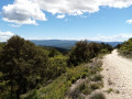
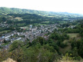
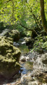
This is an unmissable walk in the Cère valley, where you can discover the gorges carved out by the glacier and then the river, on a beautiful marked trail.

Details

2563163
Creation:
Last update:
  • Walking
    Activity: Walking
  • ↔
    Distance: 2.31 mi
  • ◔
    Duration calculated by the app: 1h 33 
  • ▲
    Difficulty: Easy

  • ⚐
    Back to start: Yes
  • ↗
    Ascent: + 308 ft
  • ↘
    Descent: - 302 ft

  • ▲
    Highest point: 2,497 ft
  • ▼
    Lowest point: 2,208 ft

Description of the walk

In Vic-sur-Cère, head towards the campsite and follow the signs to Pas de Cère and the GCU campsite. Park in the car park dedicated to the site on the south side in front of the campsite. There is also a car park dedicated to the site on the north side, on the N122, for a route in the opposite direction to the one described here.

(S/E) Follow the sign for "Gorges du Pas de Cère" and the yellow markings. At the fork in the road, turn right towards "Pas de Cère". You will arrive at the edge of a diversion canal of the Cère (which used to supply the Moulin de la Salle) and find the purple umbrella dedicated to Antoine Fayet, pioneer of thermalism in Vic.

(1) Shortly afterwards, where the canal rejoins the Cère, a red umbrella commemorates the beautiful Rosière. Further on, an orange umbrella commemorates the Orléans railway station, then a purple umbrella provides information about a naturalist. You will arrive at a footbridge over the Cère, offering a beautiful view of the start of the gorges.

(2) On the other side of the river, follow the signs for "Cascade de la Roucoule". Pass an information panel about the fauna, flora and geology of the Pas de Cère. At a fork in the path, continue straight ahead (the path on the left goes up to the car park along the N122).

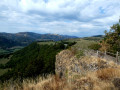
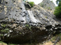
(3) You will come to a clearing with benches. Continue towards "Cascade de la Roucoule", veering slightly to the left (yellow arrow). The path becomes a little steeper as it climbs to a beautiful terrace overlooking the gorges, offering views of the Cascade de la Roucoule and the cliffs.

(4) Return to the car park (S/E) via the same route.

Waypoints

  1. S/E : mi 0 - alt. 2,228 ft - Site car park
  2. 1 : mi 0.36 - alt. 2,221 ft - Confluence of the canal and the - Cère (rivière)
  3. 2 : mi 0.66 - alt. 2,234 ft - Footbridge
  4. 3 : mi 0.9 - alt. 2,313 ft - Rest area
  5. 4 : mi 1.15 - alt. 2,457 ft - Belvedere
  6. S/E : mi 2.31 - alt. 2,228 ft - Site car park

Notes

Easy hike, but you must have hiking equipment, especially good shoes. The trail features a series of steps and paths, some of which are quite steep.

Years of extreme drought, very low water levels in the Cère and the Roucoule waterfall dried up, like most waterfalls in the region.

Worth a visit

Discover more hikes in this area with descriptions or the Visorando app here

Some photos here

The parasol theme trail: In the 19th century, thermalism was booming, and several guidebooks mention the source and waters of Vic, which are cold (12°C), ferruginous, gaseous, bicarbonate and sodium-rich, were all the more successful when the Compagnie des chemins de fer d'Orléans built a railway line and two large hotels, which it promoted: one in Le Lioran, the other on the southern slope overlooking the valley, the Grand Hôtel des Sources, run by Antoine Fayet. A favourite walk for the guests of these hotels was to the cool gorges.

La Pas de Cère, a must-see attraction in the region: around 7 million years ago, a section of the stratovolcano collapsed and an avalanche of lava megablocks submerged the area. During the last ice age, around 20,000 years ago, a glacier originating in the Cirque du Lioran forced its way through this barrier of hard rock. When the glacier melted 13,000 years ago, the Cère river finished the job by shaping these gorges.

You can download a booklet about the Pas de Cère gorge via this link.

Reviews and comments

4.9 / 5
Based on 23 reviews

Reliability of the description
4.9 / 5
Ease of following the route
5 / 5
Route interest
4.7 / 5
User 12018099
• Edited:

Overall rating : 5 / 5

Date of your route : Jul 28, 2025
Reliability of the description : ★★★★★ Very good
Ease of following the route : ★★★★★ Very good
Route interest : ★★★★★ Very good
Very busy route : No

The elevation gain is accurate.

Machine-translated

GONG54
GONG54
• Edited:

Overall rating : 4.7 / 5

Date of your route : Jul 16, 2024
Reliability of the description : ★★★★★ Very good
Ease of following the route : ★★★★★ Very good
Route interest : ★★★★☆ Good
Very busy route : Yes

A beautiful walk along the CERE river with its gorges, continuing on to the ROUCOLLE waterfall, another 30 minutes further on, where you can enjoy the view from a viewing platform.

Machine-translated

Jack42
Jack42
• Edited:

Overall rating : 4.7 / 5

Date of your route : May 20, 2024
Reliability of the description : ★★★★★ Very good
Ease of following the route : ★★★★☆ Good
Route interest : ★★★★★ Very good
Very busy route : No

A very beautiful walk with a little detective story, but the Cère river was too rough to go beyond the start of the gorges. So we turned back and drove to the car park at the Roucolle waterfall and explored the other part of the gorges.

Machine-translated

jo1703
jo1703
• Edited:

Overall rating : 5 / 5

Date of your route : Oct 22, 2023
Reliability of the description : ★★★★★ Very good
Ease of following the route : ★★★★★ Very good
Route interest : ★★★★★ Very good
Very busy route : Yes

We missed a bit of sunshine, which is normal given the weather at the end of October, but the landscape is magnificent, and we continued on to the Roucoule waterfall. After the recent rains, the two waterfalls we encountered on the trail were flowing well.
This well-maintained and safe trail must be very popular during the holidays, as we encountered many walkers.
It was pure joy all along the way, a remarkable site that we never wanted to leave..
Thank you

Machine-translated

fiat60
fiat60
• Edited:

Overall rating : 5 / 5

Date of your route : Sep 24, 2023
Reliability of the description : ★★★★★ Very good
Ease of following the route : ★★★★★ Very good
Route interest : ★★★★★ Very good
Very busy route : Yes

a beautiful hike in the shade, but it's worth climbing up to the waterfall even though there isn't much water

Machine-translated

georges1951
georges1951
• Edited:

Overall rating : 5 / 5

Date of your route : Sep 07, 2023
Reliability of the description : ★★★★★ Very good
Ease of following the route : ★★★★★ Very good
Route interest : ★★★★★ Very good
Very busy route : Yes

Very beautiful hike!
A pleasant hike in the heat.

Machine-translated

Jacky Dalançon
Jacky Dalançon
• Edited:

Overall rating : 4 / 5

Date of your route : Aug 29, 2023
Reliability of the description : Not used / Not applicable
Ease of following the route : Not used / Not applicable
Route interest : ★★★★☆ Good
Very busy route : Yes

We followed a map from the tourist office and walked from the GCU campsite car park to the waterfall viewpoint: 5 km there and back, which took us two hours. The first part (the one with the parasols) is flat, with interesting information about life in Vic-sur-Cère in the past.
The second part, from the footbridge to the viewpoint, is more difficult: there are slopes, tree roots and rocks. You need to be reasonably fit and wear good shoes to do this part, but it is very picturesque with the river running through the gorge.
For people who are not very fit and have children, it is better to see the waterfall, park in one of the car parks on the N122 and walk down the few steps to the viewpoint.

Machine-translated

jppuech
jppuech
• Edited:

Overall rating : 5 / 5

Date of your route : Aug 22, 2023
Reliability of the description : ★★★★★ Very good
Ease of following the route : ★★★★★ Very good
Route interest : ★★★★★ Very good
Very busy route : Yes

Very pleasant route, especially in very hot weather! A lovely little family outing.

Machine-translated

Xmal
Xmal
• Edited:

Overall rating : 5 / 5

Date of your route : Aug 08, 2023
Reliability of the description : ★★★★★ Very good
Ease of following the route : ★★★★★ Very good
Route interest : ★★★★★ Very good
Very busy route : Yes

Although the first part is not particularly exciting, the majority of the hike is magnificent. It is truly a superb environment, whether visually, aurally or olfactorily; all my senses were overwhelmed... by the view? Unfortunately, the route is too short, but there's never a dull moment. The elevation gain is generally low and there are lots of facilities suitable for everyone. Once again, Visiorando underestimates the elevation gain: I got 125 metres, which is a long way from the 81 metres predicted. I'm really delighted with this lovely walk. Suitable for all abilities, all ages and even dogs!

Machine-translated

claudekiko
claudekiko
• Edited:

Overall rating : 5 / 5

Date of your route : Jul 08, 2023
Reliability of the description : ★★★★★ Very good
Ease of following the route : ★★★★★ Very good
Route interest : ★★★★★ Very good
Very busy route : Yes

A lovely, well-shaded round trip with the sound of water and various waterfalls in the background. The route to the last waterfall, which can be seen from the metal viewpoint, is longer than advertised (4.5 km) and the total elevation gain is 130 m. A very beautiful hike with a section crossing a magnificent little bridge.

Machine-translated

Baladeuse66
Baladeuse66
• Edited:

Overall rating : 5 / 5

Date of your route : May 15, 2023
Reliability of the description : ★★★★★ Very good
Ease of following the route : ★★★★★ Very good
Route interest : ★★★★★ Very good
Very busy route : No

A beautiful hike that remains easy even when it's a little damp on the way down. The path that runs alongside the canal and then joins the Cère is very pleasant, full of flowers and utterly bucolic.
After the footbridge, the landscape changes and you enter the spectacular gorges!
We climb through the woods to reach the Roucoule waterfall and admire the landscape from the terrace. On the way back down the same path, there is a beautiful spot with a bench for picnics with a view.
A very beautiful route.

Machine-translated

jeanmariev
jeanmariev
• Edited:

Overall rating : 4.7 / 5

Date of your route : Feb 06, 2023
Reliability of the description : ★★★★★ Very good
Ease of following the route : ★★★★★ Very good
Route interest : ★★★★☆ Good
Very busy route : Yes

My opinion varies depending on the time of year. I've done this hike twice, once in high season when it was quite busy, and once in low season when there was hardly anyone there.

Machine-translated

Denis26
Denis26 ★
• Edited:

Overall rating : 5 / 5

Date of your route : Aug 31, 2022
Reliability of the description : ★★★★★ Very good
Ease of following the route : ★★★★★ Very good
Route interest : ★★★★★ Very good
Very busy route : No

A beautiful hike along the Cère River with the impressive Pas de la Cère, despite the low water levels in this year of extreme drought.

Machine-translated

freep09
freep09
• Edited:

Overall rating : 5 / 5

Date of your route : Apr 29, 2022
Reliability of the description : ★★★★★ Very good
Ease of following the route : Not used / Not applicable
Route interest : ★★★★★ Very good
Very busy route : Yes

a magnificent hike, not to be missed.

Machine-translated

mugiwara
mugiwara
• Edited:

Overall rating : 4.7 / 5

Date of your route : Aug 09, 2021
Reliability of the description : ★★★★★ Very good
Ease of following the route : ★★★★★ Very good
Route interest : ★★★★☆ Good
Very busy route : Yes

We did this with a one-and-a-half-month-old baby and our three-year-old. The three-year-old did almost the entire walk there on his own! Be careful with a baby in a baby carrier, though, as some of the steps are slippery and you need to watch your step to avoid falling. Allow twice as much time for the return trip if, like us, your three-year-old climbs on their own. The route is very easy and well signposted.

Machine-translated

Other walks in the area

For more walks, use our search engine .

The GPS track and description are the property of this route's author. Please do not copy them without permission.