Mont de Luminy

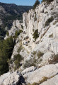
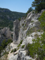
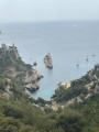
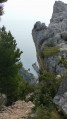
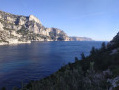
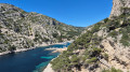
As part of the ‘short summer walks’ series – best enjoyed in the shade and done early in the morning – here is a variation on the ‘Around the Escampons’ walk, which still takes you to the magnificent viewpoints of Marseille’s calanques.

Details

n°61891790
Creation:
Last update:
Last review:
  • Walking
    Activity: Walking
  • ↔
    Distance: 4.25 mi
  • ◔
    Average duration: 2h 35 
  • ▲
    Difficulty: Easy

  • ⚐
    Back to start: Yes
  • ↗
    Ascent: + 686 ft
  • ↘
    Descent: - 679 ft

  • ▲
    Highest point: 945 ft
  • ▼
    Lowest point: 531 ft

Photos

Description of the walk

The walk starts from the huge car park at the business school on the Domaine de Luminy, a few kilometres from the Marseille exit, on the road to Cassis.

(S/E) Take the track heading due south and keep to the right at the three-way junction to begin the gentle climb towards the summit of Les Escampons. You’ll reach a three-way junction (water tank).

(1) Follow the track on the right downhill for about one kilometre.

(2) Turn left onto a clearly visible uphill path.

(3) Climb the rocky slope towards the summit of Les Escampons, then head back down and continue the descent. At the Fork in the road, turn right and arrive at a three-way junction.

(4) Take the path opposite up towards Mont de Luminy. Follow the ridge for 1.5 km, ignoring any side paths.

(5) Continue along the track on the left, which descends to join another track. Follow this track, heading north initially, for about 1 km.

(6) At the three-way junction, take the middle path down.

(7) Continue along the track to the left. Join the track you took at the start of the walk and follow it to the right to return to the car park (S/E).

Waypoints

  1. S/E : mi 0 - alt. 531 ft - Business School car park
  2. 1 : mi 0.6 - alt. 712 ft - Track on the right
  3. 2 : mi 0.99 - alt. 663 ft - Path on the left
  4. 3 : mi 1.34 - alt. 896 ft - Summit of Les Escampons
  5. 4 : mi 1.62 - alt. 797 ft - Crossroads
  6. 5 : mi 2.69 - alt. 745 ft - Turn left
  7. 6 : mi 3.54 - alt. 623 ft - T-junction
  8. 7 : mi 3.77 - alt. 531 ft - Track on the left
  9. S/E : mi 4.25 - alt. 535 ft - Business School car park

Reviews and comments

3.7 / 5
Based on 2 reviews

Reliability of the description
3.5 / 5
Ease of following the route
3.5 / 5
Route interest
4 / 5
MALTERRE Thierry
MALTERRE Thierry

Overall rating : 4 / 5

Date of your route : Apr 28, 2026
Reliability of the description : ★★★★☆ Good
Ease of following the route : ★★★★☆ Good
Route interest : ★★★★☆ Good
Very busy route : No

A lovely, easy hike. The slopes are fairly gentle.
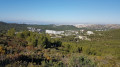
From the ridges, there are stunning views of the city of Marseille, the Rioux Islands, Île Plane and even the Morgiou calanque.
Perfect for taking friends from the North who are visiting Marseille out for a walk.

Machine-translated

Louise2019
Louise2019

Overall rating : 3.3 / 5

Date of your route : Sep 15, 2024
Reliability of the description : ★★★☆☆ Average
Ease of following the route : ★★★☆☆ Average
Route interest : ★★★★☆ Good
Very busy route : No

It wasn’t exactly a easy route.
There were two sections that were a bit tricky. I had some stability issues, but luckily I had my poles.

Machine-translated

Other walks in the area

For more walks, use our search engine .

The GPS track and description are the property of this route's author. Please do not copy them without permission.