Around Les Escampons

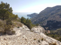
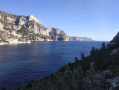
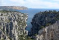
A walk whose ultimate goal is a view of the Fenêtre de Morgiou, offering magnificent panoramic views, first of Marseille and then, all along the way, of the Calanques and the beautiful cliffs.

You are in the Calanques National Park, which is subject to specific regulations. Failure to comply with these regulations may result in a fine of up to €1,500.

Details

30219995
Creation:
Last update:
Last review:
  • Walking
    Activity: Walking
  • ↔
    Distance: 6.29 mi
  • ◔
    Average duration: 3h 50 
  • ▲
    Difficulty: Moderate

  • ⚐
    Back to start: Yes
  • ↗
    Ascent: + 1,056 ft
  • ↘
    Descent: - 1,076 ft

  • ▲
    Highest point: 892 ft
  • ▼
    Lowest point: 413 ft

Photos

Description of the walk

The route starts from the huge car park at the business school on the Luminy estate, a few kilometres from the Marseille motorway exit, on the road to Cassis.

(S/E) Take the track heading due south and keep to the right at the three-way junction to begin the gentle climb towards the summit of Les Escampons. You’ll reach a three-way junction (water tank).

(1) Head down the track to the right and walk for about 700 m until you reach a fork in the path.

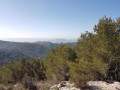
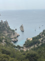
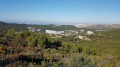
(2) Head up a well-marked path on the left. Enjoy the beautiful views of Marseille as you climb. Near the summit, the path splits into two: take the one on the right for the panoramic view of the Calanques massif, then return to the main path and continue along the route until you reach a fork.

(3) Turn right towards the south, then head for the descending track. Walk for about 500 m towards the Col de Morgiou.

(4) About fifty metres before the pass, turn left onto a path marked with coloured crosses. Ignore these and continue until you come to green-white-red markings.
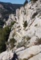
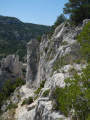
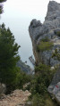
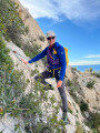
This marks the start of a rather spectacular and rugged path that follows the Escampons massif, offering beautiful views of the surrounding area.
At the end, join a track and continue to the right towards the east until you reach another junction.

(5) Turn right towards the sea onto the path that descends and, after about 300 m, look out for a wooden post at a fork in the path.

(6) Just before the post, take the path on the right that descends towards Morgiou. After a 500-metre descent, ignore the first track on the right, which is overgrown and impassable. Continue for 150 metres.

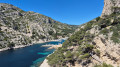
(7) Head down a small path to the right which leads to a terrace offering magnificent views, with the Roche Percée to the north and Morgiou and its headland to the south. Turn back to the post you passed earlier.

(6) Turn right (east) onto a path that joins the rest of the nature trail. Follow it to the right for 300 m, until you reach a fork in the tracks.

(8) Take the hairpin bend to the left to head back towards the Luminy estate.

(9) At the bend, take a path that goes straight ahead. At the end, turn left and head up a track that runs alongside a fence to return to the nature trail. Take it to the left and walk for about a hundred metres until you reach a fork.

(10) Turn right to follow a winding path uphill until you reach a track. Follow it to the right, heading north-west. Stay on this track until you reach a junction of three tracks (water tank).

(11) Turn onto the track on the right, heading due north, and walk straight down to the car park where you started (S/E).


Waypoints

  1. S/E : mi 0 - alt. 525 ft - Business School car park
  2. 1 : mi 0.63 - alt. 699 ft - Water tank
  3. 2 : mi 1.07 - alt. 653 ft - Path on the left
  4. 3 : mi 1.6 - alt. 853 ft - Junction on the right
  5. 4 : mi 2.02 - alt. 650 ft - Sentier des Escampons on the left – Col de Morgiou (198m)
  6. 5 : mi 2.98 - alt. 738 ft - Junction, on the right
  7. 6 : mi 3.19 - alt. 591 ft - Morgiou Trail
  8. 7 : mi 3.61 - alt. 476 ft - Roche Percée or Fenêtre de Morgiou junction
  9. 8 : mi 4.18 - alt. 676 ft - Track on the left
  10. 9 : mi 4.35 - alt. 682 ft - Turn, path straight ahead
  11. 10 : mi 4.85 - alt. 554 ft - Junction on the right
  12. 11 : mi 5.66 - alt. 643 ft - Water tank
  13. S/E : mi 6.29 - alt. 525 ft - Business School car park

Reviews and comments

4.3 / 5
Based on 3 reviews

Reliability of the description
4 / 5
Ease of following the route
4.3 / 5
Route interest
4.7 / 5
ROLLO
ROLLO

A walk through the heart of Luminy, between the calanques and the ridges.
A truly beautiful viewpoint.

Machine-translated

marie3084
marie3084

Overall rating : 4.7 / 5

Date of your route : Apr 08, 2024
Reliability of the description : ★★★★☆ Good
Ease of following the route : ★★★★★ Very good
Route interest : ★★★★★ Very good
Very busy route : Yes

A lovely walk.
Stunning views from the summit.
It gets a bit busy as soon as you hit the trails.
We completed the walk in 3 hours without rushing...

Machine-translated

Claudine Wattrelot
Claudine Wattrelot

Overall rating : 4 / 5

Date of your route : Oct 23, 2023
Reliability of the description : ★★★★☆ Good
Ease of following the route : ★★★★☆ Good
Route interest : ★★★★☆ Good
Very busy route : No

A lovely route through the calanques with great views; we didn’t go down to Morgiou as we suspected the climb back up would be a bit of a challenge… another time

Machine-translated

phildaix
phildaix

Overall rating : 4.3 / 5

Date of your route : Sep 27, 2023
Reliability of the description : ★★★★☆ Good
Ease of following the route : ★★★★☆ Good
Route interest : ★★★★★ Very good
Very busy route : No

Wonderful walks offering views of the sea, Marseille, Luminy and the wooded hills. It’s a bit busy, though, on the paths between the university and the Calanques.

Machine-translated

Other walks in the area

For more walks, use our search engine .

The GPS track and description are the property of this route's author. Please do not copy them without permission.