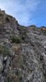
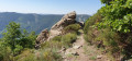
The Mont Aigu circular walk starting from Laboule

A walk that takes you through forests and heaths to the summit of Mont Aigu and its magnificent panoramic views.
Set off to explore the Tanargue Massif and its landscapes typical of the Ardèche. Please note that the first section up to the Col du Merle follows the same route as the Tour de la Cham du Cros.

Details

n°10607668
Creation:
Last update:
Last review:
  • Walking
    Activity: Walking
  • ↔
    Distance: 10.09 mi
  • ◔
    Average duration: 7h 15 
  • ▲
    Difficulty: Moderate

  • ⚐
    Back to start: Yes
  • ↗
    Ascent: + 3,012 ft
  • ↘
    Descent: - 3,009 ft

  • ▲
    Highest point: 4,311 ft
  • ▼
    Lowest point: 1,739 ft

Photos

Description of the walk

From Joyeuse, head up the Beaume valley towards Valgorge and then Laboule. Walk through the village, follow the signs to the visitors’ car park and park there.

(S/E) From the car park, set off along the road towards Laboule. Once you’ve entered the village, continue to the first junction.

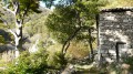
(1) Take a road on the right which quickly turns into a footpath that soon joins a road at a place called Les Cebeyres.

(2) Turn right onto this road and, at the first marked bend on the right, take the path on the left and follow it to a cross. Then turn left onto a path that leads you to the hamlet of Valos, where you’ll rejoin a road.

(3) Turn right and, after a few dozen metres, take a small path leading downhill to the left. Cross a footbridge over the River Salindres, then follow the path to a junction of three roads.

(4) Take the road opposite and, at the entrance to a cul-de-sac hamlet, follow a small path on the left. Pass above the hamlet and, at the first junction, turn left. The path winds through the forest and the climb is steady. Gradually, heath and broom take over. Continue this long climb to the Col du Merle.

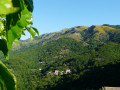
(5) At this point, take the wide track on the left (GR® de Pays Tour du Tanargue), which climbs gently and leaves the forest at the Suc du Capitaine, where a superb view opens up before you. Continue along this track to the Col de Sucheyre, where you’ll find signposts for the climb up to Mont Aigu.

(6) Take the narrow path on the right.
It’s a steep climb straight away! After a few metres, turn left. The slope gets even steeper. Cross a section of large boulders, then a path leads to the summit of Mont Aigu.

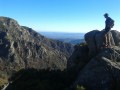
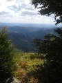
(7) From the summit, there’s a superb view of the Alps, the Monts d’Ardèche and the Cévennes...
Turn back until you reach the track.
(Note that from the summit, a path leads to the Col des Langoustines, our next stop).

(6) Continue along the track to the right and follow it to the Col des Langoustines.

(8) At the pass, as you round a bend to the right, turn onto the path leading off to the left.

(9) At the 1269 mark, leave theGRP® and continue to the left, staying on this wide path which, via a long, steady and easy descent, will take you to the hamlet of Les Cebeyres.

(2) Then turn right back onto the path you took on the way there, following it in the opposite direction until you reach the first junction with a road.

(1) Turn left and continue to the car park (S/E).

Waypoints

  1. S/E : mi 0 - alt. 2,221 ft - Visitors’ car park
  2. 1 : mi 0.25 - alt. 2,234 ft - Common junction for out-and-back route - Gîte d'étape de Laboule
  3. 2 : mi 0.41 - alt. 2,293 ft - The hamlet of Les Cebeyres.
  4. 3 : mi 1.08 - alt. 1,942 ft - Valos hamlet
  5. 4 : mi 1.46 - alt. 1,959 ft - Junction of 3 roads
  6. 5 : mi 3.36 - alt. 3,520 ft - Col du Merle
  7. 6 : mi 5 - alt. 3,973 ft - Col de Sucheyre. Towards the summit
  8. 7 : mi 5.24 - alt. 4,311 ft - Mont Aigu
  9. 8 : mi 6.04 - alt. 3,980 ft - Col des Langoustines
  10. 9 : mi 6.41 - alt. 4,163 ft - Elevation 1269
  11. S/E : mi 10.09 - alt. 2,221 ft - Visitors’ car park

Always be cautious and plan ahead when you're outdoors. Visorando and the author of this route cannot be held responsible for any accidents occurring on this route.

The GR® and PR® markings are the intellectual property of the Fédération Française de Randonnée Pédestre.

Reviews and comments

4.7 / 5
Based on 1 review

Reliability of the description
5 / 5
Ease of following the route
4 / 5
Route interest
5 / 5
Serge 35
Serge 35
• Edited:

Overall rating : 4.7 / 5

Date of your route : Jun 13, 2025
Reliability of the description : ★★★★★ Very good
Ease of following the route : ★★★★☆ Good
Route interest : ★★★★★ Very good
Very busy route : No

Hello.
In my opinion, it is better to do the loop in the opposite direction. The long climb up a wide path to point 6 may seem endless, but it is steady, without any difficulties, and offers beautiful views. There is no shade on this part of the hike, so it is best to start there in the morning (I did it on the way down, via the barns, and it seemed endless at the end of the day).
I was unable to reach the summit as the path disappears between points 6 and 7, with tall grass hiding many ankle traps. But even without being able to climb Mont Aigu, there are beautiful views on a clear day.
After point 5, the descent is via a shaded path, which is welcome in the afternoon. There are no water supplies on this route, so bring at least two litres of water in summer.
Enjoy your hike.

Machine-translated

Other walks in the area

For more walks, use our search engine .

The GPS track and description are the property of this route's author. Please do not copy them without permission.