The Tanargue Massif

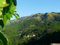
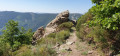
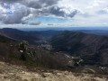
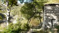
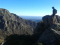
In the heart of the Monts d’Ardèche Regional Nature Park, Laboule is the ideal starting point for hikes offering a variety of landscapes. Three days of comfortable walking on a radial route around the third-highest peak in the Cévennes (1,548 m), with its rocky hills and natural rivers.
The Tanargue massif is little-known and wild; it’s well worth the trip.
Comfortable accommodation is available locally.

Details

n°180678
Creation:
Last update:
–
Last review:
  • Walking
    Activity: Walking
  • ↔
    Distance: 30.55 mi
  • ◔
    Average duration: 3 days 
  • ▲
    Difficulty: Difficult

  • ⚐
    Back to start: Yes
  • ↗
    Ascent: + 8,780 ft
  • ↘
    Descent: - 8,737 ft

  • ▲
    Highest point: 4,619 ft
  • ▼
    Lowest point: 1,634 ft

Photos

Stages of the route

This route needs several days, find the details below:

  1. S
  2. 2
  3. E

Notes

The route starts from the Laboule stopover lodge next to the church (self-catering or half-board – the choice is yours).

Although the climate is Mediterranean, it can be surprisingly chilly up on the ridges.
You should therefore pack a good windbreaker and a fleece.
Personally, I quite like a sleeveless fleece – it’s a good compromise between warm and cool.

The Sentier des Granges is scenic and physically demanding, both on the ascent and the descent.
In any case, you’ll need a good pair of walking boots.
The three walks are roughly equal in terms of duration, elevation gain and difficulty; all three are marked in yellow and white.
Only the Fergeasses mountain pasture requires caution for those prone to vertigo (a small wooden footbridge, 3 metres long).

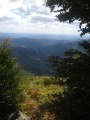
Make the most of the magnificent views to take photos: Mont Gerbier des Joncs, Cham du Cros, the Lower Ardèche, the Cévennes valleys, Mont Lozère…

Depending on the rainfall prior to your visit, some sections may be difficult; please check with Yankélée, who runs the stopover lodge.

For the adventurous and those who love a climb, at the Col des Langoustines, there’s an optional short circular loop: the Tour du Mont Aigu (1 hour), with some very scenic sections before the descent to Laboule.

Worth a visit

There’s a water point on the ascent only.
Take care at the fords if it has rained prior to your arrival.
This walk is not recommended in stormy weather, snow or fog.
There is a shelter (for hunters) halfway down the descent on the DFCI track.
Make sure you have good walking boots and an IGN map of the area.

Always be cautious and plan ahead when you're outdoors. Visorando and the author of this route cannot be held responsible for any accidents occurring on this route.

Reviews and comments

5 / 5
Based on 1 review

Reliability of the description
5 / 5
Ease of following the route
5 / 5
Route interest
5 / 5
andre69
andre69

Overall rating : 5 / 5

Date of your route : Sep 19, 2019
Reliability of the description : ★★★★★ Very good
Ease of following the route : ★★★★★ Very good
Route interest : ★★★★★ Very good

A lovely walk. Well worth doing.

Machine-translated

Other walks in the area

For more walks, use our search engine .

The GPS track and description are the property of this route's author. Please do not copy them without permission.