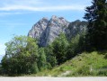
Le Mollard Gargot starting from Engins

A pleasant circular route along wide tracks leading to the Charvets meadows. Then, the stretch to the Durand Farm, overlooking the Isère valley, offers a view that is very familiar to the people of Grenoble.

Details

32289881
Creation:
Last update:
Last review:
  • Walking
    Activity: Walking
  • ↔
    Distance: 5.90 mi
  • ◔
    Average duration: 3h 45 
  • ▲
    Difficulty: Moderate

  • ⚐
    Back to start: Yes
  • ↗
    Ascent: + 1,230 ft
  • ↘
    Descent: - 1,198 ft

  • ▲
    Highest point: 3,602 ft
  • ▼
    Lowest point: 2,726 ft

Description of the walk

Park either in the car park above the Engins dam, or in the 3 or 4 spaces available at the entrance to the dam’s embankment.

(S/E) Cross the dam following the tarmac road – there’s little traffic but do take care nonetheless – and pass the houses at Batardière. Then take the wide dirt track to reach, via a gently ascending path, the Lavaresse crossroads.

(1) Continue along the track on the right, pass a tight hairpin bend, then, atthe second one, leave the track and take the wide path signposted ‘Les Roux’. You’ll reach a crossroads with several directions on a wide, level stretch.

(2) Turn left onto a path and follow the signs for Charvet. Continue uphill and then downhill to reach the houses at Charvet and a tarmac road with ease.

(3) Turn left onto this road, then continue along a new dirt track until, at a bend, you reach a crossroads of tracks at a place called Mollard Gargot.

(4) Here you have two options:
- carry on straight ahead to reach the Lavaresse junction you passed on the way out,
- turn right and continue the descent, finishing at Ferme Durand (the route chosen).

(5) Take the main track and, following an almost flat route, reach the Fonds Bonnier junction.

(6) Stay on the track to the left and continue on to reach the Lavaresse crossroads, which you passed on the way out.

(1) Follow the outbound route in the opposite direction to return to the car park at the Engins dam (S/E).

Waypoints

  1. S/E : mi 0 - alt. 2,726 ft - Engins Dam car park
  2. 1 : mi 1.21 - alt. 3,009 ft - Lavaresse
  3. 2 : mi 1.73 - alt. 3,363 ft - Replat les Roux
  4. 3 : mi 2.46 - alt. 3,510 ft - Charvet
  5. 4 : mi 2.82 - alt. 3,297 ft - Mollard Gargot
  6. 5 : mi 3.43 - alt. 2,776 ft - Durand Farm
  7. 6 : mi 4 - alt. 2,769 ft - Fonds Bonnier
  8. S/E : mi 5.9 - alt. 2,730 ft - Engins Dam car park

Notes

There is no water on this route.

Worth a visit

(5) La Ferme Durand can be reached via several different routes. Simply check Visorando to discover a few alternative routes.

Reviews and comments

4.2 / 5
Based on 4 reviews

Reliability of the description
4 / 5
Ease of following the route
4.5 / 5
Route interest
4 / 5
User 29398328

Overall rating : 3.7 / 5

Date of your route : May 18, 2026
Reliability of the description : ★★★☆☆ Average
Ease of following the route : ★★★☆☆ Average
Route interest : ★★★★★ Very good
Very busy route : No

Things went well for the first three checkpoints, but at the fourth we decided to carry on straight ahead to reach Lavâtes-se, and we ended up facing Les Trois Pucelles on the other road leading up to St-Nizier!!!

Machine-translated

safiotte
safiotte

Overall rating : 4.3 / 5

Date of your route : Nov 03, 2024
Reliability of the description : ★★★★☆ Good
Ease of following the route : ★★★★★ Very good
Route interest : ★★★★☆ Good
Very busy route : No

A lovely route near Grenoble which gave us the chance to discover another way to get to the Durand farm.
We really enjoyed it.

Machine-translated

AUJAMES Denis
AUJAMES Denis

Overall rating : 4 / 5

Date of your route : Aug 20, 2024
Reliability of the description : ★★★★☆ Good
Ease of following the route : ★★★★★ Very good
Route interest : ★★★☆☆ Average
Very busy route : No

A pleasant
hike with no major difficulties. A lovely view of Grenoble and the surrounding mountains awaits you at point no. 5. Take care at point no. 2: at the hairpin bend, go straight on to follow ‘les Roux’. A lovely, fully shaded hike.

Machine-translated

HélènO
HélènO

Overall rating : 4.7 / 5

Date of your route : Jun 21, 2024
Reliability of the description : ★★★★★ Very good
Ease of following the route : ★★★★★ Very good
Route interest : ★★★★☆ Good
Very busy route : No

A short, easy circular loop to round off the week. Lovely views over the Isère valley and the surrounding peaks. The Dent du Loup, which we’d seen on the first day, was shrouded in cloud. 10 km and 475 m of elevation gain from the road.

Machine-translated

Other walks in the area

For more walks, use our search engine .

The GPS track and description are the property of this route's author. Please do not copy them without permission.