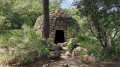
Cycling along the Verdon Canal, between Puyricard and Le Grand Saint-Jean

An almost flat cycle route, ideal for a leisurely ride. A pleasant, shaded route running alongside the canal where the water flows gently, passing through wooded areas and offering magnificent views of the Aix countryside.

Details

39526953
Creation:
Last update:
Last review:
  • Mountain biking
    Activity: Mountain biking
  • ↔
    Distance: 12.73 mi
  • ◔
    Duration according to the author: 2 hrs 
  • ▲
    Difficulty: Easy

  • ⚐
    Back to start: Yes
  • ↗
    Ascent: + 98 ft
  • ↘
    Descent: - 98 ft

  • ▲
    Highest point: 1,125 ft
  • ▼
    Lowest point: 1,050 ft
  • ⚐ Country: France
  • ⚐ City: Aix-en-Provence (13100|13090|13540)
  • ⚑
    Start/End: N 43.593211° / E 5.424866°
  • ❏
    IGN map(s): Ref. 3143ET

  • ◶
    Type of surface:
  •  
     
     
     2% Road  80% Byway  18% Path
  • ⇧
    Bike carrying: Not specified
  • ▲
    Difficulty: Easy
  • Hour-by-hour weather

Description of the route

Coming from the Village du Soleil in Puyricard, head towards Rognes and take thefirst left after the roundabout and the water tower, onto Chemin de Carraire de Truillas. Park where Chemin de la Simone crosses the canal.

(S/E) Follow the path along the canal bank, heading west, all the way along the southern side (with the canal on your right) until you reach the road.

(1) Leave the canal and go round the Fauchonne estate on the right via a quiet little road. At the next junction, on the edge of the woods, turn left to reach a bridge over the canal.

(2) Cross the bridge and turn right back onto the canal path. Continue until you reach another bridge at Rigaud.

(3) Cross the canal and follow it to your left for a short stretch. You will then emerge at the junction with the Route du Grand Saint-Jean.

(4) Go through the gate opposite (no. 2495) and turn immediately right to rejoin the canal. You’ll reach the Grand Saint-Jean Landscape Cemetery.

(5) Follow the canal until you reach the tarmac road (Route du Seuil) with a car park.

(6) Turn slightly left to go round the fence and continue along the canal until you reach the county road.

(7) Cross the road to join a loosely tarmacked track on the left. Go round the barrier by taking a small dirt track that leads back up to the canal. You’ll reach an impassable barrier belonging to the Société du Canal de Provence.

(8) Turn round and retrace your steps to return to the starting point (S/E).

Waypoints

  1. S/E : mi 0 - alt. 1,093 ft - Chemin de la Simone car park - Canal du Verdon
  2. 1 : mi 0.59 - alt. 1,086 ft - La Fauchonne
  3. 2 : mi 1.15 - alt. 1,086 ft - Bridge
  4. 3 : mi 1.81 - alt. 1,086 ft - Rigaud
  5. 4 : mi 2.12 - alt. 1,079 ft - Saint-Julien
  6. 5 : mi 2.7 - alt. 1,083 ft - Cimetière Paysager du Grand Saint-Jean
  7. 6 : mi 3.76 - alt. 1,079 ft - Car park on Route du Seuil
  8. 7 : mi 4.7 - alt. 1,053 ft - Head back towards the canal, keeping to the right
  9. 8 : mi 6.35 - alt. 1,060 ft - ‘Société du Canal de Provence’ barrier
  10. S/E : mi 12.73 - alt. 1,089 ft - Chemin de la Simone car park

Notes

Make sure you take some water with you!

At an average speed of 13 km/h, the ride takes about 1 hour 40 minutes.

The ‘No Entry’ signs are put up by the Société du Canal de Provence; this is a way for them to disclaim liability in the event of an accident in the canal. However, the path is very busy and each barrier can be easily crossed, even by bike.

Worth a visit

The Château du Grand Saint-Jean.

Reviews and comments

4.7 / 5
Based on 3 reviews

Reliability of the description
5 / 5
Ease of following the route
5 / 5
Route interest
4 / 5
User 6159022

I walked three-quarters of the route on 8 June 2025. It’s one of the few places in Provence where you can walk alongside the water, mostly in the shade – which is really lovely during our sweltering June months…
I couldn’t find hike No. 17254600 on your website, which followed the same route but was for walkers and a little shorter. It matches the route I did; I’d saved it on your website a few years ago, but when?
I’m surprised it’s disappeared from your website (or perhaps I just didn’t know how to look for it???)
For your information, we also visited the Grand Saint Jean cemetery
An easy route to follow, very pretty, and completely deserted that day (apart from a few people between La Simone and La Fauchone, we didn’t see a soul)

Machine-translated

patrickbertu
patrickbertu

Overall rating : 4.7 / 5

Date of your route : Nov 16, 2024
Reliability of the description : ★★★★★ Very good
Ease of following the route : ★★★★★ Very good
Route interest : ★★★★☆ Good
Very busy route : No

Getting past certain SCP ‘barriers’ is rather tricky. Returning via the single track beneath the canal makes for a more varied return journey

Machine-translated

pauleetpierre
pauleetpierre

Overall rating : 4.3 / 5

Date of your route : Sep 15, 2024
Reliability of the description : ★★★★★ Very good
Ease of following the route : ★★★★★ Very good
Route interest : ★★★☆☆ Average
Very busy route : Yes

A completely flat route; it was busy, but then again, it was a Sunday morning.

Machine-translated

Sasa ourida
Sasa ourida

Overall rating : 5 / 5

Date of your route : Aug 19, 2024
Reliability of the description : ★★★★★ Very good
Ease of following the route : ★★★★★ Very good
Route interest : ★★★★★ Very good
Very busy route : No

That’s all well and good, except you do have to slow down to get through the barriers, but it’s well worth it.

Machine-translated

Surioxy
Surioxy

In reply to "Suzon"

Yes, it’s perfectly possible to do it on foot.

It’s mainly flat, but in terms of time, I think you’ll need to allow at least twice or three times as long.

Machine-translated

Suzon
Suzon

Hello, I’d like to know if it’s possible to do this hike on foot?

Machine-translated

For more walks, use our search engine .

The GPS track and description are the property of this route's author. Please do not copy them without permission.