Lake Port Bielh

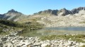
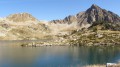
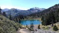
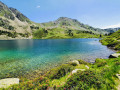
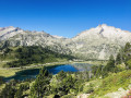
A large lake nestled at the foot of the high cliffs of the Port Bielh ridge, whose crystal-clear waters offer magnificent reflections, and numerous small lakes in the surrounding area.
You are now entering the Néouvielle National Nature Reserve, which is protected by regulations. Please respect these regulations (see practical information).

Details

81655
Creation:
Last update:
Last review:
  • Walking
    Activity: Walking
  • ↔
    Distance: 12.41 mi
  • ◔
    Average duration: 8h 00 
  • ▲
    Difficulty: Difficult

  • ⚐
    Back to start: Yes
  • ↗
    Ascent: + 2,631 ft
  • ↘
    Descent: - 2,631 ft

  • ▲
    Highest point: 7,493 ft
  • ▼
    Lowest point: 5,223 ft

Photos

Description of the walk

From Saint Lary, take the Route d’Espagne to Fabian, then take the Route des Lacs. A few kilometres further on, after crossing two bridges and negotiating a few hairpin bends, you’ll reach the Artigusse car park, the starting point.
(S/E) From there, cross a small footbridge and follow a path leading to the first Artigusse car park (EDF private).
From there, follow the track which climbs along the mountainside towards Lac de l’Oule (signposted).
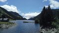
On reaching Lac de l’Oule, a splendid view of the lake unfolds before you, with the ridges of Port Bielh in the distance.
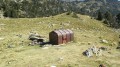
Walk round Lake de l’Oule on the left-hand side until you reach the other end; on the way, you’ll pass an old shepherd’s hut.

(1) On reaching the far end of the lake, where the Lahude hut is situated, cross a small old stone bridge under which the Port Bielh stream flows; a little further up, a junction (signposted) indicates the direction of Lake Port Bielh to the left (the Bastan lakes and refuge to the right, marked in red and white).
Turn left and follow the cairn-marked path, after crossing a second stream coming from the right, flowing down from the Bastan Lakes. A few hundred metres further on, cross a small clearing. The Pic de Bastan rises above the forest; the path running alongside the Port Bielh stream is clearly visible and pleasant, with a gentle gradient. Further up, you re-enter the forest, and the path continues alongside the stream as it rushes down the slope.
After passing through this woodland for about one kilometre five hundred, you’ll cross a small ledge, and shortly afterwards reach the Coste Ouillère hut and the lake, which is partly overgrown with grass.

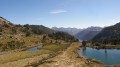
(2) Carry on, leaving the hut behind you; a hundred metres further on, a small promontory offers a fine view of the path you have followed through the valley, with Lake Oule in the background.
Further up, pass by the first small lake of Port Bielh, with its calm, clear water; go round it, pass close to a renovated sheepfold, and follow the path that leads straight ahead up a final rocky outcrop.
You’ve now reached the lakeside; the view is splendid, overlooking either Lake Bastan or Lake Port Bielh, with a ring of rocky peaks stretching from the Pic d’Aygues Cluses on the left to the Pic de Bastan on the far right.
There’s also a lovely view of the valley from the lake’s spillway, with Lake Oule five kilometres further down in the distance.

(3) Follow the same route back to the starting car park (S/E).

Waypoints

  1. S/E : mi 0 - alt. 5,308 ft - Car park. Cross the - Neste de Couplan (rivière) - Affluent de la Neste
  2. 1 : mi 2.99 - alt. 6,007 ft - Shepherd’s hut - Lac de l'Oule
  3. 2 : mi 5.36 - alt. 6,909 ft - Coste Oueillère hut
  4. 3 : mi 6.22 - alt. 7,493 ft - Lake Port Bielh
  5. S/E : mi 12.41 - alt. 5,308 ft - Car park

Notes

Regulations concerning the Néouvielle National Nature Reserve:
• Dogs are not permitted in the core zone of the Pyrenees National Park, even when kept on a lead
• Dog boarding facilities – enquiries at Aragnouet Town Hall – Tel: 05 62 39 62 63
• No open fires, to prevent fires and soil damage
• Please keep quiet to preserve the peace and tranquillity of the area
• Please bring bin bags with you to carry your rubbish back down
• No picking or collecting of plants, minerals or fossils is permitted
• Capturing animals is prohibited
• Regulated camping is permitted more than an hour’s walk from a road access point, between 7 pm and 9 am
• No camping or overnight parking of motorhomes to preserve the beauty of the sites and prevent pollution
• Hunting and fishing are prohibited

Standard kit: Rucksack, water, snacks, waterproof jacket, good walking boots, 1:25,000 map, compass.
Shelter available: A small shepherd’s hut at the far end of Lac de l’Oule provides shelter in the event of heavy rain.
The Coste Oueillère hut, which sleeps two to four people, is suitable for an overnight stay.

There is a spring nearby the renovated sheepfold, which is inhabited by a shepherd in summer.

This route passes through a protected area, which may be subject to special regulations:

Worth a visit

Lac de Gourguet and the Col de Barèges above the Coste Oueillère hut.
Complete a circular route by walking along Lake Bastanet and heading to the Bastan mountain hut.
The Nére pass.
The Caderolle pass.
The Bastanet Pass.
The Hourquette Bracque – for experienced walkers.

Reviews and comments

3.9 / 5
Based on 3 reviews

Reliability of the description
3.3 / 5
Ease of following the route
3.7 / 5
Route interest
4.7 / 5
missina
missina

Overall rating : 4 / 5

Date of your route : Jul 08, 2023
Reliability of the description : ★★★☆☆ Average
Ease of following the route : ★★★★☆ Good
Route interest : ★★★★★ Very good
Very busy route : No

Everything was going well until we reached the end of Lake Oule. We headed towards Lake Port Bielh, thinking we wouldn’t need a guidebook as the path is signposted… Except that the signs (marked route) direct you to Lake Port Bielh via the Bastan Lakes, which is a completely different route in terms of distance and time.

I therefore think it’s essential to state at the start of the guide that the description does not follow the route shown on site and that it follows an unmarked circular route starting from the end of Lake Oule.
“Turn left and follow the cairn-marked path, after crossing a second stream coming from the right, flowing down from the Bastan Lakes” --> that’s where we went wrong.

Otherwise, it was a lovely walk! Not very busy from the lake onwards. It will remain a fond memory despite the extra 2 km or so.

Machine-translated

Marie Faranchine
Marie Faranchine

Overall rating : 3.7 / 5

Date of your route : May 22, 2022
Reliability of the description : ★★★☆☆ Average
Ease of following the route : ★★★★☆ Good
Route interest : ★★★★☆ Good
Very busy route : No

In 2022, at the far end of Lake Oule, just as you leave the GR10, the sign indicating the turn-off to Lake Port Bielh is no longer there. You can find your way by the widening of the stream, which allows you to wade across it and find the start of the path on the other side of the stream. The route is marked with red circles, but the markings are very well maintained.

Machine-translated

NathalieSAM
NathalieSAM

Overall rating : 4 / 5

Date of your route : Oct 07, 2017
Reliability of the description : ★★★★☆ Good
Ease of following the route : ★★★☆☆ Average
Route interest : ★★★★★ Very good

Update the route to take account of the closure of the Oule Dam hydroelectric power station and suggest an alternative route. A lovely walk.

Machine-translated

Other walks in the area

For more walks, use our search engine .

The GPS track and description are the property of this route's author. Please do not copy them without permission.