The Blue Lake

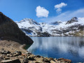
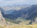
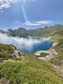
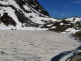
A typical Pyrenean lake in the mid-mountains. 47 hectares, 120 metres deep. Beautiful blue colour.

Details

1458
Creation:
Last update:
Last review:
  • Walking
    Activity: Walking
  • ↔
    Distance: 7.26 mi
  • ◔
    Average duration: 5h 55 
  • ▲
    Difficulty: Moderate

  • ⚐
    Back to start: Yes
  • ↗
    Ascent: + 2,927 ft
  • ↘
    Descent: - 2,940 ft

  • ▲
    Highest point: 6,427 ft
  • ▼
    Lowest point: 3,484 ft

Photos

Description of the walk

The walk starts from the Chiroulet car park in the Lesponne Valley, which can be reached by turning onto the D29 after Baudéan.

(S/E) Pass the inn and head towards the Adour, which you cross via a large bridge.

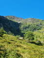
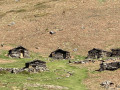
(1) At the power station, take the path on the right that winds its way up through the woods to a circular basin at the edge of the forest.

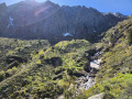
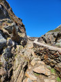
(2) Continue along the path, which becomes steeper and winds its way up to the Lac Bleu.

(3) Enjoy the deep blue lake, which is simply sublime in good weather.
Return by the same route (S/E).


Waypoints

  1. S/E : mi 0 - alt. 3,501 ft - Parking - le chiroulet
  2. 1 : mi 0.12 - alt. 3,488 ft - Power station
  3. 2 : mi 0.99 - alt. 4,196 ft - Circular basin
  4. 3 : mi 3.6 - alt. 6,404 ft - Lac Bleu (Bleu Lake) (Hautes-Pyrénées)
  5. S/E : mi 7.26 - alt. 3,501 ft - Parking - Adour de Lesponne (rivière)

Notes

It is best not to drink the water from the streams as there are many flocks of sheep grazing in the pastures.

Worth a visit

Lake Peyrelade.
The Green Lake.
Ourrec Lake.

Reviews and comments

4.8 / 5
Based on 56 reviews

Reliability of the description
4.8 / 5
Ease of following the route
4.8 / 5
Route interest
4.7 / 5
User 18117324

Overall rating : 5 / 5

Date of your route : Aug 24, 2026
Reliability of the description : ★★★★★ Very good
Ease of following the route : ★★★★★ Very good
Route interest : ★★★★★ Very good
Very busy route : Yes

This walk is simply magnificent. You start in a woodland glade on stony ground, then continue the climb across a pasture amongst the cows. The climb is quite a challenge, but well within everyone’s reach. The reward is well worth the effort: a lake of a deep blue colour. We carried on to the green lake as it isn’t far away, and the contrast with the striking blue of the blue lake is striking. A very beautiful walk, taking 3½ hours there and back. An absolute must-do!

Machine-translated

User 18541464

Overall rating : 4.3 / 5

Date of your route : Aug 19, 2026
Reliability of the description : ★★★★☆ Good
Ease of following the route : ★★★★★ Very good
Route interest : ★★★★☆ Good
Very busy route : Yes

A really lovely walk; if you’re used to it, the climb isn’t too difficult. The descent is a bit long with all the stones, and for August it was busy but not overly so.

‼️The cows on the path can be aggressive; I was charged, though nothing serious. As I hadn’t made any sudden movements or anything like that, and being used to passing close to them on various hikes, it’s best to go round them. I’ve seen another similar review, so do be careful‼️

Enjoy your hike

Machine-translated

Maryse DRITSAS
Maryse DRITSAS

Overall rating : 4.7 / 5

Date of your route : Aug 16, 2026
Reliability of the description : ★★★★★ Very good
Ease of following the route : ★★★★★ Very good
Route interest : ★★★★☆ Good
Very busy route : Yes

Hike on 12 August 2026.
Very well signposted.
The climb is fairly shaded.
The route to Lac Vert: a slightly more challenging climb, with cables.
Walked round the Blue Lake and noticed that the water level was very low due to the heatwave.
A fairly steep climb up to the Col des Bareilles.
Cool air and a magnificent view of the Pic du Midi de Bigorre. Below, Lac d’Ourrec.
Return via the same route.
A fairly popular route.
Well worth a visit.
You can make it circular by continuing on to Lac d’Ourrec.

Machine-translated

simondevc
simondevc

Overall rating : 5 / 5

Date of your route : Aug 07, 2026
Reliability of the description : ★★★★★ Very good
Ease of following the route : ★★★★★ Very good
Route interest : ★★★★★ Very good
Very busy route : Yes

A lovely walk.
Set off in the morning in summer, as that way the climb is in the shade… and it’s a long one!
Not too difficult, but a bit stony towards the end of the descent.
The lake is lovely and perfect for a picnic, but it does get quite busy.
The walk took 5 hours there and back at a ‘normal’ pace.

Machine-translated

User 8539837
• Edited:

Overall rating : 5 / 5

Date of your route : Jul 30, 2026
Reliability of the description : ★★★★★ Very good
Ease of following the route : ★★★★★ Very good
Route interest : ★★★★★ Very good
Very busy route : No

A superb hike, but a challenging one, as there’s little respite, either on the way up or on the way back.
But the whole route is magnificent and the view at the top makes the effort worthwhile.
Make sure you bring a cap and water – this isn’t just a Sunday stroll.

Machine-translated

User 22016845

Overall rating : 5 / 5

Date of your route : Jul 21, 2026
Reliability of the description : ★★★★★ Very good
Ease of following the route : ★★★★★ Very good
Route interest : ★★★★★ Very good
Very busy route : No

It’s the most beautiful walk in the area
The climb is tough, but you follow the stream as it rushes down from the lake
Right from the start, you can see your final destination
We’re occasional walkers and we reached the lake in 2 hours 50 minutes (including a few breaks)
It’s a single track, so it’s impossible to get lost
The view when you reach the lake is magnificent
The descent took a little longer (3 hours)
It’s best to set off early in the morning as a good part of the walk is in the sun
Along the route you’ll come across some wild raspberries, blueberries and redcurrants

Machine-translated

User 29826662

Overall rating : 5 / 5

Date of your route : Jul 09, 2026
Reliability of the description : ★★★★★ Very good
Ease of following the route : ★★★★★ Very good
Route interest : ★★★★★ Very good
Very busy route : No

A wonderful walk with stunning views all along the way. The lake at the end is magnificent.
You’ll be crossing several streams, so be prepared to get your feet wet 😂
It’s a challenging hike; the continuous climb is long and offers very little shade in summer, so it can be tough in hot weather. The descent isn’t too difficult.
Thanks for this lovely route 😊

Machine-translated

PapaOurs
PapaOurs

Overall rating : 5 / 5

Date of your route : Dec 29, 2025
Reliability of the description : ★★★★★ Very good
Ease of following the route : ★★★★★ Very good
Route interest : ★★★★★ Very good
Very busy route : No

Hike completed at the end of 2025

A very beautiful hike with no major difficulties
At this time of year, the ascent and descent are in the shade. You'll find the sun again at the lake.

Easy access to the car park. The first snow is higher up from the water reservoir.

Remember to bring appropriate equipment for the conditions, such as hiking boots and walking sticks.
Consider crampons as the path along the slope is a little slippery with snow.

The second bridge has been dismantled, but it is possible to cross the river above it.

The view at the top is magnificent.

Machine-translated

Chris33
Chris33

An easy route with sublime views of the lake.

Machine-translated

User 25512206

Overall rating : 4.7 / 5

Date of your route : Dec 15, 2025
Reliability of the description : ★★★★★ Very good
Ease of following the route : ★★★★★ Very good
Route interest : ★★★★☆ Good
Very busy route : No

Not many people at this time of year, which suits me fine. Probably too busy in summer. Good facilities at the start, car park, very clean toilets, bins, a great restaurant to try, opens in April. Easy climb, wide path, shaded at this time of year. You discover the lake and the sun at the same time. The sun hides behind the peaks around 2.30/3pm. A family walk.

Machine-translated

Chris33
Chris33

Overall rating : 4.3 / 5

Date of your route : Sep 24, 2025
Reliability of the description : ★★★★☆ Good
Ease of following the route : ★★★★☆ Good
Route interest : ★★★★★ Very good
Very busy route : Yes

The walk through the forest and then across the meadows is fairly easy, then it starts to climb and the final view is impressive. What's more, it had snowed during the night, making for a very pleasant panorama

Machine-translated

User 22860332

Overall rating : 5 / 5

Date of your route : Oct 13, 2025
Reliability of the description : ★★★★★ Very good
Ease of following the route : ★★★★★ Very good
Route interest : ★★★★★ Very good
Very busy route : No

No big climbs, but it's always uphill.
No flat sections.

Machine-translated

User 20923288
• Edited:

Overall rating : 5 / 5

Date of your route : Oct 06, 2025
Reliability of the description : ★★★★★ Very good
Ease of following the route : ★★★★★ Very good
Route interest : ★★★★★ Very good
Very busy route : Yes

A very pleasant walk in a beautiful landscape.

Machine-translated

Nous en rando
Nous en rando

A very beautiful hike, it's a bit of a climb but well worth the effort... The green lake isn't very far away

Machine-translated

User 27194528

Overall rating : 5 / 5

Date of your route : Sep 08, 2025
Reliability of the description : ★★★★★ Very good
Ease of following the route : ★★★★★ Very good
Route interest : ★★★★★ Very good
Very busy route : Yes

I advise hikers to take their time going up and down, provided the weather is good, of course. The key is not to overestimate your abilities. We pushed on to the green lake. Be careful, as the path to the green lake is quite technical, but not for long. Be careful in the mountains, because I think we've broken the accident record this year, haven't we?

Machine-translated

Other walks in the area

For more walks, use our search engine .

The GPS track and description are the property of this route's author. Please do not copy them without permission.