The Jas de Serre

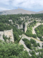
A shaded family walk, sheltered from the mistral, on the southern slope of Mont Ventoux, exploring the Jas de Serre.

Details

26069334
Creation:
Last update:
Last review:
  • Walking
    Activity: Walking
  • ↔
    Distance: 3.21 mi
  • ◔
    Average duration: 2h 05 
  • ▲
    Difficulty: Easy

  • ⚐
    Back to start: Yes
  • ↗
    Ascent: + 722 ft
  • ↘
    Descent: - 741 ft

  • ▲
    Highest point: 3,458 ft
  • ▼
    Lowest point: 2,700 ft

Description of the walk

Park on the small open area with a tree in the middle, beside the RD974 which climbs to the summit of Mont Ventoux.

(S/E) Take the wide, stony path which climbs for about 500 m to a large open area with several path junctions.

(1) Turn right onto the path marked in yellow, which climbs to the signpost for Jas de Serre.

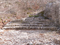
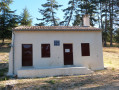
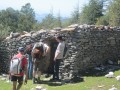
(2) Turn left towards Reillas onto a single-track path marked in yellow and red, which descends slightly to the ruins of the Jas de Serre.

(3) Retrace your steps for about fifty metres, then follow the path to the right which passes beneath the Jas de Serre to a junction with a wider track. Take this track to the left, then leave it immediately to the right to continue along a narrower path.

(4) At the crossroads, carry on straight ahead until you reach a Y-junction, then turn left onto a wide track.

(5) Turn left onto this track, which climbs gently for 100 metres. At the junction, ignore the track leading uphill to the left and continue to the right on an almost level path. Carry on straight ahead to the car park (S/E).

Waypoints

  1. S/E : mi 0 - alt. 2,822 ft - Car park beside the RD974
  2. 1 : mi 0.32 - alt. 3,018 ft - Esplanade
  3. 2 : mi 1.05 - alt. 3,458 ft - Sign for Jas de Serre
  4. 3 : mi 1.4 - alt. 3,363 ft - Jas de Serre
  5. 4 : mi 2.02 - alt. 3,022 ft - Crossroads
  6. 5 : mi 2.55 - alt. 2,700 ft - Junction with a wide track
  7. S/E : mi 3.21 - alt. 2,818 ft - Car park beside the RD974

Worth a visit

Jas de Serre.

Reviews and comments

4.8 / 5
Based on 2 reviews

Reliability of the description
5 / 5
Ease of following the route
4.5 / 5
Route interest
5 / 5
Sissss
Sissss

Overall rating : 5 / 5

Date of your route : Apr 15, 2024
Reliability of the description : ★★★★★ Very good
Ease of following the route : ★★★★★ Very good
Route interest : ★★★★★ Very good
Very busy route : No

A lovely walk with the little ones; a route that’s very easy to follow

Machine-translated

autrans
autrans

Overall rating : 4.7 / 5

Date of your route : Oct 02, 2022
Reliability of the description : ★★★★★ Very good
Ease of following the route : ★★★★☆ Good
Route interest : ★★★★★ Very good
Very busy route : No

A lovely walk!
Well signposted and clearly described
Best done outside the peak season and avoiding mountain bikes, which spoil the peace and quiet of the area a little!

Machine-translated

Other walks in the area

For more walks, use our search engine .

The GPS track and description are the property of this route's author. Please do not copy them without permission.