Country:

 City:
City:


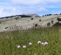
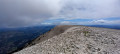
In Bédoin, head towards Mont Ventoux, cycle for roughly 12 km, and park at the side of the D974, at the ‘Jas des Melettes’ sign (altitude 1143); there is a car park for several cars to the right of the road.
(S/E) Cross the road very carefully (watch out for cars and cyclists coming down fast from the summit) and take the forest track towards Baragne (GR® 91B). The ruins of Jas des Melettes are at the start of the track on the right. Further on, at the junction, continue to the right for about a hundred metres.
(1) At the sign for Barragne, take the path that descends slightly to the left, and follow it to the Jas du Roussas.
(2) Ignore the path leading uphill to the right – this will be your return route – and carry on straight ahead through the woods until you reach the junction.
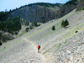
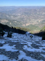
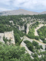
(3) Here, leave theGR® which heads off to the left and the path to the right which isn’t shown on the map; carry on straight ahead along the path that climbs up to the small viewpoint overlooking the Combe de la Grave. Begin the descent towards the valley on a fairly steep path – be careful, you’ll need to use your hands for 2–3 metres.
(4) Leave the valley and take the path opposite, which climbs towards Jas de la Couanche. After a short climb, the path turns left, runs along the edge of a cliff and continues on to Jas des Compagnons. Turn right towards Les Prayets.
(5) Please note: the path is no longer visible following brush-clearing work. The GPS track would be very useful here. Do not miss the path that branches off to the left, heading due west, and descends towards Jas de la Couanche.
(6) At the signpost, ignore the path on the left and take the one on the right, through the woods, towards the Combe de Fiole, until you reach the track.
(7) At the signpost, turn right, ignoring two barely visible paths on the left, and head up along the valley. Remains of ice houses, to the right and left of the path, are visible. Climb up to the junction with a barely visible path on the left; take this path to the junction with the track, cross it and climb up to the Jas des Pèlerins.
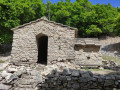
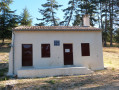
(8) From here, head towards the summit via the path leading to the Chapelle Sainte-Croix. It is best to stop for a picnic at the chapel, where it is less windy than at the summit.
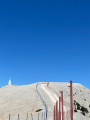
(9) After a well-deserved break, head to the summit of Mont Ventoux, take the steps leading up to a viewing platform and enjoy the magnificent views.
(10) Return to the road and walk down a few metres to the left along the road before taking the path on the right, which runs along the ridges. You’ll reach the Col des Tempêtes.
(11) Admire the north face of Mont Ventoux, covered in white rocks, and continue to follow the ridges until you reach the sign for “Tête de la Grave”.
(12) Continue along the ridges for a further 250 metres or so, until you reach the junction with the ski lift (ignore, of course, the path on the left which descends towards Mont Serein).
(13) Follow the path down alongside the ski lift to its end, then cross the road.
(14) At the sign for “Plaine des Ermitants”, turn right onto the path that descends alongside the Combe de la Grave. Ignore the paths coming from the left until you reach one coming from the right.
(15) Ignore the path on the right that descends into the valley, and carry on straight ahead to the Jas du Roussas, which you passed on the way there.
(2) Turn left onto the path you took on the way there, heading in the opposite direction, and return to the car park (S/E).



 Association / Club / Walk leader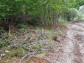
 Moderate
 Visorando Member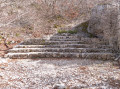
 Easy
Easy