Country:

 City:


From Bédoin, head towards the summit of Mont Ventoux on the D974 via Chalet Reynard. The walk starts to the right of the road, at Jas des Melettes (alt. 1,140 m). Several parking spaces are available.
(S/E) Take the track suitable for vehicles heading south-west, leaving the return path on your left. Go past the barrier and continue straight ahead, ignoring the few paths branching off to the right and left.
(1) At the signposts for Perrache, continue along the track as it bends to the right.
(2) At Petit Moutet Est, continue along the well-marked track on your left. It climbs very gradually up to the Font d’Angiou.
(3) This is a spring that flows practically all year round. This is where the second circular loop begins. Pass thefirst return path on your right. Turn onto the track that climbs to the right, facing the spring. Go past the gate; the track then turns left towards the north-east. The slope curves more sharply but not excessively.
(4) Ignore the GRP® signposts for this walk; continue climbing straight ahead.
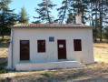
(5) At the Pavillon du Rat (forest ranger’s hut, suitable for picnics), take another well-marked track suitable for vehicles which branches off to the right at a 90° angle, heading due south. Follow this track, which initially follows the contour line almost exactly, then descends very gently to a junction at elevation 1171.
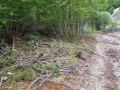
(6) Take care here: leave the track at a left-hand bend to take a poorly marked and overgrown path which descends sharply to the right in a hairpin bend until it reaches the bottom of the valley (a short but tricky descent).
(7) Once at the bottom of the valley, follow it down, keeping completely to the left, until you reach a junction with a well-marked track at an elevation of 1052.
(8) Take this track to the right, heading west. The climb is steeper but not excessively so; you’ll reach the Font d’Angiou.
(3) Take the small path on the left behind the spring. It runs slightly above and alongside the track you took on the way up. It climbs through the pine trees straight ahead, following a steep but very accessible slope. Ignore all the less clearly marked paths branching off on either side.
(9) Ignore the first path which descends to the left, then another one a little further on. Stay on the main track, still straight ahead, heading west to return to the car park (S/E).
 Association / Club / Walk leader

 Visorando Member
 Difficult
 Easy