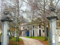
Floreffe town centre

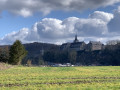
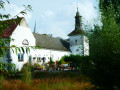
From the car park on Rue du Séminaire, opposite Floreffe Abbey, explore the town centre and the ‘noues’ (former meanders of the River Sambre). A flat and easy route, suitable for everyone.

Details

n°64721489
Creation:
Last update:
Last review:
  • Walking
    Activity: Walking
  • ↔
    Distance: 2.91 mi
  • ◔
    Average duration: 1h 25 
  • ▲
    Difficulty: Easy

  • ⚐
    Back to start: Yes
  • ↗
    Ascent: + 46 ft
  • ↘
    Descent: - 39 ft

  • ▲
    Highest point: 341 ft
  • ▼
    Lowest point: 266 ft

Description of the walk

Park in the free car park on Rue du Séminaire.

(S/E) On leaving the car park, walk up Rue du Séminaire, then turn right onto Rue Joseph Piret. Next, turn left onto Rue Chanoine Stevens and walk past the nursery school.

(1) Turn left into Rue Oscar Kaisin, then turn right into the narrow street called Rue Saint-Martin. Cross Rue Célestin Thir and continue straight ahead. At the end, turn left then right to reach a roundabout.

(2) Cross at the pedestrian crossing and turn right. Turn left after the car park to reach the Sambre, following the Ravel.

(3) Turn left to walk alongside the river on the Ravel cycle path.

(4) Go under the bridge, walk past the car park, then turn left to go round it and join Rue Mauditienne. Cross the bridge and carry on straight ahead, staying on the same street. At the Fork in the road, turn right.

(5) Take the path on the right to enter the Noue de Floreffe, which is one of the former meanders of the Sambre, created following alterations in the early 1960s to allow larger vessels to pass through. You’ll reach the banks of the Sambre.

(6) Turn right, go under the bridge again, then turn immediately right to rejoin Rue Mauditienne. Follow it to the right and cross the bridge again.

(4) Carry on straight ahead. At the junction, turn left onto Rue Joseph Hanse.

(7) Turn right to enter the small park belonging to the Floreffe Local Council, with its fine war memorial. Head towards Cul de Ry and turn left onto Rue Romedenne. Turn right, then take the first right onto Rue des Déportés.

(8) Turn left onto Rue Puits Conette. At the end, turn left again to follow Rue du Vieux Moulin, which leads onto Rue Auguste Renard. Turn right, continue along Rue Camille Giroul and return to the starting car park (S/E).

Waypoints

  1. S/E : mi 0 - alt. 305 ft - Car park on Rue du Séminaire - Sambre à finaliser
  2. 1 : mi 0.27 - alt. 305 ft - Rue Oscar Kaisin
  3. 2 : mi 0.53 - alt. 289 ft - Roundabout
  4. 3 : mi 0.77 - alt. 279 ft - The Sambre, Ravel
  5. 4 : mi 1.22 - alt. 269 ft - Junction on the Noue de Floreffe circular loop
  6. 5 : mi 1.4 - alt. 279 ft - Entering La Noue
  7. 6 : mi 1.74 - alt. 285 ft - Bank of the Sambre
  8. 7 : mi 2.47 - alt. 282 ft - Municipal Administration Park
  9. 8 : mi 2.68 - alt. 289 ft - Rue Puits Conette
  10. S/E : mi 2.91 - alt. 308 ft - Car park on Rue du Séminaire - Sambre à finaliser

Notes

(5) Please keep your dogs on a lead; the water is not safe to drink.

Worth a visit

You’ll pass a few small shops in Floreffe.

Reviews and comments

5 / 5
Based on 1 review

Reliability of the description
5 / 5
Ease of following the route
5 / 5
Route interest
5 / 5
Cobbaert Patrick
Cobbaert Patrick

Overall rating : 5 / 5

Date of your route : Mar 10, 2025
Reliability of the description : ★★★★★ Very good
Ease of following the route : ★★★★★ Very good
Route interest : ★★★★★ Very good
Very busy route : No

Perfect!

Machine-translated

Other walks in the area

For more walks, use our search engine .

The GPS track and description are the property of this route's author. Please do not copy them without permission.