The Garlaban via the Grand Vallon

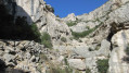
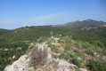
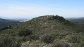
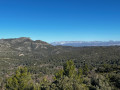
A beautiful hike with cable and chain passages and magnificent 360° views from the top of the Garlaban.
Please note that a municipal by-law has prohibited descent via the Dansaires trail since 2010 due to rockfalls.

Details

46197
Creation:
Last update:
Last review:
  • Walking
    Activity: Walking
  • ↔
    Distance: 5.79 mi
  • ◔
    Average duration: 4h 35 
  • ▲
    Difficulty: Moderate

  • ⚐
    Back to start: Yes
  • ↗
    Ascent: + 2,159 ft
  • ↘
    Descent: - 2,142 ft

  • ▲
    Highest point: 2,329 ft
  • ▼
    Lowest point: 669 ft

Photos

Description of the walk

Parking on the Chemin Départemental 44E in Roquevaire.

(S/E) From the car park, continue along the road towards Lascour for 500 metres, where a sign on the left indicates "Grand Vallon par Esparet".

(1) Follow this direction to the left, walking alongside the properties until you see the first yellow markings.
Continue straight ahead towards the bottom of the valley, following the dry stream bed (ignore the yellow markings). This unmarked path continues to the Premières Roches, which you will pass using a cable lifeline.
Continue to reach the first potholes, which you will pass with the help of chains fixed to the walls.

(2) Leave a yellow-marked path climbing up to the right and continue straight ahead towards the bottom of the valley, passing near a cave below the path. After a few zigzags, you will find a yellowGR® path.

(3) At the first crossroads, turn left towards Puits de l'Aroumi. You will soon come to another crossroads. This time, turn right onto a small path that climbs steeply. Climb up to a signpost.

(4) Turn left and continue climbing gently until you reach a plateau (very nice view of the valley and the Garlaban). At the next junction, turn left again and start descending to join a yellowPR® trail. Follow this trail towards the Garlaban to reach the Source de Barquieu.

(5) Behind the spring, a path climbs straight up the scree, with a short section secured by cables, and then it's the final stretch to Garlaban (several paths lead there).

(6) To return, descend from Garlaban by taking the trails on the right, follow the yellow markings and return to the Source de Barquieu.

(5) From there, turn completely right onto the Dansaïres trail, which overlooks the Garlaban ravine and is protected by a large rock barrier.
Once at the bottom, you will find the car park (S/E).

Waypoints

  1. S/E : mi 0 - alt. 686 ft - Parking on Chemin Départemental 44E.
  2. 1 : mi 0.48 - alt. 758 ft - Turn left towards Grand Vallon via Esparet.
  3. 2 : mi 1.73 - alt. 1,601 ft - Go straight towards the valley.
  4. 3 : mi 2.02 - alt. 1,775 ft - Turn left towards Puits de l'Aroumi.
  5. 4 : mi 2.28 - alt. 2,067 ft - On the left
  6. 5 : mi 3.52 - alt. 1,693 ft - Barquieu Spring
  7. 6 : mi 4.04 - alt. 2,329 ft - Garlaban
  8. S/E : mi 5.79 - alt. 686 ft - Parking on the Chemin Départemental 44E.

Notes

There is a natural shelter at the top of the Grand Vallon, after the chained passages.
The Source de Barquieu is halfway along the route.
No particular difficulty for children, except for the chained passage at the bottom of the Grand Vallon. Bring a rope to help them if necessary.

Always be cautious and plan ahead when you're outdoors. Visorando and the author of this route cannot be held responsible for any accidents occurring on this route.

The GR® and PR® markings are the intellectual property of the Fédération Française de Randonnée Pédestre.

Reviews and comments

4.5 / 5
Based on 72 reviews

Reliability of the description
4.4 / 5
Ease of following the route
4.5 / 5
Route interest
4.7 / 5
User 11762809

Overall rating : 4 / 5

Date of your route : Apr 13, 2026
Reliability of the description : ★★★★☆ Good
Ease of following the route : ★★★★☆ Good
Route interest : ★★★★☆ Good
Very busy route : No

Machine-translated

User 27390299

Overall rating : 5 / 5

Date of your route : Mar 11, 2026
Reliability of the description : ★★★★★ Very good
Ease of following the route : ★★★★★ Very good
Route interest : ★★★★★ Very good
Very busy route : No

A lovely hike leading to the summit of Garlaban.
An original route through the depths of the Grand Vallon, with a very wild atmosphere. The difficulty is greatly underestimated: you have to scramble over rocks and boulders, often using your hands. The section with chains requires good physical fitness and you have to pull yourself up using your arms.
The difficulty level, rated as "Moderate", is not accurate; it should be rated as "Difficult".

Machine-translated

User 19652463

Overall rating : 5 / 5

Date of your route : Nov 27, 2025
Reliability of the description : ★★★★★ Very good
Ease of following the route : ★★★★★ Very good
Route interest : ★★★★★ Very good
Very busy route : No

The passage through the valley with the pools is simply magnificent.

Machine-translated

Titi3413
Titi3413

Overall rating : 3.7 / 5

Date of your route : May 10, 2025
Reliability of the description : ★★★★☆ Good
Ease of following the route : ★★★★☆ Good
Route interest : ★★★☆☆ Average
Very busy route : No

Difficulty greatly underestimated. The sections with chains are very technical and difficult. The time is also very underestimated. It took us over two hours to get to point B.
The climbs are steep and the descents vertiginous;
To be done only if you are well trained and bring non-slip shoes and gloves for the sections with chains.
Enjoy the ride.

Machine-translated

Gijean
Gijean

Overall rating : 4.7 / 5

Date of your route : Oct 30, 2024
Reliability of the description : ★★★★★ Very good
Ease of following the route : ★★★★☆ Good
Route interest : ★★★★★ Very good
Very busy route : No

Nice hike with a good climb up a dry torrent

Machine-translated

Gijean
Gijean

Overall rating : 4.7 / 5

Date of your route : Oct 30, 2024
Reliability of the description : ★★★★★ Very good
Ease of following the route : ★★★★☆ Good
Route interest : ★★★★★ Very good
Very busy route : No

Nice hike with cabled sections and nickel chains

Machine-translated

laton
laton

Overall rating : 4.3 / 5

Date of your route : May 09, 2024
Reliability of the description : ★★★★☆ Good
Ease of following the route : ★★★★☆ Good
Route interest : ★★★★★ Very good
Very busy route : No

This hike should be rated difficult to very difficult for the passage of the basins with chains...

Machine-translated

dominiquemoser
dominiquemoser

Overall rating : 4.7 / 5

Date of your route : Jan 18, 2024
Reliability of the description : ★★★★★ Very good
Ease of following the route : ★★★★☆ Good
Route interest : ★★★★★ Very good
Very busy route : No

An original and very wild trail at the bottom of the Grand Vallon. You have to step over rocks and pebbles, often using your hands. The part with chains requires good physical condition and you have to pull on your arms.
The level of difficulty, described as "Medium", is not appropriate; it should be described as "Difficult".
Avoid after rain.

Machine-translated

Fontenotte
Fontenotte

Overall rating : 4 / 5

Date of your route : Jan 22, 2024
Reliability of the description : ★★★☆☆ Average
Ease of following the route : ★★★★☆ Good
Route interest : ★★★★★ Very good
Very busy route : No

I don't think the 'average' classification is right. Although the distance and altitude difference would justify it, there are some technical sections that may be difficult or even discouraging for some hikers.

Machine-translated

Sanny
Sanny

Overall rating : 5 / 5

Date of your route : Dec 06, 2022
Reliability of the description : ★★★★★ Very good
Ease of following the route : ★★★★★ Very good
Route interest : ★★★★★ Very good
Very busy route : Yes

Magnificent hike with some great climbs

Machine-translated

ERUAF
ERUAF

Overall rating : 5 / 5

Date of your route : Nov 05, 2022
Reliability of the description : ★★★★★ Very good
Ease of following the route : ★★★★★ Very good
Route interest : ★★★★★ Very good
Very busy route : Yes

It was very windy that day, especially at the summit of Garlaban, but the route described was very pleasant and enjoyable, with exceptional views.
Worth doing and doing again.
E.Ruaf

Machine-translated

Chesenau
Chesenau

Overall rating : 4.7 / 5

Date of your route : May 01, 2022
Reliability of the description : ★★★★☆ Good
Ease of following the route : ★★★★★ Very good
Route interest : ★★★★★ Very good
Very busy route : No

At point 2, join a yellow track which you follow to the left.
At the first crossroads with a post, turn left.
At the next crossroads with a post, turn right.
The time taken seems to me to be underestimated.
Ph Ch

Machine-translated

13manu38
13manu38

Overall rating : 4.3 / 5

Date of your route : Jun 12, 2021
Reliability of the description : ★★★★☆ Good
Ease of following the route : ★★★★★ Very good
Route interest : ★★★★☆ Good
Very busy route : No

The route is very well explained all the way up. Be careful on the way down not to miss the fork in the road on the left as you come down from Garlaban. The car park at the start is not very easy to find.
The climb through the vegetation is very pleasant and the scenery is superb. I only met 2 people at the summit, which was surprising for a weekend in June, but very pleasant.

Machine-translated

Allaudien
Allaudien

Overall rating : 4.7 / 5

Date of your route : May 10, 2021
Reliability of the description : ★★★★★ Very good
Ease of following the route : ★★★★★ Very good
Route interest : ★★★★☆ Good
Very busy route : No

The passage through the potholes is a bit sporty and fun, so if you're doing it with children under 10/12 years old, I'd advise you to bring a rope, karabiners and a harness to secure certain passages with a chain.
The route is very exposed to the sun, so be careful when it's hot, hats and a supply of water are essential, as are good, notched shoes if possible! So be careful...

Machine-translated

Didier.RAID3D
Didier.RAID3D

Overall rating : 5 / 5

Date of your route : Mar 21, 2021
Reliability of the description : ★★★★★ Very good
Ease of following the route : ★★★★★ Very good
Route interest : ★★★★★ Very good
Very busy route : No

Good morning, the fine weather accompanied us on this outing:
- ascent via the marmites in the cool of the valley. Steep, thorny path. Excellent.
- The few chain crossings were easy.
-My German Wirehaired Pointer enjoyed this walk where there was often water to drink.

After that, the discovery part is fine, only the Croix loop is overcrowded compared with the rest of the walk, which is superb. Be careful, though, when it's hot, as most of the trail is in the sun.

Machine-translated

Other walks in the area

For more walks, use our search engine .

The GPS track and description are the property of this route's author. Please do not copy them without permission.