Country:

 City:
City:



Park in the Cours Sudre car park in Gémenos, very close to the post office.
(S/E) Walk down towards the post office, take the steps and turn right onto Rue de Flore. Walk up the street until you reach a flight of steps.
(1) These appear to lead to private property, but in fact the path runs alongside it. This marks the start of a steep climb up to a track.
(2) Follow it down to the left until you reach a bend in the track
(3) Take the path on the right towards the Vallon des Camps d’Aubagne.
(4) After a long climb, ignore a track branching off to the right and continue along the path which enters the Vallon de la Galère. Pass under a power line. Continue straight on, ignoring the paths branching off to the right and left a little further up.
(5) Keep well to the right.
(6) Turn left onto the uphill path which leads to a track 400 m further on.
(7) Head down this track to the right.
(8) 250 m further on, don’t miss the start of a path on a slope, in a right-hand bend. Follow the path to the left.
(9) 250 m further on, turn right and follow the yellow signposting towards the Col de Brest. Begin the descent via a series of hairpin bends down to a track.
(10) Continue the descent to the right along the return track until you reach a fork.
(11) Ignore the climb to the right; continue along the track on the left, passing under a power line, and rejoin the fork from the outward journey.
(2) Turn left and carefully begin the descent along the outward route in the opposite direction , returning to the car park (S/E).
 Visorando Member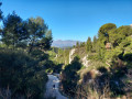

 Difficult
 Association / Club / Walk leader