The Mas des Ligaudières route

A flat walk through the heart of the Bièvre plain.
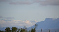
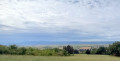
During this easy walk, you can admire all the peaks on the horizon, from east to west: Mont du Chat, the Chartreuse, the Alps (Chamrousse, Taillefer, etc.), the Vercors and the Monts du Pilat.

Details

n°207074
Creation:
Last update:
Last review:
  • Walking
    Activity: Walking
  • ↔
    Distance: 8.69 mi
  • ◔
    Average duration: 4h 10 
  • ▲
    Difficulty: Moderate

  • ⚐
    Back to start: Yes
  • ↗
    Ascent: + 210 ft
  • ↘
    Descent: - 233 ft

  • ▲
    Highest point: 1,283 ft
  • ▼
    Lowest point: 1,070 ft

Photos

Description of the walk

The route begins at Place de l’Eglise in La Côte-Saint-André.
This square is crossed by theGR®65(marked in white and red) and the Way of St James (yellow shell on a blue background)

(S/E) Follow theGR® heading west (Rue du Commandant Julhiet). When you reach the junction with Avenue Jongkind, you can see the Villa Beauséjour, where the painter lived. On the other side of the junction, there is a memorial stone erected in his honour.

Carry on straight ahead along Rue du Commandant Julhiet and walk past the cemetery (there’s a drinking fountain inside). After the cemetery, turn right and continue until you reach the D518a.
Cross the road carefully (traffic goes very, very fast) and first turn right then left onto Chemin de Fagot. You’ll come to a T-junction where there’s a fountain
(1). Turn left (you’ll be leaving theGR® trail, which goes in the other direction).
Cross the D73, where you’ll take a first turn right then left (50m) to continue along the path southwards. You’ll pass through orchards and the greenhouses of an organic farm.

(2) When you reach a T-junction, turn right, then take thefirst left. This small tarmac road turns into a wide farm track, which curves naturally to the right.

(3) You’ll come out onto a small road.

(4) Turn left onto it. It will take you to the village of Sardieu.
Turn right onto the main street (Rue du Landron) and follow it to the central square, where you’ll find a bakery.

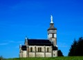
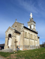
(5) In the square, head down to the left, past the cobbled church and the town hall.
Then take the first street on the left, passing the cemetery (water point) and then the sports grounds.

(6) After these, turn right. Then take thefirst road on the left, followed by thefirst path on the right. This path naturally curves to the left.

(7) It leads you to the Mas des Ligaudières.

(8) When you reach the road, turn right, then left after the small copse.
You’ll start a series of hairpin bends. When these are over, take a track on the right which leads onto a small tarmac road.

(9) Turn left. This will take you to the D518a, which you cross again to continue straight ahead

(10). When the small road bends to the right, take the small path opposite, situated between the playground and the EDF substation. You’ll reach a complex junction.
Take thesecond street on the left (Chemin du Cerf Montant). Carry on, ignoring any streets or paths branching off to the right or left, until you reach thesecond ‘Stop’ sign.
Before that, you will have passed the Parc d’Allivet and its château (half of the park is open to the public and offers a lovely spot to rest on the magnificent lawns).

(11). After thesecond ‘Stop’ sign, carry on straight ahead until you reach the church square (S/E).

Waypoints

  1. S/E : mi 0 - alt. 1,263 ft - La Côte-Saint-André Church
  2. 1 : mi 1.32 - alt. 1,263 ft - T-junction + water point
  3. 2 : mi 1.96 - alt. 1,142 ft - T-junction
  4. 3 : mi 2.74 - alt. 1,138 ft - The farm track branches off to the right
  5. 4 : mi 3.35 - alt. 1,155 ft - Small tarmac road – turn left
  6. 5 : mi 4.08 - alt. 1,148 ft - Central square, bakery, turn left as you come down
  7. 6 : mi 4.64 - alt. 1,086 ft - After the sports grounds, on the right
  8. 7 : mi 5.23 - alt. 1,083 ft - The path turns left
  9. 8 : mi 5.86 - alt. 1,096 ft - Small tarmac road, turn right
  10. 9 : mi 6.78 - alt. 1,112 ft - Small tarmac road, on the left
  11. 10 : mi 7.71 - alt. 1,142 ft - D518a
  12. 11 : mi 8.35 - alt. 1,165 ft - Allivet Castle
  13. S/E : mi 8.69 - alt. 1,263 ft - La Côte-Saint-André Church

Notes

Please note! The centre of La Côte Saint-André is a blue zone. You will therefore need to find a parking space either on Avenue Jongkind (heading west) or on Place Hector Berlioz (to the south).
There are several water points: La Côte Saint-André cemetery (1), Sardieu cemetery.
In La Côte Saint-André, you’ll find plenty of shops, services and restaurants.
In Sardieu, there is a bakery (closed on Sunday afternoons and Mondays)

Worth a visit

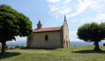
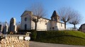
During the walk, you’ll be able to admire the peaks surrounding the Bièvre plain, the Villa Beauséjour where the painter Jongkind once lived, the pebble-stone church in Sardieu and, at the end of the route, the Château and Parc d’Allivet.
In La Croix-Saint-André, the church, the market hall and the Berlioz Museum.

Always be cautious and plan ahead when you're outdoors. Visorando and the author of this route cannot be held responsible for any accidents occurring on this route.

The GR® and PR® markings are the intellectual property of the Fédération Française de Randonnée Pédestre.

Reviews and comments

4.7 / 5
Based on 1 review

Reliability of the description
5 / 5
Ease of following the route
5 / 5
Route interest
4 / 5
dachrys
dachrys

Overall rating : 4.7 / 5

Date of your route : Feb 23, 2023
Reliability of the description : ★★★★★ Very good
Ease of following the route : ★★★★★ Very good
Route interest : ★★★★☆ Good
Very busy route : No

The explanations are very clear and helpful. Thanks to the author, you don’t get bogged down in complicated explanations. It lets you go for a little walk near home.

Machine-translated

Other walks in the area

For more walks, use our search engine .

The GPS track and description are the property of this route's author. Please do not copy them without permission.