From La Côte Saint-André to Revel-Tourdan via the GR®65

Panoramic views over the Bièvre and Liers plains, the Dolon valley and all the surrounding peaks.

Details

n°201045
Creation:
Last update:
Last review:
  • Walking
    Activity: Walking
  • ↔
    Distance: 13.51 mi
  • ◔
    Average duration: 6h 50 
  • ▲
    Difficulty: Moderate

  • ⚐
    Back to start: No
  • ↗
    Ascent: + 719 ft
  • ↘
    Descent: - 643 ft

  • ▲
    Highest point: 1,614 ft
  • ▼
    Lowest point: 1,155 ft

Photos

Description of the walk

You set off from the town centre of La-Côte-Saint-André. The route is very well signposted with a dual signposting system that is regularly updated:
- White and Red (GR®)
- Yellow shell on a blue background (Camino de Santiago): the point where the shell’s lines converge indicates the direction you should take.

(S) Head west. As you leave the village, pass the house where the painter Jongkind spent his final days.

(1) Cross the D518 and continue westwards, walking alongside the cemetery; at the next Fork in the road, turn right. After carefully crossing the D518a, you’ll reach a T-junction with a double water trough.

(2) Turn right.
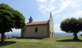
A little further on, at the top of the small hill, take a detour to the right to admire the charming Saint-Michel Chapel, as well as the view over the Bièvre plain.
Continue along the road back to the D518a: then turn left.

(3) At the junction, turn right. At the next T-junction, turn left, then join a road coming from the right and follow it to the left, heading west. Enter Ornacieux.

(4) At the crossroads, turn left.

(5) At Le Planot, take the right-hand track. Go round the hill on the left to reach the Liers plain at the very pretty Moulin Pion Giraud.

(6) Continue north-north-west. At the 370-metre mark, turn off roughly opposite, veering slightly to the left. At the next junction, turn left.

(7) Turn right to reach the beautiful Étang du Marais.

(8) Turn right and follow the lake for a short while before turning left and reaching a roundabout. Carry on straight ahead and enter Faramans (pharmacy).

(9) Take the first street on the left and carry on until you reach the junction with the Chemin de la Croze.

(10) First turn right then left onto Chemin du Guyard. Carry on straight ahead.

(11) At the junction, turn right at a right angle, then left about a hundred metres before the D37 road. Cross the Suzon stream.
Cross one road, then a second, and head up to Pommier-de-Beaurepaire. After the wayside cross, turn left towards the oppidum. Once you’ve gone round it, continue south-west to reach an orientation table on the outskirts of the village.

(12) From here, stay on the ridge of the hill until you reach Revel-Tourdan.

(13) Along the way, you’ll pass above the village of Pisieu, near a small cemetery.

(14) As you enter Revel-Tourdan, you can take a detour to the right to see the castle ruins and some very beautiful houses.

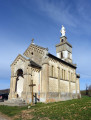
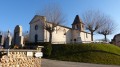
Finish your walk in the centre of Revel-Tourdan, a charming little village, and head to the church (E).

Waypoints

  1. S : mi 0 - alt. 1,260 ft - Church of La Côte St André
  2. 1 : mi 0.17 - alt. 1,247 ft - Memorial stone in honour of the painter Jongkind
  3. 2 : mi 1.35 - alt. 1,263 ft - Water point (double!)
  4. 3 : mi 1.86 - alt. 1,299 ft - Junction
  5. 4 : mi 2.65 - alt. 1,391 ft - Ornacieux
  6. 5 : mi 2.84 - alt. 1,421 ft - Le Planot
  7. 6 : mi 3.82 - alt. 1,240 ft - Moulin Giraud
  8. 7 : mi 4.87 - alt. 1,198 ft - Elevation 365
  9. 8 : mi 5.24 - alt. 1,181 ft - The magnificent Marais pond
  10. 9 : mi 5.77 - alt. 1,230 ft - Faramans Pharmacy
  11. 10 : mi 5.97 - alt. 1,227 ft - Chemin de la Croze
  12. 11 : mi 7.53 - alt. 1,178 ft - Elevation 359. Turn left towards the - Suzon (cours d'eau) - Affluent de l'Oron
  13. 12 : mi 9.45 - alt. 1,611 ft - Pommier orientation board
  14. 13 : mi 12.04 - alt. 1,490 ft - Pisieu cemetery
  15. 14 : mi 13.28 - alt. 1,368 ft - Ruins of Revel-Tourdan Castle
  16. E : mi 13.51 - alt. 1,332 ft - Revel Tourdan Church

Notes

The route follows good footpaths or small tarmac roads. The signposting is excellent! The only challenge is the distance.

There are no public transport links between the two towns of La-Côte-Saint-André and Revel Tourdan.

There are plenty of shops and accommodation options in La Côte-Saint-André.
There are two bakeries along the route: one in Faramans and another in Pommier de Beaurepaire, which sell bread, snacks and cold drinks.
There is a chemist’s in Faramans.
Shortly after setting off, you’ll find a water point before Balbins, as well as, of course, in the cemeteries of the villages you pass through (Balbins, Faramans, Pommier, Pisieu).

Worth a visit

Hector Berlioz Museum in La Côte Saint-André.
Medieval market halls in La Côte Saint-André.
Barbarin Castle.
The village of Revel-Tourdan.
Tourdan Priory.

Always be cautious and plan ahead when you're outdoors. Visorando and the author of this route cannot be held responsible for any accidents occurring on this route.

The GR® and PR® markings are the intellectual property of the Fédération Française de Randonnée Pédestre.

Reviews and comments

4.7 / 5
Based on 1 review

Reliability of the description
5 / 5
Ease of following the route
5 / 5
Route interest
4 / 5
User 30771839

Overall rating : 4.7 / 5

Date of your route : Oct 19, 2026
Reliability of the description : ★★★★★ Very good
Ease of following the route : ★★★★★ Very good
Route interest : ★★★★☆ Good
Very busy route : No

A lovely walk starting in Saint-Hilaire-de-la-Côte. Beautiful houses and lovely views, without too much of an uphill climb.

Machine-translated

Other walks in the area

For more walks, use our search engine .

The GPS track and description are the property of this route's author. Please do not copy them without permission.