Country:

 City:
City:



Start at Place de l’Église in La Côte-Saint-André.
(S/E) Leave Place de l’Église in La Côte-Saint-André heading south-east, taking Rue Saint-André. Cross the main road, Rue de la République, then Rue Longue and Rue Tourtain, until you reach a mini-market. Head into the car park, passing the shop. Turn right towards the petrol station and walk past it.
At the back of the fence, on the left, there is a small gate. Go through it, turn left and walk between the two houses. At the end of the cul-de-sac, when you reach a wooded area, take the inconspicuous path leading down to the right. You’ll come out onto a small road; turn left onto it. Almost immediately on the right, you’ll come to a large white gate
(1). You are now in Allivet Park. Enter the park and follow the path on the left until you reach the large pond. On your right stands Allivet Castle. Once you’ve passed the pond, you can cut across the meadow towards the children’s playground. You’ll exit through the gate directly in front of you. It’s locked for the children’s safety, but you’ll have no trouble opening it.
Take the street on the left, then the first on the right (Rue Ninon Vallin). There are signs indicating that it is a dead end and that the speed limit is 30 km/h. The dead end isn’t a problem if you’re on foot, and as for the speed limit, it should be fine… When the street bends to the right, take the dirt track that leads straight ahead.
(2) You’ll go through the tunnel under the D518a and continue along the dirt track, then take a small road on the left. You’ll pass a road joining from the left.
(3) A little further on, just before a farm building (Ferme de la Bâtie), take a dirt track on the left. It bends to the right and then to the left, leading onto a small road which you take on the left.
You cross the D518a again. (Caution! Here, the 90 km/h speed limit is regarded by motorists as the minimum to be observed...) Take the small road opposite, which then curves naturally to the right.
(4) You’ll come to a stop sign. Cross the road and turn left, then almost immediately, at the complex junction, take the first road on the right. There are small blocks of flats on the left and detached houses on the right. You’ll come to a stop sign (which you’ll obey) and carry on straight ahead onto ‘Chemin du Mignon’ (which should suit you just fine...). You’ll follow this small road for quite a while. You’ll pass your first junction.
(5) You’ll reach the D518, which links La Côte-Saint-André to Brezins (traffic moves quickly here too!). Take the second road on the left. You’ll very quickly come to a quarry, a disused former motocross track. Immediately afterwards, turn right onto a dirt track. When it ends, turn left and then quite quickly right, before following a small road to the left.
(6) You’ll come to a Fork in the road. Take the left-hand fork. The small road takes you into the eastern part of Gillonnay; keep going straight on.
(7) When you reach a stop sign (D73, Rue centrale de Gillonnay), cross the road to take the street opposite (various signs: Route de Mongontier, Notre-Dame du Mont). From here on, the road climbs gradually for quite some time.
Carry on along this small road, ignoring a lane coming in from the left. When you reach a Fork in the road, take the left-hand turn (Route du Château de Pointières). Ignore a road on the right and go round a hairpin bend.
(8) You’ll arrive at the rear of the Château de Pointières (there’s a water tap here, as well as a low wall where you can sit). Carry on until you reach a two-part junction. Continue straight ahead (Chemin des Vignes) along the hillside and pass another junction.
(9) You’ll pass two buried water towers before taking a stony track that climbs to the right. Then, before reaching a small road, take the first track that continues to climb to the left (forming a hairpin bend). When the track descends steeply onto a small road, turn left, and almost immediately take a grassy track on the right.
When you reach a small road, turn left and then take a track that descends to the right
(10) You’ll arrive at the Poulardière water intake (sign: 450m). Head down to the left along a grassy track. On your left is the archery range (no danger – you’re clearly visible and the local archer is quite skilled...). Halfway along the field, turn right onto a small path (sign: ‘no vehicles allowed’). Follow the Biel stream.
(11) Carefully cross the D71 and follow the stream, which will lead you to Château Louis XI in La Côte-Saint-André.
(12) When the stream disappears underground, you’ll find yourself facing Château Louis XI. It’s not open to visitors, but you can enter the courtyard – the gate is open and it’s a municipal building. Head down to the left and then quickly turn right onto Rue des Remparts. As you turn, take a moment to look through the open window in the left-hand wall. Don’t hesitate – it’s there on purpose. You’ll see the waterwheel of an old mill. It was restored by pupils from the Lycée Professionnel de la Bièvre.
Very soon after, turn left onto a small flight of steps leading to Rue du Château (which is in very poor condition).
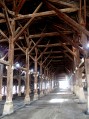
(13) You’ll emerge into the old market halls, which you’ll walk through (admire the carpenters’ work!). Opposite (due west), take Rue de l’Hôtel de Ville, which will take you back to Place de l’Église (S/E).
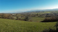
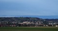
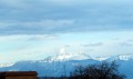
 A lovely walk offering magnificent views of the Pic de la Meige, the Pilat massif and the Bièvre plain!!!
 Visorando Member

 Easy
Easy