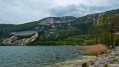
The Tossiat–Saint-Martin-du-Mont route

A route that can be done in a morning, without having to get up early, for a bit of exercise. You’ll still start with a 30-minute climb, pushing your bike, unless you’re a pro. After that, it’s heaven: flat or downhill. Sixty per cent of the route is through the cool, shaded forest.

Details

291943
Creation:
Last update:
Last review:
  • Mountain biking
    Activity: Mountain biking
  • ↔
    Distance: 7.86 mi
  • ◔
    Duration according to the author: 2 hrs 
  • ▲
    Difficulty: Moderate

  • ⚐
    Back to start: Yes
  • ↗
    Ascent: + 817 ft
  • ↘
    Descent: - 810 ft

  • ▲
    Highest point: 1,644 ft
  • ▼
    Lowest point: 869 ft
  • ⚐ Country: France
  • ⚐
  • ⚐ City: Tossiat (01250)
  • ⚑
    Start/End: N 46.141546° / E 5.318892°
  • ❏
    IGN map(s): Ref. 3129SB, 3230OT

  • ◶
    Type of surface: Not specified
  • ⇧
    Bike carrying: Not specified
  • ▲
    Difficulty: Not specified
  • Hour-by-hour weather

Photos

Description of the route

Start at Tossiat Stadium (car park).

(S/E) Turn right (east-north-east) onto the Route de Journans and, at the Fork in the road, turn right.

(1) At the next junction, turn left, cross the Reyssouze (river) and enter Journans via Rue du Moulin (D52h). Continue to the church.

(2) Take the path that climbs to the left of the church in Journans. Follow the path, ignoring two paths on the right. After 600m, turn right at a treeless clearing and continue level for about 50m.

(3) Turn left onto the bumpy track which climbs straight up the slope for 200m, ignoring the tracks that run level. The track then curves to the right (you’ve finished the hard part; the slope levels out considerably).

(4) Get back on your bike for a 1 km stretch of straight, almost flat track through the forest.

(5) Change direction; the path turns 90° to the left – do not go straight on, as there is still a section of metal barrier there. Reach the crossroads and the signpost marked ‘Le Bois du Seigneur’.

(6) Continue along theGR®59to reach Le Fayet.

(7) Stay on the level path to the right, then 100 metres further on, turn left. The descent is then stony: proceed with caution if you’re a beginner or not particularly sure-footed. You’ll reach La Tour.
.
(8) Turn right at the ‘Chemin du Peroux’ sign. You’ll then join the road leading down towards La Croix Pommier. The downhill path running alongside Colombier Hill is currently badly damaged; it’s best to follow the road at the top of the hairpin bend to reach the La Croix Pommier crossroads.

(9) Turn right and cycle for about 1.4 km, passing through Salles, until you reach the Pion crossroads.

(10) Turn right onto the Chemin des Fontaines, following 100 metres of tarmac followed by 100 metres of steep, stony track. You’ll reach another junction of paths.

(11) Turn left at this point onto a grassy track overlooking the road and the vineyards. The end of the track is somewhat overgrown with brambles for 60 metres before climbing steeply to the right for 100 metres and joining a lovely country lane that branches off to the left, gently sloping down towards the Chanaz washhouse.

(12) Continue along the road to the junction you took on the way there.

(1) Turn left to reach the car park (S/E).

Waypoints

  1. S/E : mi 0 - alt. 869 ft - Espace des Sports car park
  2. 1 : mi 0.3 - alt. 892 ft - Crossroads - Reyssouze (rivière)
  3. 2 : mi 0.91 - alt. 994 ft - Church of Journans
  4. 3 : mi 1.26 - alt. 1,276 ft - Head straight up
  5. 4 : mi 1.47 - alt. 1,437 ft - The Holy Grail
  6. 5 : mi 2.04 - alt. 1,598 ft - A 90° left turn
  7. 6 : mi 2.51 - alt. 1,601 ft - Signpost for “Le Bois du Seigneur”
  8. 7 : mi 3.51 - alt. 1,499 ft - Keep to the right
  9. 8 : mi 3.97 - alt. 1,306 ft - Bugey and Cerdon wine cellar
  10. 9 : mi 5.03 - alt. 938 ft - Croix Pommier
  11. 10 : mi 6.04 - alt. 892 ft - Chemin des Fontaines
  12. 11 : mi 6.16 - alt. 942 ft - Path through the vineyards
  13. 12 : mi 7.04 - alt. 902 ft - La Chanaz washhouse
  14. S/E : mi 7.86 - alt. 869 ft - Espace des Sports car park

Notes

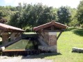
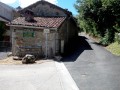
At the start of the route, you can see the source of the Reyssouze and its old washhouse. At the end of the route, in Tossiat, you can admire the Chanaz washhouse and its large picnic area. The water that feeds the washhouse is cool and delicious (I’ve drunk it many times).

Worth a visit

Places to see:
- the source of the Reyssouze in Journans and its washhouse, and along the way, the Glaude and the Bombé
- the Chanaz wash house in Tossiat and its large picnic area
For wine lovers:
if you’ve got a large rucksack, at the ‘8 ’ stop you can certainly sample and take away some Bugey or Cerdon wine – it’s almost all downhill from there! There are other winegrowers in Gravelles-le-Haut.

Always be cautious and plan ahead when you're outdoors. Visorando and the author of this route cannot be held responsible for any accidents occurring on this route.

The GR® and PR® markings are the intellectual property of the Fédération Française de Randonnée Pédestre.

Reviews and comments

4.1 / 5
Based on 3 reviews

Reliability of the description
4.3 / 5
Ease of following the route
4 / 5
Route interest
4 / 5
pierthomas
pierthomas

Overall rating : 4 / 5

Date of your route : Jun 22, 2024
Reliability of the description : ★★★★☆ Good
Ease of following the route : ★★★★☆ Good
Route interest : ★★★★☆ Good
Very busy route : No

A very enjoyable and varied route

Machine-translated

stuch
stuch

Overall rating : 4.3 / 5

Date of your route : Feb 08, 2020
Reliability of the description : ★★★★★ Very good
Ease of following the route : ★★★★☆ Good
Route interest : ★★★★☆ Good

The road journey through Salles between 9 and 10 isn’t very interesting.
So we have a suggestion that we’ve tried out ourselves.
Park in the only car park in Salles, then walk up to points 10, 11, 12, 1 and 2.
In Journans, have a meal at the restaurant Le Petit Campagnard (very good – simple but effective)
Then continue the route via points 3, 4, 5, 6, 7 and 8.
At the 310-metre mark, Le Collombier, take the path that leads you to Salles, then descend 200 metres and return to the car park.
Enjoy the day’s walk: sections 2 to 4 are quite steep, but that’s just what you need to work off a good meal.
It takes 2 hours by bike, but allow at least double that on foot, if not more.
Best regards

Machine-translated

gillou45
gillou45

Overall rating : 4 / 5

Date of your route : Dec 03, 2017
Reliability of the description : ★★★★☆ Good
Ease of following the route : ★★★★☆ Good
Route interest : ★★★★☆ Good

I walked it in 3 hours
Take particular care at point 2

Machine-translated

Other walks in the area

For more walks, use our search engine .

The GPS track and description are the property of this route's author. Please do not copy them without permission.