The Resistance Trail in Dompierre-sur-Yon

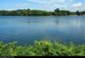
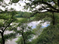
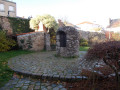
An easy walk, approximately 11 km long, awaits you around Dompierre-sur-Yon. The route, which is accessible thanks to its gentle gradient, winds its way through hedgerows and wooded areas. It is a circular walk perfect for a leisurely outing, whilst enjoying the area’s natural and local heritage.

Details

107291489
Creation:
Last update:
Last review:
  • Walking
    Activity: Walking
  • ↔
    Distance: 7.54 mi
  • ◔
    Average duration: 3h 35 
  • ▲
    Difficulty: Moderate

  • ⚐
    Back to start: Yes
  • ↗
    Ascent: + 131 ft
  • ↘
    Descent: - 141 ft

  • ▲
    Highest point: 276 ft
  • ▼
    Lowest point: 194 ft

Description of the walk

Start at the Malvoisine car park.

Follow the green signposts

(S/E) From the car park, head towards the Chemin de Malvoisine at the junction.

(1) Take thefirst track on the right.

(2) At the crossroads, take thefirst path on the left.

(3) Continue straight ahead along the path leading diagonally towards Maison Neuve de la Doue.

(4) At the junction, keep to the right and walk through the hamlet of Maison Neuve de la Doue.

(5) At the junction, carry straight on along the country lane. At the end, join the Chemin de l’Ancienne Carrière.

(6) Follow it to the left, heading due south.

(7) At the hairpin bend, take the path on the right. You will reach the Malvoisine roundabout; continue straight on along the D100.

(8) At the Fork in the road, head down to the left towards the Chemin du Vallon and cross the D100.

(9) Follow the rural track as it curves to the left.

(10) At the end, head downhill to the right towards the ‘Chemin du Bas de la Doue’ and then cross the road.

(11) At the junction after the power line, follow the path on the left to head uphill.

(12) Just before the stream at the entrance to La Berthelière, continue climbing on the left.

(13) Carry on to the left at the next junction.

(14) At the Y-junction, follow the path on the right leading to Saint-Epus.

(15) In Saint-Epus, take the path on the left, cross the D100 and carry on to the end of the path.

(16) Follow signs for La Garlière along the path on the right.

(17) Follow the Chemin de la Garlière on the left. At the junction, head straight ahead, cross the stream and continue to the end of the path. Turn left to return to the junction you passed on the way there.

(1) Follow the path on the right to the Malvoisine car park (S/E).

Waypoints

  1. S/E : mi 0 - alt. 262 ft - Malvoisine car park
  2. 1 : mi 0.09 - alt. 253 ft - Junction
  3. 2 : mi 0.31 - alt. 266 ft - Crossroads
  4. 3 : mi 0.65 - alt. 233 ft - Chemin en biais
  5. 4 : mi 0.87 - alt. 253 ft - Continue to La Maison Neuve de la Doue
  6. 5 : mi 1.15 - alt. 253 ft - Crossroads
  7. 6 : mi 1.84 - alt. 269 ft - Path to the end
  8. 7 : mi 2.23 - alt. 266 ft - Pin
  9. 8 : mi 2.48 - alt. 266 ft - Fork in the road
  10. 9 : mi 2.96 - alt. 262 ft - Bend in the path
  11. 10 : mi 3.34 - alt. 256 ft - End of the path
  12. 11 : mi 4.06 - alt. 262 ft - Fork in the road after the power line
  13. 12 : mi 4.74 - alt. 200 ft - Crossroads before the stream
  14. 13 : mi 4.88 - alt. 207 ft - Crossroads
  15. 14 : mi 5.64 - alt. 233 ft - Y-junction
  16. 15 : mi 5.87 - alt. 249 ft - Saint-Epus
  17. 16 : mi 6.81 - alt. 230 ft - Path to La Garlière
  18. 17 : mi 6.94 - alt. 249 ft - Path
  19. S/E : mi 7.54 - alt. 266 ft - Malvoisine car park

Worth a visit

The ‘Chemin de l’Ancienne Carrière’, marked in green, offers an accessible, gently sloping 11 km circular route. The route passes through the Ancienne Carrière, a remarkable site in the area, and forms part of the village’s discovery route. More information at www.dompierre-sur-yon.fr.

During the Second World War, Dompierre was a key centre of the Resistance. Why Dompierre? Because of its central location, its bocage landscape, and the cover provided by the Bois des Gâts… And thanks to the courage of the young fighters of the Maquis R1 and the local residents, who facilitated two airdrops of weapons and contributed to the liberation of the area. More information here

Other walks in the area

For more walks, use our search engine .

The GPS track and description are the property of this route's author. Please do not copy them without permission.