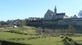
Versigny Castle from Ormoy-Villers

Two very contrasting sections: first, the two rocky areas encountered in beautiful forests, at the Pierre du Coq, then the Pierre Glissoire. Two beautiful châteaux reached via cultivated fields: the Grande Ferme in Droizelles and Vertigny, an important historical site. Little elevation gain, very easy paths, even in wet weather. Option to shorten the route by almost 4 km.

Details

6185270
Creation:
Last update:
Last review:
  • Walking
    Activity: Walking
  • ↔
    Distance: 13.20 mi
  • ◔
    Average duration: 6h 20 
  • ▲
    Difficulty: Moderate

  • ⚐
    Back to start: Yes
  • ↗
    Ascent: + 299 ft
  • ↘
    Descent: - 305 ft

  • ▲
    Highest point: 417 ft
  • ▼
    Lowest point: 249 ft
  • ⚐ Country: France
  • ⚐ City: Ormoy-Villers (60800)
  • ⚑
    Start/End: N 49.200021° / E 2.837557°
  • ❏
    IGN map(s): Ref. 2412OT, 2512OT
  • Hour-by-hour weather

Photos

Description of the walk

The walk starts from the station for those using public transport. Otherwise, you can start from the church. There are no problems with parking at either location.

(S/E) From the station, head back onto the tarmac road (Rue Sombreuse, D98) and follow it to the left towards the village. You’ll come out onto the D136; follow it to the left into the village.

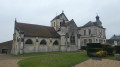
(1) Just before reaching the church, take the first right (Sentier de la Terrière). At the end, turn left onto Rue du Chemin Vert and continue to the cemetery.

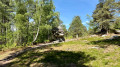
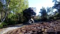
(2) Climb the few steps at the corner of the cemetery and take the path on the right leading towards the forest. Pass a bunker on the left of the path. At the fork, take the right-hand branch. At the picnic area, turn right and head uphill. You’ll come to a flat area (the Pierre au Coq is on the right; it’s also possible to take a round trip along the southern path which leads to a signpost, but don’t expect a sweeping panorama.

(3) Head down towards the west. The path joins a track; follow this to the left. Ignore all paths to the right or left until you reach a T-junction, then turn left.

(4) Cross a fairly wide track, then climb for about 600 m. Upon reaching the ridge, the path turns right and arrives at a five-way junction. Take the path almost directly opposite, heading south-west.

(5) 200 m further on, a junction is marked by two large oak trees bearing illegible signs: take the path on the right. At thefirst fork, stay on the left-hand branch and you will reach theGR®®11a little further on. Follow it to the right for about 50 m.

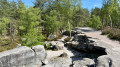
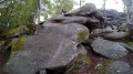
(6) Leave theGR®® atthe first path leading up to the left, marked Chemin d'Auger. After about 150 m, turn onto a barely visible path on the right which descends a gully towards the rocks visible between the trees. A large pile of rocks, some of which are very large. The famous Pierre Glissoire is at the foot of the pile on the western side (near the road).

(7) After sliding (or not) down the Pierre Glissoire, take the path that climbs back up alongside the road towards theGR®®. Cross the D136 with care, and continue opposite on theGR®®, which gently curves to the left to reach the railway line.

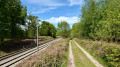
(8) Continue on theGR®® which follows the railway line to Pont Faron.

(9) Cross the bridge and leave theGR®® to turn immediately left and follow the railway line on the other side. You will reach a tarmac road.

(10) Follow the road to the right for about 500 m. As you leave the forest, leave the road and take the path on the right, which initially runs along the edge of the woodland before turning left into the fields, heading almost due west.

(11) On reaching the edge of the village, turn left to walk alongside the long boundary wall of a property until you rejoin the tarmac road you left earlier. Turn right to admire the Château de la Grande Ferme de Droizelles.

(12) Turn right onto Rue du Château.

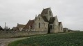
(13) Walk past the charming church in its small cemetery, continue along Rue du Château, which first turns right then left before reaching the last isolated house at a slight bend to the right.

To take a shortcut (by bypassing Versigny), continue straight on to reach point 17 directly in less than 500 m.

(14) Turn left at a right angle onto the path leading into the fields. At the (old) water tower, cross the tarmac road and continue straight on until you reach another tarmac road.

(15) Turn left and enter the village of Versigny. You will then come to Rue Charles de Gaulle, which you follow to the church, and opposite: the castle. In case of bad weather for the picnic, there is shelter opposite the church.

(16) With your back to the castle, turn left onto the main road (D330a), then take thefirst right onto Rue Jacques de Kersaint, which leads back to the junction with Rue Charles de Gaulle where we arrived. Head back along the road leading out of the village.

(15) Continue straight ahead before heading into the fields. At the fork, leave the main path and veer to the right. At the tarmac road, turn right until you reach the junction where you rejoin theGR®®11.

(17) At the crossroads, turn left onto the tarmac road leading to a large farm. When the road turns left at Lessart, continue straight ahead. The road turns into a track that first runs alongside the hedge bordering the farm before entering the fields, then reaches a corner of woodland. Follow theGR®® to the right for 150 m.

(18) Leave theGR®® and turn left onto a good track (heading north-east). Atthe first clear crossroads where four paths meet, continue straight ahead, still heading north-east. Pass a good path on your right (roughly at the highest point of the path), and 200 m further down, take a good track that branches off to the right at a right angle (heading south-east). You will arrive at a small, open hillock.

(19) Continue along this track until you reach the track running alongside the railway line. Turn left and follow the railway line north-north-east to a bridge.

(20) Go under the railway line and turn left onto Chemin de l'Ermitage, which leads back to the village. When the path turns right after the stadium, cut straight across to the path that crosses the old railway line and joins Chemin de la Longue Haie, which you take on the left. Follow this road to the end: the station is just on the other side of the road, which you must cross carefully (S/E).


Waypoints

  1. S/E : mi 0 - alt. 315 ft - Gare d'Ormoy-Villers
  2. 1 : mi 0.31 - alt. 322 ft - Terrière Trail - Église Saint-Martin (Ormoy-Villers)
  3. 2 : mi 0.7 - alt. 338 ft - Ormoy-Villers Cemetery
  4. 3 : mi 1.1 - alt. 390 ft - Flat section - Pierre au Coq
  5. 4 : mi 1.48 - alt. 331 ft - Crossing of a major road
  6. 5 : mi 1.99 - alt. 404 ft - Crossroads of the Two Oaks
  7. 6 : mi 2.61 - alt. 358 ft - Chemin d'Auger
  8. 7 : mi 2.91 - alt. 354 ft - Pierre glissoire de Péroy-les-Gombries
  9. 8 : mi 3.54 - alt. 354 ft - Railway line
  10. 9 : mi 3.89 - alt. 374 ft - The Pont Faron
  11. 10 : mi 4.85 - alt. 335 ft - Underpass
  12. 11 : mi 5.78 - alt. 289 ft - Edge of the village
  13. 12 : mi 6.06 - alt. 279 ft - Château de la Grande Ferme
  14. 13 : mi 6.2 - alt. 276 ft - Église Saint-Dieudonné (Droizelles)
  15. 14 : mi 6.44 - alt. 282 ft - Droizelles: a shortcut is available
  16. 15 : mi 7.35 - alt. 259 ft - Rue Pierre Gueu, near the - Nonette (rivière)
  17. 16 : mi 7.7 - alt. 266 ft - Versigny Castle - Église Saint-Martin (Versigny)
  18. 17 : mi 9.29 - alt. 292 ft - GR 11: elevation 89
  19. 18 : mi 10.5 - alt. 318 ft - Exit from the GR
  20. 19 : mi 11.29 - alt. 410 ft - Hill (elevation 127)
  21. 20 : mi 12.01 - alt. 315 ft - Passage under the railway line
  22. S/E : mi 13.2 - alt. 315 ft - Gare d'Ormoy-Villers

Notes

- Ormoy-Villers station is on the Transilien K line, between Paris-Nord and Crépy-en-Valois. Please note: there is only one train every two hours.
- Light walking shoes are sufficient.
- Picnics can be enjoyed under shelter opposite Versigny church.
- Refreshments (bakery) opposite the church in Ormoy-Villers.

Worth a visit

- La Pierre du Coq: a large, isolated rock carved by erosion
- La Pierre Glissoire: one of the slabs in a large rock pile. Legend has it that “Women would sit on top of the rock with their bottoms bare and slide down its entire length. You could then tell whether they were going to have a child”…
- The Château de la Grande Ferme in Droizelles
- The church of Versigny, with its tall bell tower and gargoyles
- The Château de Versigny. During the final decisive phase of the war, in the summer of 1918, General Mangin established his headquarters at the Château de Versigny. It was here that the Second Battle of the Marne was planned and the foundations for victory over the Germans were thus laid.

Always be cautious and plan ahead when you're outdoors. Visorando and the author of this route cannot be held responsible for any accidents occurring on this route.

The GR® and PR® markings are the intellectual property of the Fédération Française de Randonnée Pédestre.

Reviews and comments

4.5 / 5
Based on 6 reviews

Reliability of the description
4.4 / 5
Ease of following the route
4.2 / 5
Route interest
4.8 / 5
krando94
krando94

Thank you! And I see, incidentally, that you had already suggested this possibility in one of your previous messages.

Machine-translated

Claude L2.
Claude L2.

Thanks for the advice: I’ve made the change.

Machine-translated

krando94
krando94

Overall rating : 4.5 / 5

Date of your route : Apr 25, 2026
Reliability of the description : Not used / Not applicable
Ease of following the route : ★★★★☆ Good
Route interest : ★★★★★ Very good
Very busy route : No

There are a few long stretches here and there, but overall it’s a pleasant walk that takes you through two or three very pretty spots.

I didn’t come across a single soul for the vast majority of the walk. Just a few people picking lily of the valley in the woods at the start, as is typical for the season. And a very active group of hunters in one of the neighbouring woods (we don’t go through there). I thought the season was over, but perhaps they’re allowed to do that on private land.

Regarding the section between point 18 and point 19, the problem does indeed exist (see other comments), and to be more precise, only the part that goes over the small hill. That is, between point 49.1806260,2.8145072 and point 49.1817383,2.8208845.

Today, the vegetation was low, and the ferns were still tiny, so it was fine going ‘across the field’, but as there isn’t really a defined path, I imagine that once the vegetation has grown back, it must indeed be difficult to get through.

But actually, there is a much easier route, confirmed on OpenStreetMap.
- On the path heading towards the Maison forestière de l'Ermitage, do not turn right at the fork that is supposed to take you to the path crossing the hill (49.1815637,2.8122609).
- Continue straight on for about 200 metres until you reach another junction with a path that veers sharply to the right – when I passed by, there was a sort of hunting lookout (49.1828969,2.8139367)
- Take this path to the right; you’ll head up the hill.
- Continue along this path until you reach the railway line: 49.1797988,2.8197000
- Turn left and follow the path alongside the railway line until you rejoin the original route a little further on (between point 19 and point 20). The path in question is clearly marked, no problem.

I strongly advise the author of the walk (or a moderator) to make this change; it ‘saves’ the section over the hill for all seasons, without requiring a detour.

Machine-translated

Françoise G9.
Françoise G9.

Overall rating : 5 / 5

Date of your route : Oct 10, 2022
Reliability of the description : ★★★★★ Very good
Ease of following the route : ★★★★★ Very good
Route interest : ★★★★★ Very good
Very busy route : No

A very pleasant walk; we went through the ferns to reach the hilltop, but mainly to get back onto the railway track; off the beaten track, we followed the route/GPX file and found our way back, though we didn’t find that part very pleasant; otherwise, the rest of the walk was brilliant and we’ll definitely do it again....
The description is very good (we always use both: the description and the GPX file, just in case)
Please note:

Machine-translated

weidenfeldm
weidenfeldm

Overall rating : 4.3 / 5

Date of your route : Jun 17, 2022
Reliability of the description : ★★★★☆ Good
Ease of following the route : ★★★★☆ Good
Route interest : ★★★★★ Very good
Very busy route : No

Another wonderful discovery. Spectacular rocks, a beautiful forest and heathland in the process of regeneration, not to mention the villages.
Please note: after point 18, the numerous tracks through the ferns have disappeared, making it difficult to reach the top of the hill (I didn’t go there); as for the path running alongside the railway line, it isn’t very visible.

I’ll be showing this route to some friends.

Machine-translated

duabreg
duabreg
• Edited:

Overall rating : 4.3 / 5

Date of your route : Jun 05, 2022
Reliability of the description : ★★★★☆ Good
Ease of following the route : ★★★★☆ Good
Route interest : ★★★★★ Very good
Very busy route : No

A lovely walk, but I can confirm that between points 18 and 19 there is no hiking trail at point 18; we carried on straight towards L'ERMITAGE, where the owners told us it was a path, but we didn’t see any signposts

Machine-translated

ovil
ovil

Overall rating : 4 / 5

Date of your route : Dec 07, 2021
Reliability of the description : ★★★★☆ Good
Ease of following the route : ★★★★☆ Good
Route interest : ★★★★☆ Good
Very busy route : No

An easy walk on a misty, cool day along wide paths with a few short muddy sections.
Churches and castles, but nothing accessible – a shame.
We may not have taken the planned route, but we reached the hill (point 18/19) and came out onto a wide path leading down towards the railway line.
There was no one on the paths; we just came across a group of walkers heading into Droizelles.
A warm welcome at the bar in Ormoy-Villers, where we were able to wait in the warmth for the train back.
The practical information states that there is a train every two hours. This varies depending on the time of day.
For example, from Gare du Nord, there are trains at 7.12 am, 8.12 am and 10.12 am, and for the return journey, between 5 pm and 8 pm there is practically a train every hour, provided you go via Crépy-en-Valois every other time to get back to Paris. Check the timetables carefully.

Machine-translated

Claude L2.
Claude L2.

I went on my hike again today. I’ve clarified the route description between 18 and 19
It’s true that the ferns have grown… but the start of the path was visible through the ferns.
It’s a shame to miss this little hill, which offers quite a lovely view of the forest, especially in this colourful autumn season. There might be another, better-marked access route, because when I reached point 18, I noticed a well-cleared path where a vehicle can pass, coming from the NW direction, so it probably branches off from the path that leads directly to the Hermitage.

Machine-translated

VincentLafon
VincentLafon

Overall rating : 4.7 / 5

Date of your route : Oct 18, 2021
Reliability of the description : ★★★★★ Very good
Ease of following the route : ★★★★☆ Good
Route interest : ★★★★★ Very good
Very busy route : No

An enjoyable walk overall, taking in woodland, fields, villages and pretty houses (plus a castle). The only problem was that I couldn’t find the path in the middle of sections 18–19, probably because it was overgrown with ferns. My advice is to head straight on towards the Hermitage in the Bois de Lessart.

Machine-translated

Other walks in the area

For more walks, use our search engine .

The GPS track and description are the property of this route's author. Please do not copy them without permission.