Country:
 City:
City:


Arguel car park in the centre of the village. Yellow-blue markings, with some unmarked sections.
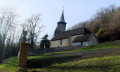
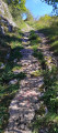
(S/E) Head to the far end of the car park to join the sandy path which leads off to the left towards the old wash house. Walk up the lawn towards the road, cross it carefully at the pedestrian crossing and, at the corner of the house opposite, take the small path leading up to the church (despite a Yellow Cross and Blue Cross on a low wall suggesting you turn back). Take a quick look around the church and its cemetery. Walk up the path opposite the cemetery gate. At a fire hydrant, turn right onto the dead-end road, which becomes a lovely path climbing up the hillside (yellow-and-blue signpost).
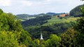
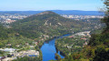
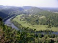
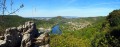
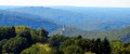
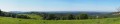
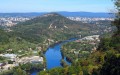
(1) At the sign for the “Route des Grands Prés”, continue to the right, ignoring the Yellow Cross and the Blue Cross, towards the viewpoint 300 metres away. You’ll soon reach your first unprotected viewpoint overlooking Planoise: take care! Another offers views over the Pugey valley, the Arguel hillside and the Jura mountains, in particular the Poupet. Continue carefully along the ledge path, dotted with further viewpoints and a few remains of the castle. At a small hollow and a fork in the path, climb the small hill carefully (the path runs along the edge of the cliffs) to the tip of the promontory for a superb 180°-plus view of Besançon and its hills, and the Mercureaux Valley.
(2) Head back to the small hollow and, at the fork in the paths, turn right towards the Doubs valley. You’ll come to a path; walk about ten steps to the right for another view.
(3) Two options:
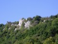
- continue along this path, which winds its way through beautiful rock formations, for a round trip to the start of the jagged ridge you spotted from the viewpoint. When you come to a path leading down to the right, carry on straight ahead for a further hundred metres or so. The path disappears at the foot of the first rocks on the ridge. Do not go any further; it is likely dangerous. Turn back and follow the instructions for the option below.
- Turn round immediately and head straight on, this time following the ledges on the river side. You’ll pass beneath a wall. Unfortunately, this is all that remains of this feudal site. Complete the circular route by returning to the first viewpoint. Ignore the first path on the right and head back to the foot of the ‘Grands Prés’ marker post.
(1) Leave the path you took on the way there. Turn right onto the second path. Continue along this path until you reach a small metal gate and a pasture. Follow the faint track through the grass. At the bottom, head down, veering to the left towards a clearing at the edge of the ‘Saut non sécurisé’ area.
(4) Head back up through the pasture towards the fence to rejoin a stony track. There’s a lovely unobstructed view of the valley and the keep at Montferrand. Head down to the right for about fifty metres along the D142. Ignore the signposting and, despite the Yellow Cross and Blue Cross, take the stony track on the left which branches off immediately. Carry on straight ahead. You’ll enter the woods.
(5) When you reach a clearing, look out for the dirt track on your right. Ignore it for now and carry on to the end of the stony track. You’ll pass in front of the fort, of which only the embankments and ditches remain. A council sign prohibits access due to the risk of rockfalls. Carry on to the edge of the meadow for a view of the Jura mountains, particularly Mont Poupet, and return to the junction.
(5) Turn left onto the dirt track, which will take you beneath some ancient walls. When the track joins the meadow, head down to the right along the path that leads to a cave.
Return to the pastures and head down to the right, following the edge of the woodland with views over the Doubs valley and the keep at Montferrand. The path enters the lovely Malpertuis Wood. Shortly afterwards, at the fork, carry on straight ahead (sign: ‘Hunting Reserve: dogs must be kept on a lead’). Continue at a leisurely pace along this beautiful, wide path that runs along the ridge.
(6) Caution! Look out for a sign on the right indicating you should descend the wooded slope via a path (which is more or less visible). If you miss it, don’t worry – you’ll soon come across a gate and signs belonging to a landowner who clearly isn’t too keen on walkers! You’ll reach the pastures. Head straight down to the small road, which you’ll take to the right. About 300 metres past a farm shed, at the junction marked by a signpost, carry on straight ahead to the hamlet of La Maltournée.
(7) Turn right onto the departmental road and, at the nearby Stop sign, despite the crosses, carry on straight down towards Beurre for two hundred metres. Head up to the right into the woods along the forest track.
(8) At the large clearing, follow the edge of the woodland to the left until you reach the corner where the path descends towards a promontory overlooking the Doubs valley. After about twenty steps, the path branches off into the scree to the right. Take great care: the path leading down to the unsecured Chère promontory, which can be slippery at certain times of year, runs close to the edge of the cliffs. Stay on the grassy part of the promontory. Return to the pasture and climb diagonally across it towards the opposite corner. There you’ll find a lovely path that leads into the woods, winding its way between beautiful rocks and taking you back to the Chemin des Grands Prés.
(1) At the signpost for the Grands Prés, head back down to Arguel via the same route you took on the way up. Continue to the left as far as the last house in the village to see an old Michelin sign, then cross the small bridge. Turn right to rejoin the sandy path, the old wash house and the car park (S/E).
 Visorando Member
 Easy
Easy