Country:
 City:
City:


Arguelcar park in the village centre. No signposting.
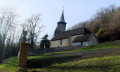
(S/E) Head to the far end of the car park to join the sandy path which leads, on the left, to the old wash house. Cross the stream via the footbridge, then take the bridge on the left and head back up towards the village. You’ll pass an old Michelin sign. Cross the road at the pedestrian crossing and, at the corner of No. 12, head up towards the church along the path. Turn right at the corner of the cemetery and head downhill. Enter the woods and you’ll soon reach a fork in the path.
(1) Climb the wooded hillside to the left via a steep ascent. Pass over an old, moss-covered dry-stone wall – a remnant of our former terraced fields – then a second one. A few steps further on, look out for the small path on the right.
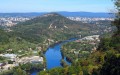
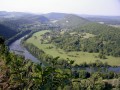
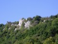
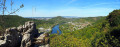
(2) Climb to the right towards a small cave at the foot of the rock. Carefully go round it; the path runs along the edge of the cliff. You’ll come to the remains of some walls – no doubt the most advanced part of Arguel Castle – then to a promontory offering views over the Doubs valley and the Besançon mountains. Don’t go any further than a small sugar-loaf-shaped rock; turn back.
(2) Continue climbing to the right. You’ll reach the ridge. Carry on towards the beautiful rocks on the left until you come to a fork. Be careful! Make sure you take the path on the right, which goes round the rock and passes in front of a small crevice. A little further up, the path forks: the path on the right, which runs along the edge of the crumbling cliff, is closed off by red-and-white barrier tape. Be sure to take the path on the left. The path veers to the left, turning away from the cliff, and forks.
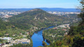
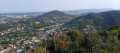
(3) Head left for about ten small steps along the narrow path leading towards a pile of stones. The path splits and you take the right-hand branch, continuing for another ten or so steps, until you reach a path running perpendicular to it. Head left, carefully climbing over a small rock; the path runs along the edge of the cliffs to the tip of the headland, offering a superb 180° view of Besançon and its hills, and the Mercureaux valley. Return to the wider path.
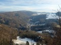
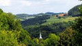
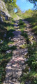
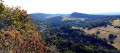
(3) Continue to the left to soon reach another open area, offering a view to the south over the Arguel valley with the distant silhouette of Mont Poupet standing out against the sky. Continue the descent along a beautiful, steep path to reach the ‘Chemin des Grands Prés’ signpost marking a crossroads.
(4) Do not go all the way to the marker post, but head straight up the path on the right, which crosses a lovely forest—though, sadly, one with too many fallen trees, victims of global warming. Cross the pasture lengthways until you reach the edge of the woodland opposite.
(5) Follow the edge of the woodland on the right to find a path leading into the woods. After about twenty steps, the path branches off into the scree on the right. Descend with great care; the edge of the cliff is not far away. You’ll arrive at the Chère promontory, with a superb view of the upper part of the valley. Retrace your steps.
(5) Follow the edge on the other side, veering slightly to the left to join a forest track that climbs through the woods. A little further up, pass between two small rocks whose very straight edges suggest they have been carved over the centuries by the passage of the iron-rimmed wheels of old carts. You’ll emerge onto another pasture. Continue along the edge of the woodland until you reach the paragliding take-off point, which offers a 180-degree view of the upper and lower reaches of the Doubs valley.
(6) Turn your back on the viewpoint and head left, crossing the pasture diagonally towards the opposite edge to find the start of a path (marked as a trail). At the next fork, head down the hillside to the right, passing the signpost you saw on the way up.
(4) Continue down the slope to the right until you reach the village. At the first fork, look out for the path—half stone, half grass (on the other side of the road)—which leads down towards the departmental road. Cross the road at the pedestrian crossing and turn left to reach the car park (S/E).
 Visorando Member
 Moderate