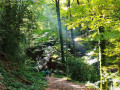
The Bois de Linars via Olemps

A lovely walk that takes you from urban areas into a beautiful forest set in a valley carved out by the River Aveyron.

Details

n°11367751
Creation:
Last update:
Last review:
  • Walking
    Activity: Walking
  • ↔
    Distance: 8.57 mi
  • ◔
    Average duration: 4h 35 
  • ▲
    Difficulty: Moderate

  • ⚐
    Back to start: Yes
  • ↗
    Ascent: + 787 ft
  • ↘
    Descent: - 801 ft

  • ▲
    Highest point: 2,014 ft
  • ▼
    Lowest point: 1,640 ft

Description of the walk

Park in the car park by the side of the road.

(S/E) Take the path opposite, on the other side of the road. Turn left after going down the small path. Then walk around the Labardie gardens, following the banks of the Aveyron. Once you reach the end, rejoin the road and turn right to cross the bridge.

(1) Turn right and follow the GR® for 1 km. Walk round the cemetery, take a footbridge over the railway line and go through a tunnel under the ring road. Continue along the small road to the Olemps roundabout.

(2) At the roundabout, go straight on, then take the second left (Rue de Casagnettes). Stay on the GR®. This is also Route 8, ‘Le Vieil Olemps’, established by the local authority. We’ll refer to it as ‘C8’ from now on.

(3) At the junction with the Chemin des Grillons, turn right and continue along the C8, leaving the GR® behind. After 200 m, take the path on your left which winds its way to the Ruffarenc crossroads.

(4) Leave the C8, which continues straight ahead for a short while, and turn left. Walk past a farm, then take the path on your left (south-east).

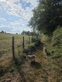
(5) At the junction of the two paths, take the one on the right (west) and you’ll rejoin the C8. The path opposite is less clearly marked. Then walk alongside the River Aveyron, heading straight on for nearly 2 km. Leave the C8 again halfway along this stretch. Join the Route des Ballades, using the handrails to guide you.

(6) Once you’ve reached it, follow it to the right and carry on straight ahead until you reach the bridge.

(7) After the bridge, turn right onto the track, initially running alongside the River Aveyron and then moving away from it.

(8) At the hairpin bend, carry on straight ahead and rejoin the C8. Follow this track for 1.5 km.

(9) Leave the C8 and take the track on your right which leads to a metal footbridge. Then follow the path uphill, passing under a power line

(10) At the crossroads, take the path on your right and head uphill to the road, where you turn left.

(11) Keep right at the hairpin bend, then at the end, turn left onto Rue du Moulin towards the village.

(12) Turn right and carry on straight ahead.
At the fork in the road, keep left onto the main road towards Rodez and cross the N88 and the railway line.

(13) At the junction, turn left towards Saint-Jean d’Olemps. Head downhill and carry on straight ahead (north-west) for about 1.5 km.

(14) At the end of the track, follow the road to the right behind the crash barrier for 200 m. Then take the main road on your right (south-east). You’ll need to follow it for 500 m before you come to a suitable spot for walkers. There’s enough space for it to be safe. However, do remain vigilant.
You will then rejoin the original path and thus the car park (S/E).

Waypoints

  1. S/E : mi 0 - alt. 1,699 ft - Car park at the boules court
  2. 1 : mi 0.53 - alt. 1,706 ft - GR® junction
  3. 2 : mi 1.26 - alt. 1,969 ft - Olemps roundabout
  4. 3 : mi 1.57 - alt. 2,014 ft - Chemin des Grillons
  5. 4 : mi 2.33 - alt. 1,765 ft - Ruffarenc crossroads
  6. 5 : mi 2.64 - alt. 1,732 ft - Entrance to the woods
  7. 6 : mi 3.63 - alt. 1,660 ft - Route des Ballades - Brienne (ruisseau)
  8. 7 : mi 4.07 - alt. 1,640 ft - Pont des Ballades - Aveyron (rivière)
  9. 8 : mi 4.62 - alt. 1,811 ft - Route de Toizac
  10. 9 : mi 5.45 - alt. 1,686 ft - Footbridge
  11. 10 : mi 6.11 - alt. 1,732 ft - Moulin de Bénéchou junction
  12. 11 : mi 6.38 - alt. 1,877 ft - Olemps Path
  13. 12 : mi 6.58 - alt. 1,959 ft - Vieil-Olemps
  14. 13 : mi 7.09 - alt. 1,860 ft - Path to St Jean d’Olemps
  15. 14 : mi 7.87 - alt. 1,680 ft - Junction with the Chemin des Attizals
  16. S/E : mi 8.57 - alt. 1,699 ft - Car park at the boules court

Notes

There is a fountain near the garden cottage, not far from (S/E)
Make sure you wear walking shoes; although the terrain is usually very easy, a section through the woods may prove more challenging.
I recommend bringing binoculars, as birds of prey and passerines are often spotted in the valley.

Worth a visit

The Linars Wood, despite having suffered a fire, is a beautiful place with a wealth of biodiversity.
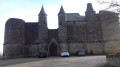
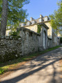
Le Vieil-Olemps, which you’ll pass on the walk, makes for an interesting little detour between (12) and (13) for architecture enthusiasts.

Always be cautious and plan ahead when you're outdoors. Visorando and the author of this route cannot be held responsible for any accidents occurring on this route.

The GR® and PR® markings are the intellectual property of the Fédération Française de Randonnée Pédestre.

Reviews and comments

4.7 / 5
Based on 1 review

Reliability of the description
5 / 5
Ease of following the route
5 / 5
Route interest
4 / 5
kala05
kala05

Overall rating : 4.7 / 5

Date of your route : Oct 09, 2024
Reliability of the description : ★★★★★ Very good
Ease of following the route : ★★★★★ Very good
Route interest : ★★★★☆ Good
Very busy route : No

PLEASE BE CAREFUL on the way back: there’s a 1 km stretch along a fairly busy road.

Machine-translated

Other walks in the area

For more walks, use our search engine .

The GPS track and description are the property of this route's author. Please do not copy them without permission.