The Bois Cornillé route in Val-d’Izé

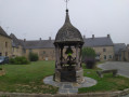
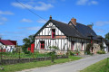
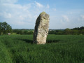
Lovely country lanes winding through gently rolling countryside dotted with charming houses.

Details

n°3184983
Creation:
Last update:
Last review:
  • Walking
    Activity: Walking
  • ↔
    Distance: 9.70 mi
  • ◔
    Average duration: 4h 40 
  • ▲
    Difficulty: Moderate

  • ⚐
    Back to start: Yes
  • ↗
    Ascent: + 256 ft
  • ↘
    Descent: - 246 ft

  • ▲
    Highest point: 397 ft
  • ▼
    Lowest point: 289 ft
  • ⚐ Country: France
  • ⚐ City: Val-d'Izé (35450)
  • ⚑
    Start/End: N 48.178738° / W 1.301521°
  • ❏
    IGN map(s): Ref. 1318SB
  • Hour-by-hour weather

Photos

Description of the walk

The entire route is signposted with Green Triangles bearing the number 5 for the Vitré Agglomération routes. Standard yellow signposting may also be used. The description below was written by ‘Le Randonneur Breton’

Car park at the sports complex, Rue du Château in Val d’Izé

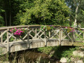
(S/E) Follow Rue du Château to the right for a few metres. At the end of the car park, take the path on the right which very quickly crosses the Ruisseau du Bois Cornillé. Walk alongside the football pitches along the footpath and turn right at the end of the first pitch. Walk alongside it, then turn left and cross a grassy triangle to reach a footbridge.

(1) Cross the footbridge to the left. Join the path which, after a bend to the right, leads to La Gaignardière and Rue des Hauts d’Izé.

(2) Take this street on the left for 50 metres, then turn right towards La Haie d’Izé. Continue along this road to reach the hamlet of Loirie.

Red and white markings forthe GR®37

(3) TheGR® comes in from the right; join it by turning left. When you reach La Jactière, take the path on the right. It passes a small pond on your left before joining a track on the right that heads due north.

(4) Follow it as it makes three sharp bends and leads to the access road to La Bourgonnière.
Carry on in the same direction, then keep to the left. Cross the D528 and continue along the path opposite. At the T-junction, turn left.

Green Triangle signposting

(5) Let theGR® continue straight ahead and turn right. At the end of the path, turn left.

(6) After 300 m, continue to the right. Follow the road leading to Les Salles and La Larderie. On the road, 150 m after a left-hand bend, turn right onto a path. Leave La Veuvre on your right and head for the D105.

(7) Head left, then turn right towards Bois d’Izé and La Gillebretais.
After thesecond hamlet, turn left, then ignore a path on the left. On the road, turn right and keep left at the next two junctions.

(8) Turn right to cross the Chenevessais. You’ll join theGR®37. Head down to the left until you reach the crossroads, then first turn right then left to continue almost due south.
Cross the Landes de la Commune, passing the motocross route on your left. Keep left at the crossroads.

(9) Let theGR® carry on straight ahead and turn right to join the D794 at Bourgneuf.
Follow this road to the left and leave it at Croix Saint-Laurent, turning right. At Le Grand Peu, continue to the left and enter Val d’Izé.

(10) Turn right into thefirst street: Rue des Lys. At the junction, turn left into Rue de la Changeonnais. Continue along Rue Saint-Martin and turn right before the cemetery into Rue Saint-Florent.

(11) Turn left into Rue du Vieux Marché. Cross Rue de l’Église and continue straight ahead into Rue des Écoles. Follow Rue Saint-Étienne-des-Eaux to the left for 20 metres and join Rue du Château on the right to return to the car park (S/E).

Waypoints

  1. S/E : mi 0 - alt. 292 ft - Car park at the sports complex
  2. 1 : mi 0.22 - alt. 295 ft - Footbridge
  3. 2 : mi 0.55 - alt. 361 ft - La Gaignardière
  4. 3 : mi 1.04 - alt. 384 ft - Loirie – turn left onto the GR
  5. 4 : mi 1.45 - alt. 397 ft - Heading north. GR
  6. 5 : mi 2.67 - alt. 381 ft - Path on the right. Leave the GR
  7. 6 : mi 3.54 - alt. 325 ft - Path on the right
  8. 7 : mi 4.68 - alt. 292 ft - Turn left onto the departmental road
  9. 8 : mi 6.37 - alt. 328 ft - La Chenevessais
  10. 9 : mi 7.71 - alt. 384 ft - Path on the right. Leave the GR
  11. 10 : mi 9.12 - alt. 344 ft - Turn right onto the street
  12. 11 : mi 9.5 - alt. 292 ft - Rue du Vieux Marché
  13. S/E : mi 9.7 - alt. 292 ft - Car park at the sports complex

Worth a visit

You’ll notice two bell towers in Val d’Izé, as the town hall now occupies thefirst 15th-century church, the Church of Saint-Étienne-des-Eaux, a Neo-Romanesque building constructed in the late 19th century at the request of the mayor at the time. Be sure to visit it to admire the mosaics by the Odorico brothers, Italian emigrants who settled in Rennes.
At the end of the walk, you’ll be surprised to see, on the façade of a modest house on Rue Saint-Martin, two statuettes depicting Saint Stephen and Saint Martin in a projecting window.

The Château du Bois Cornillé

Always be cautious and plan ahead when you're outdoors. Visorando and the author of this route cannot be held responsible for any accidents occurring on this route.

The GR® and PR® markings are the intellectual property of the Fédération Française de Randonnée Pédestre.

Reviews and comments

5 / 5
Based on 1 review

Reliability of the description
5 / 5
Ease of following the route
5 / 5
Route interest
5 / 5
Picson06230
Picson06230

Overall rating : 5 / 5

Date of your route : Mar 16, 2023
Reliability of the description : ★★★★★ Very good
Ease of following the route : ★★★★★ Very good
Route interest : ★★★★★ Very good
Very busy route : No

A lovely walk featuring long, slightly undulating straight stretches, which helps to break up the monotony.
At the southern end, a small south-facing path leads to the Étang de la Noé, where you can spot the ducks and other birds that gather there.
Many sections follow sunken paths or run slightly below the level of the fields, which makes them muddy even several days after it has rained.
You can see some beautifully restored farmhouses that have been converted into homes.

Machine-translated

Other walks in the area

For more walks, use our search engine .

The GPS track and description are the property of this route's author. Please do not copy them without permission.