Country:

 City:
City:



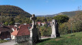
Car park, Place de la République, opposite the War Memorial, in the centre of Montgesoye.
Marked in yellow and blue. A short section is unmarked.
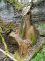
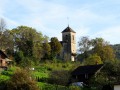
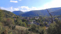
(S/E) Head towards the statue of the Virgin Mary and, immediately on the right, turn into Rue de sous Mouthier. At the first junction, take a quick look to the right at the old fountain, then head left up the cul-de-sac to No. 4. Take the steps leading up to the Church of Saint-Gengoul, patron saint of the cuckolded! Take the time to stroll amongst its beautiful old graves, whilst admiring the views upstream and downstream along the Loue Valley.
(1) Set off again along the street that runs alongside the side of the church, heading up Rue de la Ville-Haute, past the school, the town hall and an old fountain. At the fork marked by a signpost, turn left (towards the Thuyère viewpoint), passing the castle – privately owned by EDF – which was built in the 16th century and extended during the second half of the 19th century. It features a 9th-century tower and a Renaissance gateway.
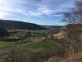
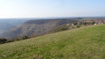
(2) At the corner by the castle, head up to the right for a few metres along the Chemin des Vergers de Chaulard. Caution! Immediately take the grassy path that runs alongside the castle wall for a steep, straight climb up to the ledges. Before entering the woods, ignore the path branching off to the left into the pasture and take a short break to enjoy the view down the valley. Continue straight on through the woods until you reach a nearby fork.
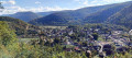
(3) Carry on straight ahead (left-hand path). The track veers off to the left and runs alongside the wooded ledges. You’ll soon reach a small track leading to a short round trip to a small, unprotected outcrop overlooking the village. Carry on to the secure viewpoint at La Thuyère.
(4) Set off again, passing between the two picnic tables. Take the path on the left, which continues to follow the edge of the cliff and soon reaches a clearing; keep to the left of this to rejoin the D133. Follow it down to the left for two hundred metres until you reach a signpost marking the start of a lovely gravelly forest path, which descends without any signposting.
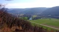
(5) Head down to the left along this wide path and you’ll reach the pastures at the hairpin bend of an ascending track. Take a short break to enjoy the lovely view down the Loue valley, then climb up to the left. The track becomes gravelly and descends back down to the castle.
(2) Head down to the right until you reach the next junction and a lovely old fountain. More lovely views of the Loue’s rocky outcrops. Head down to the left for about thirty metres until you reach Place Bellevue. Take about fifteen steps to the right to discover the pleasant little footpath, reserved for pedestrians, which will take you back to the car park. (S/E)
 Visorando Member
 Moderate