


Along the Gran Rû canal from Bruil, Rhêmes-Notre-Dame


A short, pleasant walk for when the weather is a bit unpredictable. A walk along an irrigation canal, also known as the Rû. We start in the quiet village of Bruil and make a loop back via Pessey and Rhêmes-Notre-Dame. We start with a decent climb, but after that, it is relaxed.
Details
Creation:
Last update:
Last review:
–
–
-
 Activity: Walking
 -
 Distance: 3.20 mi
 -
 Average duration: 2h 00
 -
 Difficulty: Easy
 -
-
 Back to start: Yes
 -
 Ascent: + 577 ft
 -
 Descent: - 584 ft
 -
-
 Highest point: 6,125 ft
 -
 Lowest point: 5,525 ft
-
 Country:
Italy
Country:
Italy
-
 Area: Alps
 -
 City:
Rhêmes-Notre-Dame
City:
Rhêmes-Notre-Dame -
 Start/End: N 45.569623° / E 7.11802°
 -


 Hour-by-hour weather


Waypoints
- S/E : mi 0 - alt. 5,663 ft - Bruil
- 1 : mi 0.6 - alt. 6,109 ft - Gran Ru canal
- 2 : mi 1.76 - alt. 5,705 ft - Le Pessey
- 3 : mi 1.93 - alt. 5,640 ft - Dora Di Rhêmes (cours d'eau) - Italie - Affluent du Savara
- S/E : mi 3.2 - alt. 5,663 ft - Bruil
Other walks in the area
Rhêmes-Notre-Dame – Rifugio Benevolo
 Visorando Member
 5.32 mi
+1,916 ft
-98 ft
4h 05
5.32 mi
+1,916 ft
-98 ft
4h 05
 Moderate
 Departure from Rhêmes-Notre-Dame (Aosta Valley)
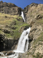
The Waterfalls Trail: thesecond stage of a circular route in the Gran Paradiso National Park.
Starting from Rhêmes-Notre-Dame, you reach Rifugio Benevolo, passing numerous impressive waterfalls along the way.
Bruil - Eaux Rousses
8.16 mi
+4,177 ft
-4,347 ft
7h 25
 Difficult
Departure from Rhêmes-Notre-Dame (Aosta Valley)
Difficult
Departure from Rhêmes-Notre-Dame (Aosta Valley)
Another valley trek, the aim of today is Valsavarenche.
From Rhêmes-Notre-Dame to Refigio de la Marmotte
5.41 mi
+1,929 ft
-1,926 ft
4h 10
Moderate
Departure from Rhêmes-Notre-Dame (Aosta Valley)
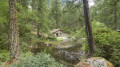
A beautiful and fairly easy walk to a very nice Refigio. A large part is through the forest, so there is plenty of shade. After the Refigio, you can walk a little further to sit and relax at a small current (2). If you fancy a very short walk (due to bad weather, for example), turn left at (3) instead of going up. You walk along a very old irrigation canal (Rû).
Grand Ru from Rhemes-Notre-Dame
 6.04 mi
+1,670 ft
-1,660 ft
4h 15
Moderate
Departure from Rhêmes-Notre-Dame (Aosta Valley)
6.04 mi
+1,670 ft
-1,660 ft
4h 15
Moderate
Departure from Rhêmes-Notre-Dame (Aosta Valley)
An easy walk at the bottom of the Rhêmes Valley, through larch and spruce forests and along the Grand Ru irrigation canal.
A short, slightly steeper detour takes you to the beautiful Vallon d’Entrelor and the Refuge Delle Marmotte.
On the way back, don’t miss the chance to admire the stunning Entrelor Waterfall and the lovely little Lake Pellaud.
Refuge de la Marmotte - Eaux Rousses
 Association / Club / Walk leader8.35 mi
+2,831 ft
-4,406 ft
6h 20
Difficult
Departure from Rhêmes-Notre-Dame (Aosta Valley)
Association / Club / Walk leader8.35 mi
+2,831 ft
-4,406 ft
6h 20
Difficult
Departure from Rhêmes-Notre-Dame (Aosta Valley)
A short day as the next day takes you into the Gran Paradiso National Park, where camping is prohibited; I had to cut the stage short, otherwise it would have had to be extended unreasonably. The Hostellerie du Gran Paradis is the only place to stay overnight. The food is great, but be warned: at weekends there are often Italians, French people, etc. out mountain biking.
Lake Tsanteleina and the Tour du Truc de Tsanteleina
 9.43 mi
+2,923 ft
-2,920 ft
6h 55
Moderate
Departure from Rhêmes-Notre-Dame (Aosta Valley)
9.43 mi
+2,923 ft
-2,920 ft
6h 55
Moderate
Departure from Rhêmes-Notre-Dame (Aosta Valley)
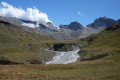
A day-long circular route taking you round the Truc de Tsanteleina and close to the foot of the Granta Parey, set in a rocky landscape that is home to Lake Tsanteleina, also known as Lago di Santa Elena.
From Thumel to Lago di Golettaz
8.05 mi
+3,071 ft
-3,071 ft
6h 25
Moderate
Departure from Rhêmes-Notre-Dame (Aosta Valley)
This is a long and tiring hike ending at a fantastic lake with nothing but eternal snow and even a glacier surrounding it! I skipped the Rifugio Benevolo because I had already done it a few days earlier. This Rifugio is well worth the effort and can easily be integrated into this trek.
From Thumel to mountain hut Benevolo and back, Gran Paradiso National Park
5.54 mi
+1,670 ft
-1,657 ft
4h 00
Moderate
Departure from Rhêmes-Notre-Dame (Aosta Valley)
A beautiful walk to the lovely Benevolo mountain hut on the edge of the Gran Paradiso National Park. Along flowing mountain streams and grazing cows and lots of flowers, even Edelweiss!!! Park your car in Thumel and take a relaxed walk back and forth.
For more walks, use our search engine .
The GPS track and description are the property of this route's author. Please do not copy them without permission.

